Edited to add: Estimated G 60 mph here with considerable dust at 5:50 pm MST!

Drier air has so far invaded only into far eastern Cochise County and the 2248 UTC (3:48 pm MST) visible satellite image above shows a number of thunderstorms north - east - southwest of metro Tucson.
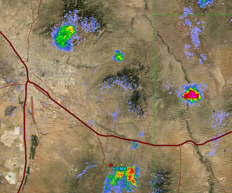
The thunderstorm north of Benson clearly appears to be severe with very high reflectivity. Below is a cross-section through this storm indicating some reflectivities above 70 dBZ and tops to 50 kft above the radar elevation. No warning at 4:00 pm but storm appears to be in the San Pedro ag area where there are many farms.

No comments:
Post a Comment