Monday, April 24, 2023
Continued Dry
Monday, April 17, 2023
Warm Week Ahead
Thursday, April 13, 2023
Red Flag Alert Today
Tuesday, April 11, 2023
Continued Dry
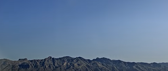
Cloudless skies over the Catalinas at 8:20 am MST this morning. Yesterday's high at the airport of 97 F was the record high for the date.
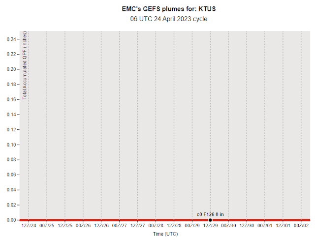
Plumes from 00 UTC runs of the GEFS - above temperature and below wind. Temperatures remain fairly hot, but with several cooler days toward the weekend. Plumes for wind indicate strong speeds for Wednesday and especially Thursday. Current NWS TUS forecast calls for gusts as high 43mph on Thursday afternoon.
Current morning graphic from the Forecast Office (above) indicates chances for another record high today at the airport, as well as slight chances for high-based thunderstorms over Cochise County this afternoon.
The morning runs of WRF model at Atmo forecast isolated light showers over Cochise County but keep the lightning activity along the Continental Divide in northern Mexico. Long-range forecast for total precipitation (below, through 06 UTC on April 27th) keeps almost all of Arizona precipitation-free.
Wednesday, April 05, 2023
March Overview Plus Dust
March summary for Tucson (above, from John Glueck) is currently available at the NWS Forecast Office webpage, and also at:
https://www.weather.gov/twc/2023MonthlyClimateReports#Mar
Here at the house we had three rainfall events that totaled 0.75". That's about the March average here since 2000. There was a bit snow mixed in with the rain on the 1st.
Monday, April 03, 2023
Windy Today Cooler Tomorrow
Perfectly clear skies over the Catalinas this morning, as we start the first, full week of April.
During the next 36-hours a strong trough at 500 mb will be swinging across Arizona. The GFS 500 mb forecast (above) is valid at 12 UTC tomorrow morning. This feature will bring windy conditions today, followed by much cooler temperatures tomorrow.
Forecast plumes here are from the 06 UTC runs of the GEFS. Precipitation (above) is flat-lined at zero. The temperature trend (below) shows a significant drop for tomorrow, but with gradual warming for rest of the week. Winds are very strong for today and then mostly quite light for rest of week.The 12 UTC WRF-RR forecast for winds at 2:30 pm this afternoon (above) indicates strong speeds for southeast Arizona and high winds for northern locations. The current morning forecast from the Tucson NWS office (below - for the airport) includes a wildfire Red Flag Warning, as well as an advisory for wind gusts that could reach over 40 mph.
Saturday, April 01, 2023
Severe Storm Outbreak Yesterday
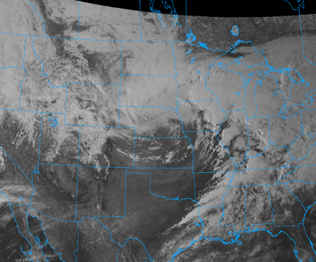
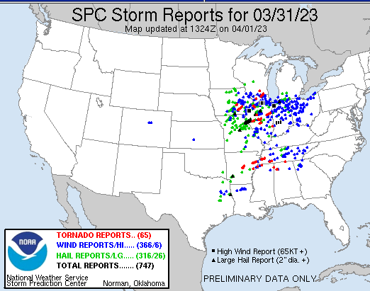
Visible satellite image (above - from from 2206 UTC on March 31st) shows large cyclone over the northern Plains that was moving eastward, producing widespread thunderstorms over a large area to its east and south. Storm reports (for 24-hours ending at 1324 UTC - 6:24 am MST) this morning from SPC - number of reports shown were 747 with 65 reports of tornadoes. The tornadoes produced widespread destruction and a number of fatalities.
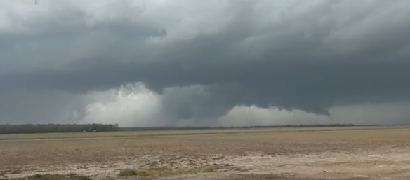
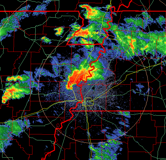
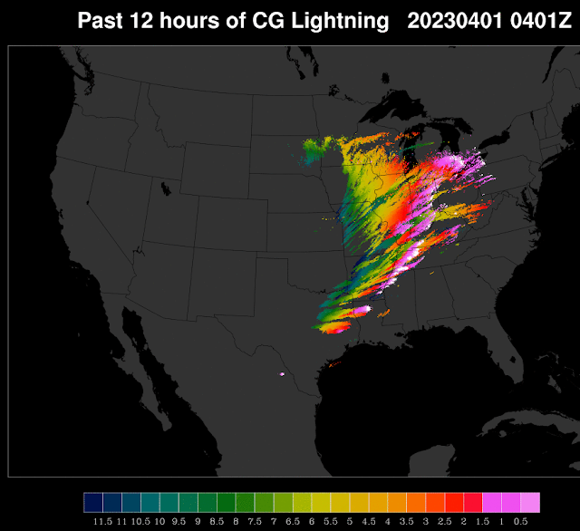
Shown above is a large tornado near Wynne, Arkansas (which is a bit northwest of Memphis). The hook echo that produced this tornado is shown in the base radar scan (below) from Memphis at 2322 UTC. Second below shows CG flashes detected during the 12 hours ending at 0401 UTC (9:01 pm MST).
This outbreak was somewhat similar to the Tri-State event of March 18, 1925, as well as the "Jumbo Outbreak" of April 3 and 4, 1974. However, both of those events produced many hundreds more casualties than did yesterday's storms.
