Saturday, July 31, 2021

Another Active Day


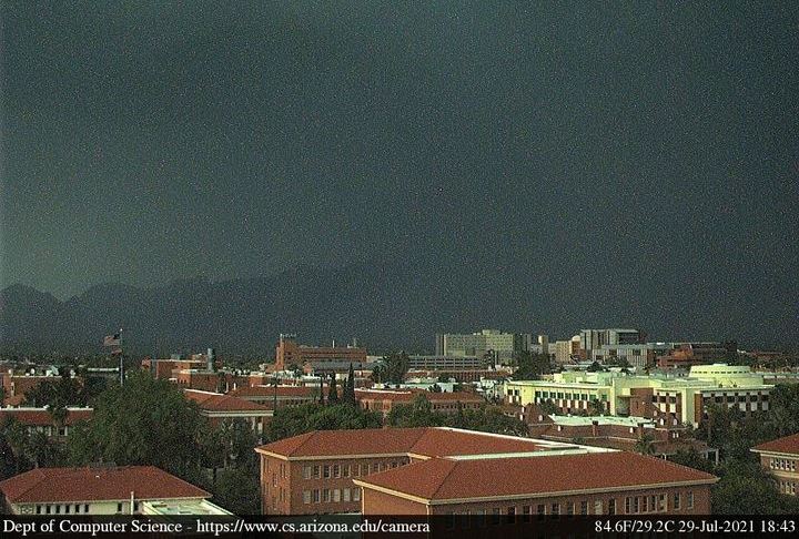
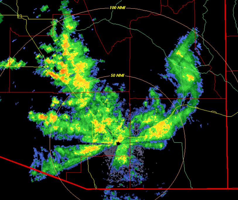
View of lingering clouds over the Catalinas early this morning, following another active day. This was a rare case of two active storm and rain days occurring in succession. The plot of detected CG flashes (below, from Atmo and Vaisala) shows that storms were very active across all of Pima County as midnight approached.


Reports from the ALERT network (above and below for 24 hours ending at 6:00 am MST this morning) show the widespread character of yesterdays precipitation. Eight sites reported more than an inch of rain.

The airport received 0.67" and also had a severe wind gust to 67 mph around 8:00 pm. We had 0.50" here, and around 5:15 pm I estimated gusts hit 45 to 50 mph.


The 300 mb analysis at 12 UTC this morning (above) shows that forecasts yesterday morning (see previous post) verified quite well, with the west-to-east trough only a bit north of the predicted position.

The morning sounding from TUS/TWC (below) continues to be very moist, with some CAPE, and WRF runs continue to keep PW above an inch through the day. However, with west to southwest winds above 500 mb and the upper-level trough now to our north, I would expect - at most - isolated storms over the high terrain of southeast Arizona. Thus, a return to the expected pattern of a down day following a widespread rain event.


Friday, July 30, 2021

Storms And Rains Yesterday


Nice colors on clouds at sunrise this morning. View of campus before sunset (below), highlighted by heavy storm moving into the metro area.


Plot of detected CG flashes (above - from Atmo and Vaisala) for 24 hours ending after midnight last night - note focus over eastern Pima County, with holes to southeast and northwest.

Rain was widespread across ALERT network (below) for 24 hours ending at 8:00 am MST this morning. There are 12 sites with over half an inch and five of those exceeded an inch. Here at house we had 0.21". The Rillito was running again this morning - was a good week for the sand trout.


This morning's sounding (above) for TUS/TWC is, again, not very exciting, and would have little chance of convecting, especially after yesterday's event. 

However, there is a distinct 300 mb short wave (above) approaching from northeast Sonora. This feature is forecast to extend from western Arizona eastward to the Big Bend by midnight (below). So, this short wave may help storms to develop later today.


Thursday, July 29, 2021

Chances For Showers Improving Slowly


Heavy clouds over the mountains a bit before sunrise this morning. At bottom, east view from San Simon, Arizona, at 6:10 am MST.

Plot of detected CG flashes yesterday (above from Atmo and Vaisala for 24 hours ending at 8:03 UTC) shows thunderstorm activity avoided Pima County and concentrated over Cochise County. There were reports of rain amounts in Cochise County (from MesoWest), and I note one report at south end of Huachuca mountains of over an inch.


This morning's TWC/TUS sounding has increased PW (1.40"), but moisture profile below 700 mb remains poor, with Td decreasing with height. There is a sliver of CAPE, however, above 700 mb. Still not a sounding I can get excited about, but a bit better than yesterday morning.

GFS 250 mb forecast (from 06 UTC runs - below, valid at 5:00 pm this afternoon) shows the upper-tropospheric cyclone heading in our general direction, but with most of US covered by a strong anticyclone.


Finally, two forecasts from the WRF-GFS 06 UTC runs at Atmo - above is radar valid at 5:00 pm, showing a few echoes over eastern Pima County; below is total precipitation forecast through midnight tonight, with some light amounts over parts of metro area.


Wednesday, July 28, 2021

Scattered Thunderstorms Yesterday


Wispy clouds over the Catalinas before sunrise this morning.

There was considerable thunderstorm activity over southeast Arizona yesterday afternoon and evening - as per above plot of detected CG flashes for 24 hours ending at 7:53 UTC (from Atmo and Vaisala).

Precipitation reports from the ALERT network (above and below) show heaviest rain amounts along I-10 from downtown off toward Tortolita, and in the the Catalinas. Reports from observations: TUS 1.29" along with gusts to 54 mph; Atmo 0.35"; DM 0.03"; and here at house 0.01". Looks like areal coverage across the network was a bit over 50%.


Plot of TPW this morning at 6:00 am MST (above) shows most moist air now pushed out to far southwestern corner of Arizona. The morning sounding from TWC/TUS (below) is down to PW of 1.25 inches, with Td decreasing rapidly up to 700 mb. No matter how I estimate the evolution of this sounding during the day, I come up with a double BL structure, that has at most a sliver of CAPE - so probably much less activity than yesterday.


At 300 mb this morning the low near Brownsville, Texas, appears to be elongating east-to-west. Current forecasts now take this feature into New Mexico this weekend, and weaken it markedly.

Finally, a look at the 06 UTC WRF-GFS forecast of precipitation through midnight tonight (below). The model forecasts only a bit of rainfall over the Rincons, which fits with the fairly pathetic morning sounding shown above.


Tuesday, July 27, 2021

Storms This Evening?

Clear skies continue at 7:56 am MST this morning. Lightning plot below (from Atmo and Vaisala) shows little thunderstorm activity over Arizona yesterday, but there were several, isolated storms over southeast portion of state.


SkewT plot for this morning's sounding (above - from SPC) is quite impressive with substantial CAPE. Thunderstorms are likely, but the southeasterly flow through the troposphere suggests that anvils could spread ahead of storm cores, shading the surface. The 06 UTC WRF-GFS (below) forecasts a line of strong echoes over parts of metro area at 7:30 pm this evening, as well as more significant activity over Cochise County. Note that the forecast does indeed forecast anvils spreading ahead of the storms - a negative aspect of today's setting.


Looking ahead toward the weekend, the situation in the upper troposphere is very interesting. A closed low at 300 mb is centered south of Brownsville, Texas, and is forecast to head our way. The two forecasts below show the low over northern Mexico at 48 hours, and then nearly over Tuscon on Friday evening, but also much weakened by then.

Bit of commentary - forecast discussions from NWS Tucson have been referring to this features as an "easterly wave." Such waves have their strongest winds in low-levels - certainly not the situation with this upper low. Brownsville sounding this morning shows strongest winds with the low are up around 250 mb, so it's  definitely not an easterly wave.


Monday, July 26, 2021

Flagstaff ALERT Data


David Blanchard sent the ALERT data around Flagstaff for the past week for comparison to Tucson (shown in post below). Values were large up there at high elevations also - note the 6.57 inches south of the main highway intersection. There are also some suspect low values, but harder to assess up there because of the much more complex terrain. Regardless, this chart emphasizes what an exceptionally wet week many parts of the state have experienced.

Was A Very Wet Week


Mostly clear skies this morning after several cloudy, dreary days. Visible image (below from 7:26 am MST) shows storms have moved to far western Arizona and southern California. Las Vegas had flooding during the early morning hours, and flood watches and warnings are out for much of southern California.


Here are the ALERT totals for the past week (going back to the 19th). Looks like one suspect station north of Oro Valley, but what amounts for just 7 days! I count ten sites with over 5 inches of rain - here at house we had 3.04".


Above analysis is for 300 mb and shows winds, streamlines, and divergence (yellow shades). Cyclones are mostly south of 30 degrees N, with anticyclones dominating from the Southeast to the Northwest and over Mexico. The upper-level anticyclone is forecast to strengthen markedly during the next couple of days.

This morning's skewT plot for TUS/TWC (above) continues quite moist, although some drying is expected today, and CAPE will be very limited over all of Arizona this afternoon. Below is 06 UTC WRF-GFS forecast for total precipitation through 5:00 am tomorrow morning - a real dry out after all this rain will actually be a nice change.

Sunday, July 25, 2021

Rains Continue


Heavy clouds over the Catalinas, with light showers over most of the metro area this Sunday morning.  The base scan radar below (from 8:12 am MST) shows current distribution of echoes around the region.


Data from the ALERT network through 7:00 am (north sector above and south below) show general heavy rains of one to two inches plus over the entire network (note that there is one site south of Three Points that is not functioning). I see one station on Mt. Lemmon had just over three inches. here at house we have had only 1.45 inches.

Second graphic below indicates detected CG flashes for 24 hours ending at 6:53 am this morning - for the second day in a row southeastern Arizona has had essentially no thunderstorms, just heavy showers.


The low at 500 mb (above analysis from Univ. of Wyoming) has shifted now to southeastern Arizona and appears to be centered just to our north-northeast - the 300 mb chart (below from SPC) has the low positioned about correctly.

Finally, this morning's sounding came in a bit late and many analyses were done before there was data from TWC/TUS. Sounding below from SPC continues very moist (PW of 1.90 inches), with mostly light winds, and just a tiny sliver of CAPE.