Saturday, September 23, 2023

Beautiful Sunrise Today

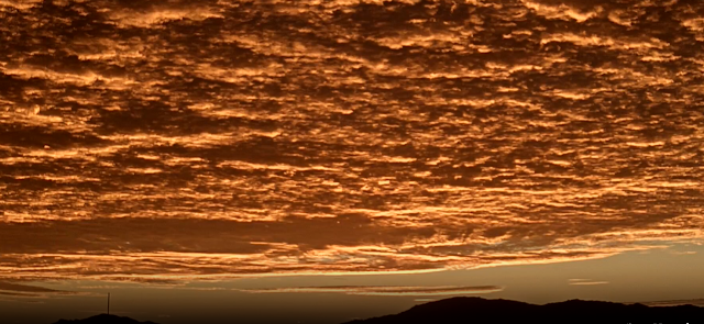
Golden sky in view toward Rincons/Redington Pass at about 6:15 am MST this morning.

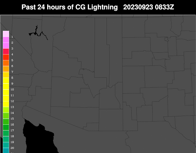
 Another day yesterday with no thunderstorm activity over Arizona and western New Mexico. Plot above shows no detected CG flashes for 24 hours ending at 0833 UTC this early morning.

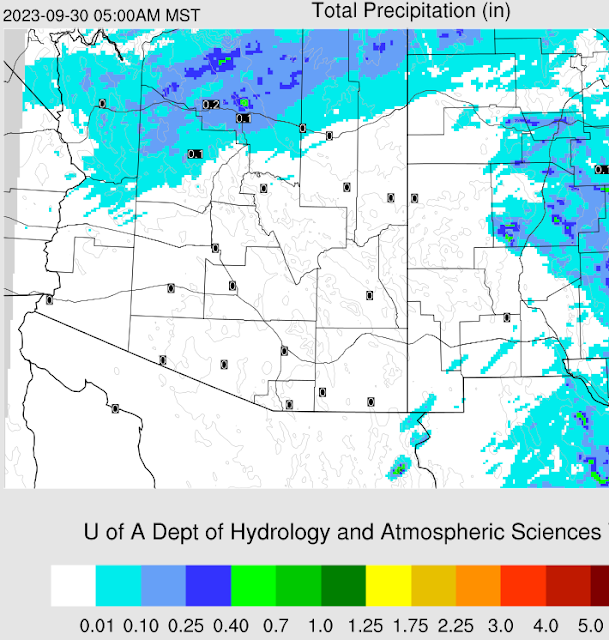
Forecast below (from 00 UTC WRF-GFS) indicates no precipitation for southern Arizona through 5:00 am on September 30th.

Wednesday, September 20, 2023

Quick Update


Nice morning colors looking toward the Rincons at around 6:10 am MST this morning.

Plot of detected CG flashes for the 24 hours ending at 0803 UTC this morning (above) shows almost no thunderstorm activity, except over far northeast New Mexico.

This morning's 500 mb analysis (above from SPC) shows anticyclone center very distinct over central Mexico, with ridge extending north across far eastern Arizona. 

I have taken a look at the question: When did the monson end? After examing upper-air analyises and TWC/TUS soundings, it appears to me that September 3rd marked the end of our summer monsoon period.

Our morning TWC/TUS sounding (above, also from SPC) is quite strange below 500 mb, with big swings in dewpoint (PW is very low at 0.73 inches). Ignore the analyzed lifted parcel showing CAPE. I don't find any CAPE when I mix the sounding up through 700 mb. Winds aloft, however, have become quite strong - note the 90 kts at 200 mb.

The forecast below (from 06 UTC GFS) shows precipitation through 06 UTC on October 1st - little to look forward to rest of month, according to model forecasts.
Friday, September 15, 2023

Blog Break

 Little to write about across our portion of Arizona. I'll not be posting for a few days, and hope that things become more interesting next week.

Thursday, September 14, 2023

Significant Dry-Out


View of the Catalinas at 7:30 am MST this morning.

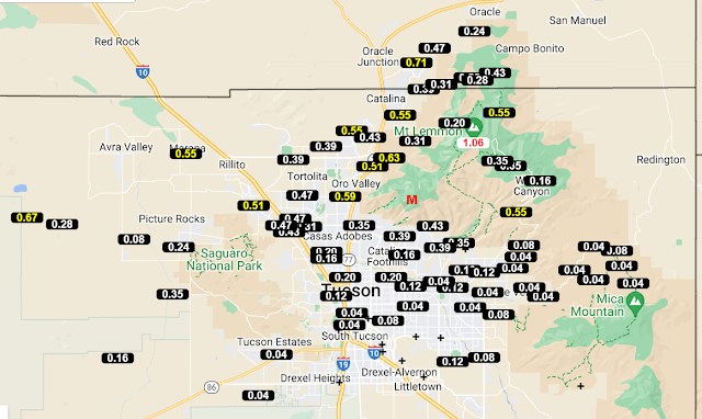
Plot of detected CG flashes for 24 hours ending at 0833 UTC this morning (from Atmo and Vaisala) shows limited activity in much of the metro area. However, both airport and DM reported thunderstorms. Precipitation reports (below - from MesoWest) show mostly light amounts for 24 hours ending at 8:00 am this morning - except around southern fringes of area shown. Here at the house we had a very brief shower that produced only 0.03"; Atmo and DM reported 0.21"; and the airport had 0.33".


This morning's TWC/TUS sounding above) continues to show some CAPE, although drier air is intruding from several directions. Forecast below (from the 06 UTC WRF-GFS) shows precipitation amounts through 06 UTC on September 29th. So much of the rest of September is likely to be very quiet weatherwise.

Wednesday, September 13, 2023

Morning Showers Yesterday


Looking toward the Rincons at 6:30 am MST this morning.

Plot of detected CG flashes (from Atmo and Vaisala) for 24 hours ending at 0813 UTC this morning. It was a very active thunderstorm day across much of Arizona. Storms in our area occurred during the morning.

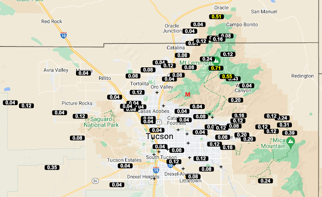
Plots of observed rainfall across the ALERT network (above and below) show widespread accumulations, with a number of sites exceeding half an inch. Here at the house we had a total of 0.27", which was first rain since the 1st. DM reported a Trace, the airport had 0.01", and Atmo measured 0.08".


The morning sounding from TWC/TUS (above) continues moist and unstable, with considerable CAPE. Winds aloft remain westerly through most of the troposphere.

Forecast precipitation totals (above, from the 06 UTC WRF-GFS) are valid for period ending at 5:00 pm tomorrow. Much of the metro area gets light showers, if forecast veriifies. Current morning forecast from the NWS (below) indicates 40/30 percent POPs for the airport this afternoon and evening.

Tuesday, September 12, 2023

Damp And Dreary Morning


Rain along the foothills at 7:15 am MST this morning. Visible satellite image (below) from 1403 UTC shows deep convection out to our west.


Plot of CG flashes detected for 24 hours ending at 1403 UTC (above) shows much recent thunderstorm activity across parts of the metro area and westward.

Observations from the ALERT network (above and below) show widespread rainfall across the northern part of the array, with more scattered reports to the south.

Here at house there was 0.14" in the gauge at 6:00 am and it has been raining lightly, off and on, since then. The airport has had 0.01", DM a Trace, and Atmo 0.06".


The morning sounding from TWC/TUS (above) shows deep westerly flow and considerable CAPE, with PW of 1.63". The QPF plumes from the 06 UTC GEFS (below) indicate a rainy day and night, followed by a dry-out through the weekend. The current NWS morning forecast (bottom) indicates declining POPs at the airport through Wednesday night.

Really nice to get some rain here after a very dry start to September!


Monday, September 11, 2023

Slight Chance For Showers Today

View of the Catalinas about 6:20 am MST this morning. Afternoon high temperatures at the airport yesterday and Saturday reached to record high levels - 111 F yesterday and 108 F on Saturday. The 111 F was the hottest ever day in September since records began in Tucson.

Plot of detected CG flashes for 24-hours ending at 0833 UTC this morning (below) indicates that almost all of Arizona was very suppressed yesterday. There was storm activity in Mexico south of Santa Cruz and Cochise Counties.


The morning sounding (above) from TWC/TUS remains quite dry below 600 mb, with westerly winds aloft. There is virtually no CAPE present, but model forecasts increase lower-level moisture some during the day.


The forecast from the 06 UTC WRF-GFS at Atmo (above) forecasts some precipitation in eastern Pima County through midnight tonight. The morning forecast from the NWS (below) indicates POPs at the airport of 30 to 40 percent through Tuesday night, with slightly cooler temperatures

Friday, September 08, 2023

Cloudy At Sunrise

View looking toward east end of the Catalinas at 6:00 am MST this morning. The low, black smoke at right edge is from the Ventana wildfire, which started after midnight during the early morning hours. The blaze is mostly contained at this time.

Visible satelitte image (below, from 1500 UTC this morning) shows a fairly large cloud mass over southeastern Arizona, that will likely clear-off by mid-day.

Plot of detected CG f;ashes (below, from Atmo and Vaisala) indicates only Arizona storms yesterday afternoon occurred along the far southern, Arizona and New Mexico border.


Elongated, west-east anticyclone remains centered over southern New Mexico this morning (above). The morning sounding from TWC/TUS (below) shows light winds below 300 mb, a deep and dry BL that extends up to almost 500 mb, and essentially no CAPE. The 12 UTC WRF-RR forecast (bottom) shows no precipitation over the metro area through midnight on Sunday night. Only rain here during September has been the 0.01" on the 1st, so things are very dry and I've got to do some watering.


Wednesday, September 06, 2023

Very Dry

Clear skies over the Catalinas at 5:50 am MST this morning.


No CGs were detected over the Southwest and northern Mexico for 24 hours ending at 0803 UTC this morning (above). Quite amazing actually. Satellite view of the same area at 1351 UTC also shows a huge region with clear skies (below).


The morning sounding from TWC/TUS (above) shows only 0.77" of PW with no CAPE.

The 12 UTC WRF-RR forecast (from Atmo - below) indicates almost no precipitation across a huge area through 5:00 pm tomorrow afternoon.

Saturday, September 02, 2023

Dry Day Here


Cumulus sitting over the Catalinas at 0810 am MST this morning.

Plot of detected CG flashes (from Atmo and Vaisala) for 24 hours through 0833 UTC this morning (above) shows almost no thunderstorm activity over eastern Pima County.


ALERT plots (above and below) for 24 hours ending at 0800 am this morning show most precipitation on and near the mountains, with scattered reports across the lower elevations. Here at house the 0.01" before sunrise was all that we had. The airport reported a Trace, DM had 0.04", and Atmo came in with 0.07".  All in all a pretty low-key day.


Morning sounding (above from TWC/TUS) looks favorable for storms today. However, it appears that slightly warmer and drier air will advect in at middle-levels, decreasing CAPE as day progresses. Current NWS forecast is for 20 POPs for rain at airport today. Forecast below (from the 12 UTC WRF-RR) is for rainfall through midnight on Labor Day. So, basically a mostly warm and dry three day Holiday weekend.