Monday, February 27, 2023

Sunday's Precipitation


View of Catalinas at about 11:00 am MST yesterday morning shows that snow levels came down onto the foothills before the morning precipitation ended.

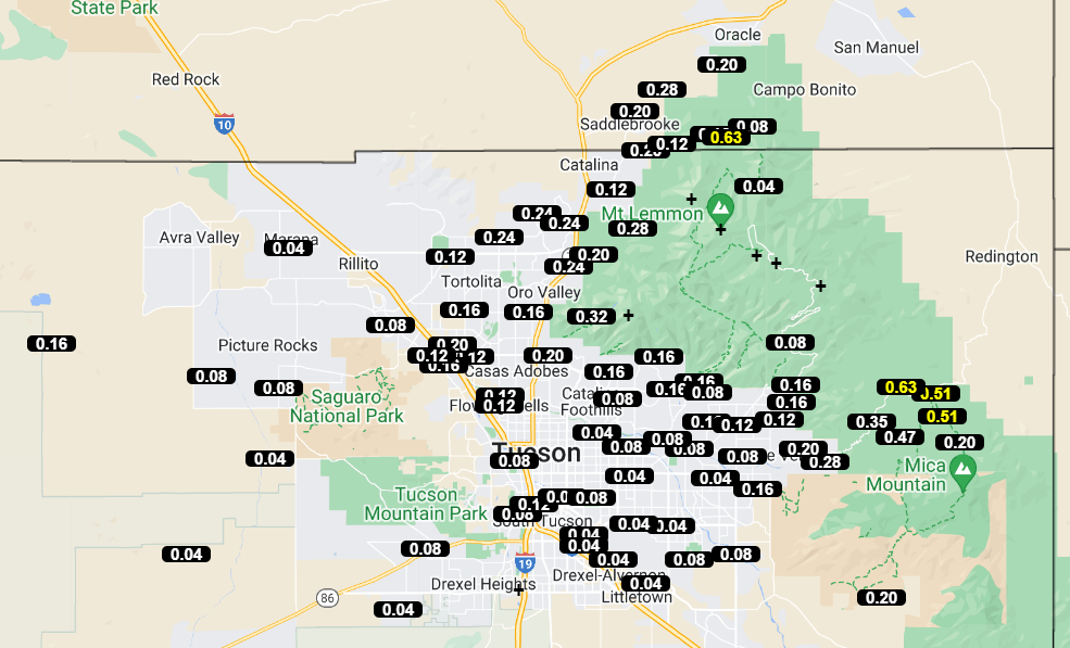
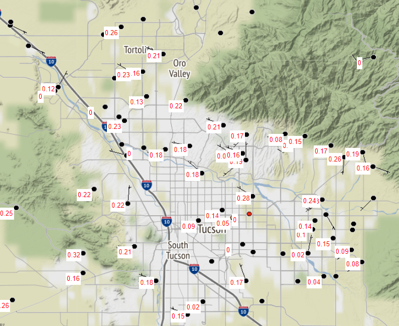
ALERT measurements for the event (above and below) show that considerable rain fell on the mountains before it changed over to snow. Here at the house showers began before sunrise and continued into mid-morning - total here was 0.34".


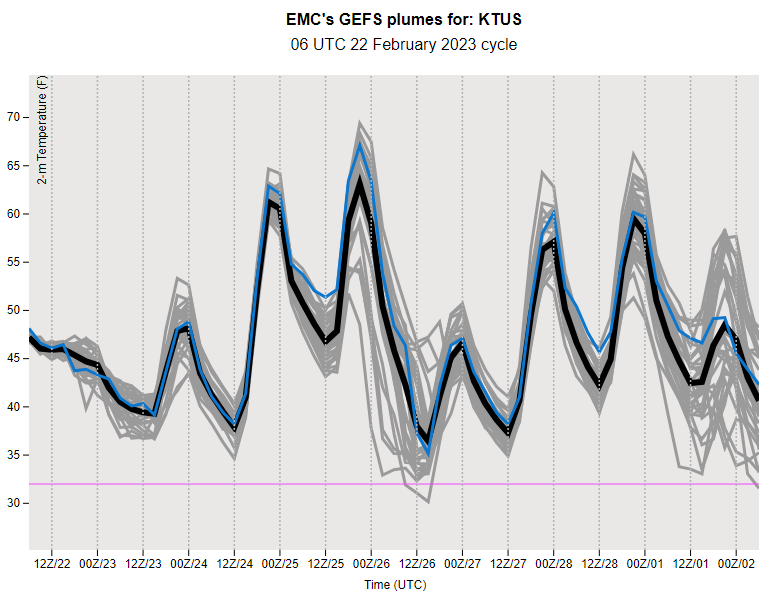
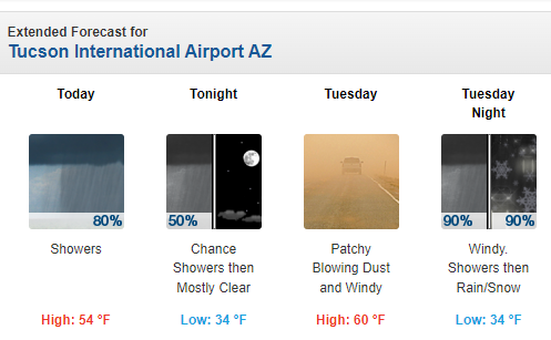
Looking ahead to mid-week, and start of March, the 00 UTC runs from the GEFS indicate another event on Wednesday the 1st. The QFP plumes are shown above, and plumes for P-Type (below) indicate strong chances for rain and snow mixed before the event ends. Second below shows 00 UTC WRF-GFS precipitation forecast through 5:00 am on March 2nd, as our unsettled period continues.


Saturday, February 25, 2023

Showers Likely


View of Rincons at 7:05 am MST this morning showing chaotic skies.

The TWC/TUS morning sounding (above) shows strong winds aloft ahead of a Pacific closed low off of California. The low is forecast to move eastward and cross our area tonight and tomorrow, bringing low-elevation showers and mountain snows.

Plumes here from the 06 UTC GEFS runs show QPF (above), temperature (below), and precipitation type (second below). Showers are indicated at the airport tomorrow morning and again on Thursday night. Amounts forecast are fairly substantial for both events - which would bring a wet end to February, as well as a damp start for March.
Temperature continues to vary considerably (above) with two cold periods indicated. The plumes for precipitation type (below) indicate chances for snow mixed with the rain during both precipitation events.

Forecast from the 12 UTC WRF-RR (second below) shows the model's forecast for total precipitation through midnight Sunday night. Looks like an unsettled week ahead as meteorological winter comes to an end.


Thursday, February 23, 2023

More Showers


A bit of sunshine broke through to the west end of the Catalinas at 5:15 pm MST yesterday afternoon.

It was another day yesterday with widespread but mostly light rain amounts and more snow on Mt. Lemon. ALERT plots above and below are for the 24-hours ending at 9:00 am this morning. Here at the house we had a repeat day, with 0.17" in the gauge.

Below is forecast (from the 12 UTC WRF-RR) for precipitation through midnight Saturday - model keeps the rain to our northwest until Sunday.

Wednesday, February 22, 2023

Winds And Showers


Snow falling at the General Store in Summerhaven at 9:15 am MST this morning. Down at bottom are current warning graphics issued by the NWS Forecast Office. Winds are very strong at the airport, where a gust to 51 mph occurred at 5:00 am this morning.


Precipitation amounts for past 24 hours over the ALERT network (above and below). Amounts were generally light, except on and near the Catalinas. Here at the house we had 0.17".


At 500 mb (above for 12 UTC) there is powerful trough digging into the West from Idaho to southern California, with very cold temperatures near -40C.
Plumes forecast from the GEFS at 06 UTC are shown here: above QPF, below T, and second below Wind). The ensemble members predict three periods of precipitation at the airport during the coming week. Temperatures are on a roller-coaster ride, and the winds peak out today. A lot of weather to watch across all of the West this week.


Tuesday, February 21, 2023

Chance Of Showers

Heavy clouds over the Rincons at 7:35 am MST this morning. Current NWS graphic for wind gusts possible over southeast Arizona tonight and tomorrow. Note the 68 mph at Bisbee! Second below shows 12 UTC WRF-HRRR forecast for steady wind speed valid at 3:30 am early tomorrow morning.


Current 500 mb analysis (above) shows egg-shaped cutoff west of Baja - this feature will open-up today and then move across northern  Mexico, Arizona and New Mexico. The forecast sounding (below) from the HRRR run this morning develops some CAPE at Tucson by early afternoon. NWS forecast discussion mentions slight chances for thunderstorms.


This morning's NWS forecast for the airport (above) indicates high POPs for measurable rain today through much of Wednesday. Graphic below shows the 06 UTC WRF-GFS forecast for total rainfall through midnight tonight, indicating a widespread event across southeastern Arizona.

Friday, February 17, 2023

Windy Today


Views this morning of the Catalinas at 6:25 am MST (above) and of Rincons at 7:05 am (bottom).

A graphic (above from NWS webpage this morning) shows their forecast for max wind speeds today - note the 52 mph at Oracle and very high speeds at high elevations. Graphic below shows forecast steady speeds from the 12 UTC WRF-RR runs at Atmo - speed at airport forecast to be 31 mph at 10:00 am this morning.


Text forecast for today (above from NWS) indicates chances for blowing dust and windy conditions at the airport today. Observations indicate that the airport has already gusted to 46 mph this morning, while Mt. Hopkins has hit 61 mph. Definitely windy and not "breezy."

Interestingly, the 06 UTC GEFS plumes (above for wind) have considerably under-forecast speeds this morning, but forecast quite strong winds on Sunday, the 12th. The plumes for QPF at the airport (below) indicate chances for rain and showers beginning Sunday and continuing into next week. 

Wednesday, February 15, 2023

Rain and Snow Here


ALERT rainfall observations for Monday. Amounts were mostly light, except for on the north side of the Catalinas. We had a total here of 0.14 inches.


View of the Catalinas at 9:00 am MST this morning (Wednesday the 15th), showing light snow cover on the mountains. Down at bottom, image shows snow falling at Bisbee at 7:00 am this morning.


Observations of rainfall (above) from Mesowest at Univ. of Utah for 24 hours ending at 9:00 am this morning. Note that precipitation turned to snow during the early morning hours today, and most places had more precipitation than indicated. Here at house there was 0.12" in gauge at 9:00 am, but funnel was nearly full of snow. I won't know total until all the snow melts later this morning. 


System that brought the snow was centered well north of here. Image above shows IR satellite imagery at 14:00 UTC, while 12 UTC 500 mb analysis is shown below. Wind speeds exceeded 100 knots around the base of the low. The morning sounding from TWC/TUS (second below) indicates max wind speeds around 130 knots. This system will be a prolific snow producer as it moves toward the Great Lakes Region.


Monday, February 13, 2023

Showers Parts Of Metro Area


Showers moving onto the west end of the Catalinas at 8:50 am MST this morning.


At 500 mb the closed low has moved on shore and is centered near the north end of the GoC at 12 UTC (above - note lack of observations at San Diego). The morning forecast for the airport (below from TUS NWS) indicates high POPs for the airport as well as 80 to 90% POPs for entire metro area today. 

First band of showers is moving across eastern Pima County and it has been raining lightly here - there's 0.03" in gauge now, but skies have cleared and there's bright sunshine. ALERT observations below are for early morning hours through 9:00 am.

Windy periods are forecast to continue - the airport had gusts to 36 mph yesterday afternoon. Forecast wind speeds below are from the 09 UTC WRF-RR and are valid at 2:pm tomorrow afternoon.