Thursday, December 30, 2021

End Of 2021


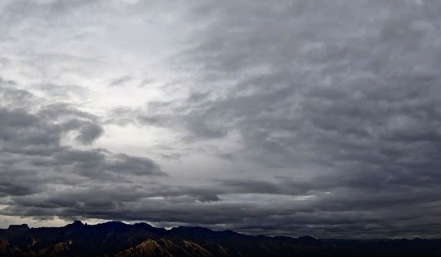
Heavy clouds over the Catalinas at about 7:50 am MST this morning.

Above shows current morning forecast from NWS for the airport - note that POPs for today (Thursday) have ranged from 30 to 70 percent since last Sunday. The nasty weather for the end of year will be associated with two rapidly moving troughs moving into and then across Arizona - as per 06 UTC GFS 500 mb forecast below valid at 11:00 pm MST Friday night.


Shown here are three graphics from the 06 UTC forecast run of the WRF-GFS at Atmo. Above shows forecast for strong wind speeds over southeastern Arizona at 3:00 pm tomorrow afternoon. Forecast below is for total precipitation through noon on Saturday - 1 January 2022. Second below is WRF forecast for snow amounts through 5:00 pm on New Years Day - models keep snow mostly on the mountains.


Very nice graphic below from the NWS shows expected snow amounts at various elevations on the Catalinas. If this verifies, the road up the mountain to Summerhaven will undoubtedly be shut down some time tomorrow. 


Monday, December 27, 2021

Unsettled End Of Year

Colorful sunrises this morning around 7:15 am MST - above Catalinas from campus, and bottom view along I-10 from Wilcox,

The year is going out with a large trough holding over the western US. Graphic above shows the 06 UTC GFS forecast for 500 mb valid at 11:00 am on Friday, the 31st of December. Note the two very strong short waves in the trough, with the southern one about to move across southern Arizona and northern Mexico. It will be followed by the second wave as the New Year begins. 

Forecast above (from the 00 UTC WRF-GFS run) shows total precipitation through 5:00 pm on Sunday January second, while panel below shows snow accumulations (from same run and same period). Note there is snow indicated at higher elevations of southeast Arizona; however, the color scale is very vague and hard to read from 19 through 43 inches, so amounts forecast are hard to discern. 


The GFS forecast of total precipitation through 5:00 pm on the second of January is shown above. Below is this morning's wet forecast from the NWS Forecast Office through the day Friday.


Friday, December 24, 2021

Rainy Morning


As per forecasts from past few days, we have showers across the metro area this morning (above). Amounts are currently light, with only a few hundredths to around a tenth of an inch - I haven't ventured out yet to check the gauge here. 

Freezing level is high, as per TWC/TUS morning sounding above, at almost 600 mb - so it's raining on Mt. Lemmon. Photo at bottom shows that way up at Flagstaff it was snowing heavily at 6:40 am MST.

IR satellite image (above) and base scan radar (below - both from around 8:00 am) indicate heavier showers approaching. Regardless, it's definitely a dreary start for the Holiday weekend.


Thursday, December 23, 2021

Christmas Eve Forecasts


Cirrus shrouded sunrise here, as viewed from Sahaurita (above). Below is very colorful sunrise as viewed from I-10 at San Simon.

At bottom are early am views of heavy snow at Mammoth Lakes, California, and of rain at LA.


Forecasts of precipitation (above - through 11:00 pm MST tomorrow) from the 06 UTC run of the WRF-GFS indicate light rainfall for metro area, with heavier rain for the mountains. 

Wind forecast below indicates strong winds at 11:00 am tomorrow morning, note the 39 kts (45 mph) at Sierra Vista. 


Probability forecasts for various locations and amounts in southeast Arizona from NWS this morning. Contrast with the warning below for snow amounts in the California Sierras - 3 to 7 FEET of snow expected by Christmas.


Wednesday, December 22, 2021

Mid-Week Update


Pre-sunrise views this morning: above of Catalinas from campus and bottom along I-10 east of Wilcox.

Forecast (above - from 06 UTC GFS)) of 500 mb pattern valid at 11:00 am MST on December 24th. Note the low-amplitude, short-wave trough crossing Arizona - winds with this feature are very strong.

Forecast above is from the 06 UTC WRF-GFS run at Atmo - shown are forecast radar echoes at 9:00 am on the 24th. Heaviest echoes are indicated for east-central Arizona, with weaker echoes crossing Pima County. Below (from same model run) is forecast for total precipitation through 5:00 pm on Christmas Day.

Second below is the current forecast for the weekend from the NWS Forecast Office here. There appears to be a bit of timing differences between forecasts shown here - but there are still a couple of days for the situation to evolve.


Tuesday, December 21, 2021

A Football Aside

We are now in the season of seemingly endless college football bowl games. Today, on the first day of astronomical winter, the Famous Idaho Potato Bowl is underway at the Albertsons Stadium of Boise State University - shown above. The stadium is, as far as I know, the only one with blue artificial turf - making it a bit of a visual stand out setting for this game.

This year the Kent State Golden Flashes (7-6) are trailing the Wyoming Cowboys (6-6) in a high-scoring game - currently in the fourth quarter. An unknown is whether the potatoes are french fried, mashed, baked, or scalloped.

Unsettled By End Of Week


Some nice color over the Catalinas just before sunrise this morning. At bottom is unwrapped view up at the SkyCenter on Mt. Lemmon at 6:55 am MST - note the waning moon at top of tree on right side.

As a 500 mb trough sets up along the West Coast, several weak disturbances will affect Arizona for the Holiday Weekend. However, the chances for rainfall at airport are all over the place. The 06 UTC GEFS plumes for QPF (above) range from zero to over an inch. The operational GFS (blue) is a heavy rain outlier. At this time it appears that the most unsettled period will be centered on Christmas Eve.

Forecasts from the 06 UTC WRF-GFS (above radar valid at 5:30 pm on Christmas Eve and below forecast total precipitation through 11:00 pm Christmas Eve) indicate about 0.20" inches for airport, with the heavier portions of the event just extending southward into the mountains of eastern Pima County. 


Saturday, December 18, 2021

Week Ahead

Very clear skies this morning, as early sunshine illuminates the Catalinas.

Morning low temperatures have been quite chilly this morning, as per above from MesoWest. Low here at house was 26 F - first morning of Fall/Winter with temperature in the 20s (lows yesterday and Thursday were 32 F - first freezing temperatures here at house).


Looked at the GEFS plumes for the coming week. Forecasts for QPF at airport for week (above) indicate chances for light showers at end of week, and on Christmas weekend; plumes for temperature (below) indicate a basically mild week - plumes are showing a bit of a warm bias for morning lows; plumes for wind (second below) indicate periods of gusty winds on Christmas Eve and Christmas. 


Precipitation amounts for Arizona around Christmas have a decreasing trend past few runs. Below is GFS forecast (from 06 UTC run last night) for 60 hour precipitation amounts ending at 11:00 pm MST Christmas night.

Wednesday, December 15, 2021

Cold Front With Light Showers


Chaotic skies this morning with clouds hugging the Catalinas, but also some blue showing through. Down at bottom is view of traffic on I-19 at Drexel Road a bit before 7:00 am MST, showing wet roadways.

ALERT network rainfall amounts for 24-hours ending at 7:30 am this morning - above north half and below south half. Amounts generally were light, but there's one site on Catalinas that had over half an inch. Here at house we had 0.03" during the early morning hours. The airport reported 0.06" with gusts to 33 mph; DM had 0.02" with gusts to 40 mph; and Atmo had 0.04" inches with gusts to 30 mph. The time series for T and Td at Atmo (second below) clearly shows the timing of cold front passage and showers occurring around 3:30 am.


Although the GFS forecasts no more precipitation for at least the coming week, the model indicates a stormy period during the days around Christmas. Forecast above is precipitation forecast for 24-hours ending at 11:00 pm Christmas Eve and below is for 24-hours ending at 11:00 pm on Christmas Day.

Forecast second below is for total GFS forecast precipitation through 11:00 pm on Tuesday the 28th of December, indicating a very impressive event for most of Arizona.