Friday, March 31, 2023

Yesterday's Winds

View of Summerhaven at 9:20 am MST this morning shows that there was probably a skiff of snow up on the mountain yesterday.

However, the main story was the gusty winds across most of eastern Arizona. Many sites reported gusts of 30 to 45 mph (TUS reported gusts to 31 mph). Sites that reported gusts over 45 were:

Ft. Huachuca - 46
Safford - 46
Pioneer Airfield - 55
Douglas - 56
Guthrie - 56

Thursday, March 30, 2023

Cooler And Windy


Views of the Catalinas and Rincons (bottom) at about 6:15 am MST this morning, as we have another colorful sunrise.

Forecast for 500 mb (above, from 12 UTC WRF-RR) shows a trough affecting Arizona at 5:00 pm today, as it shears out toward the northeast. This feature will bring cooler temperatures today - highs last two days were 83 F, but NWS forecast for today is only 62 F. Wind advisories are out for southeastern Arizona (below), and current forecast indicates gusts as high 26 mph at the airport this afternoon.


Forecast wind speeds valid at 3:30 pm this afternoon (above from same WRF run) - note the very windy conditions forecast across most of New Mexico. The MIMIC analysis of TPW (below for 12 UTC) shows what a moisture-starved system is impacting us today.


Monday, March 27, 2023

Unsettled Mid-Week

View looking toward Rincons - with contrail - at about 6:30 am MST this morning.

Forecasts from the 00 UTC run of the WRF-GFS model at Atmo:

Above is for wind speeds at 11:00 am on Thursday morning. If this forecast verifies, then we would likely have gusts of 40 to 45 mph. Precipitation forecast (below) is for totals through 11 pm on March 31st. This forecast indicates only a slight chance for very light showers in parts of eastern Pima County. Any showers would occur during the 30th. 

Thursday, March 23, 2023

Yesterday's Rain


Clouds and sunshine on the Catalinas at 7:00 am MST this morning.

Yesterday's rainfall affected the northeast portions of the ALERT network, with heaviest amounts on the Catalinas - warm character of event kept snow levels very high. Here at house we had 0.27".

Image at bottom shows heavy showers moving into the northern part of the metro area at 10:30 am yesterday morning.


Wednesday, March 22, 2023

Chance For Showers


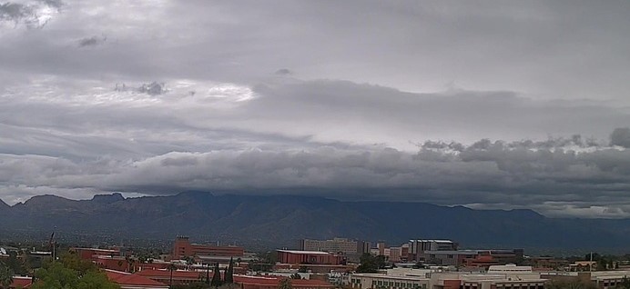
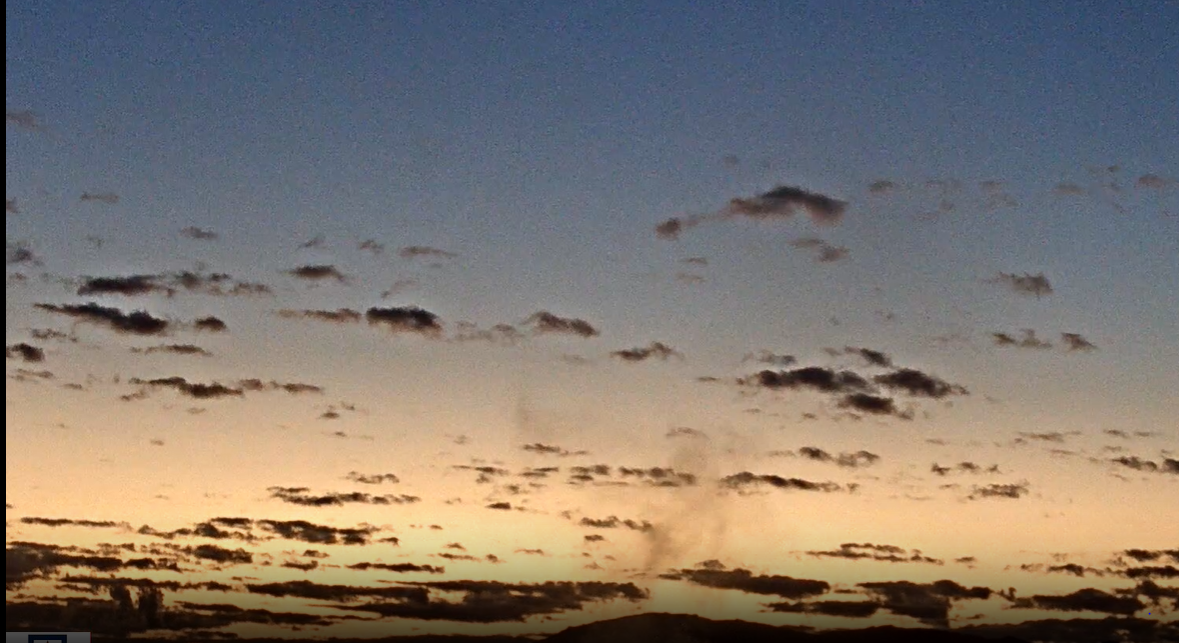
Heavy cloud cover on the Catalinas at about 7:15 am MST this morning.

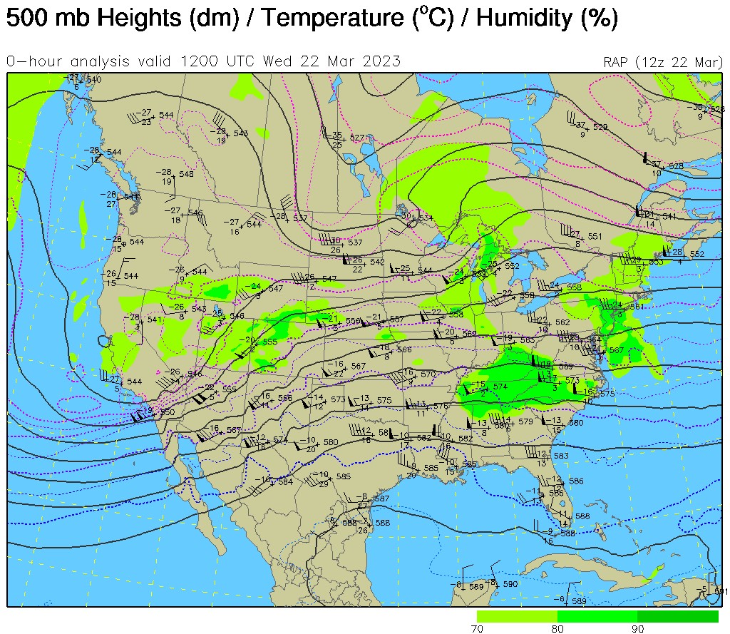
The 500 mb low (above) off of California is opening up and coming ashore this morning, with the trailing, southern portion of this feature forecast to move across Arizona later today.

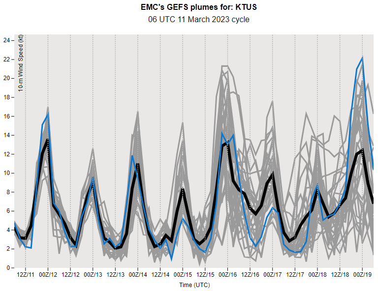
Forecast plumes from the 06 UTC runs of the GEFS are shown here - above is for QPF, with the plumes all indicating light rainfall at the airport today, and then quiet through most of rest of the month. The plumes for temperature (below) indicate a cool couple of days, with mostly falling temperatures today. Plumes for wind (second below) indicate several windy periods through the coming week.


Forecast above (from the 12 UTC WRF-HRRR) is for precipitation through midnight tonight - precipitation over eastern Pima County is mostly quite light, except on the Catalinas. Current forecast from the NWS Forecast Office for today (below) indicates 80% PoPs and breezy - text indicates gusts up to 37 mph, which to me is definitely windy.

Tuesday, March 21, 2023

Windy Then Showers


Heavy clouds hang on the Catalinas at 7:20 am MST this morning.

The 06 UTC GEFS plumes for QPF (above) forecast rain at the airport tomorrow in all ensemble members; however, amounts are quite light. Forecasts for winds (below) indicate strong speeds today through tomorrow morning.


The WRF-RR forecast for rain amounts from the 09 UTC run (above) forecasts rain across all of Pima County. Amounts are light at the airport but heavier over parts of metro area and the mountains. Forecast wind speeds below (from 12 UTC WRF-RR) are valid at 1:00 pm today. Note that the NWS Forecast Office has issued a wind advisory for southeast Arizona today (second below).


Sunday, March 19, 2023

Coming Week


View of Catalinas at 6:30 am this morning shows high, thin cirrus overcast.

Plumes  from 06 UTC WRF-GFS are shown here. Forecasts for QPF at airport (above) are consistent showing rain at the airport from Tuesday into Thursday morning - there is a large spread with the operational GFS one of the heavier members. Forests for temperature and wind (below) indicate significant temperature drop on Tuesday followed by slow warming. Forecasts also indicate several windy periods during coming week.


Forecast for coming week (through 5:00 am next Sunday - above) indicates a wet week for most of Arizona - note the very heavy totals across the Rim country. Current forecast from the Tucson NWS Forecast Office is shown below.


Friday, March 17, 2023

St. Patrick's Day


Early morning view toward the Rincons before sunrise today. Below is 2:00 pm MST view of showers on the Catalinas yesterday.

Green hair is in today - photos at bottom from Philadelphia and Chicago.


Scattered showers yesterday afternoon produced rain amounts of 0.04" or bit more at many sites across the ALERT network (above and below). Areal coverage appears to have been 30 % or so. Here at house we had 0.09" during the early afternoon.


Thursday, March 16, 2023

Yesterday's Rain

 View above from 11:15 am MST this late morning shows scattered low clouds beneath a cirrus overcast - the morning has been a bit dreary because of the high overcast.

Yesterday's showers produced widespread rains across the metro area, and even mostly rain on the Catalinas. ALERT maps below are from 7:00 am this morning for past 24-hours. Here at house we received a total of 0.09" from several periods of light showers during the day.


Wednesday, March 15, 2023

Chance For Showers

Another morning with spectacular skies over the Rincons a bit after 6:00 am MST.

IR satellite image from 8:55 am (above) shows large cloud mass covering much of Arizona. The skew-T plot from Yuma at 14 UTC this morning (below) shows a nearly saturated troposphere, with strong west-southwesterly winds aloft.


The 06 UTC WRF-GFS forecast from Atmo (above) is for precipitation through 5:00 pm tomorrow. That model keeps heaviest precipitation well to our north. The GEFS plumes for QPF have been very consistent last several days, indicating about 0.30" of rain at the airport (below). The morning weather graphic at bottom is from the NWS Forecast Office webpage.


Saturday, March 11, 2023

Quick Look Ahead


Golden skies over the Rincons this morning. High clouds moving over Arizona from southern California will make the morning seem a bit dreary at times.

Doing a quick look here using the GEFS plumes from 06 UTC. The forecast for precipitation at the airport (above) indicates some chances for showers after mid-week. Temperatures (below) remain mild, while the model forecasts indicate the possibility of several windy periods during the week - especially on Wednesday and Saturday. It has been dry here for almost 10 days now.