Friday, January 27, 2023

End Of January


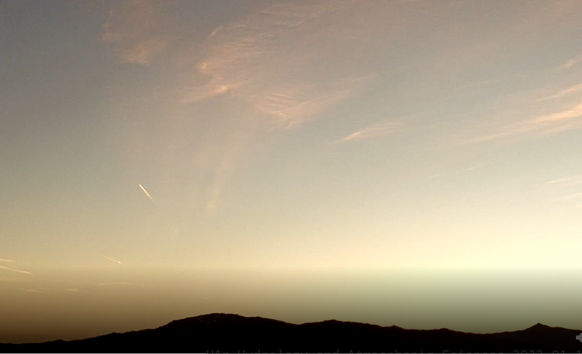
View of vivid blues skies over the Catalinas at 8:25 am MST this morning. Forecast models continue to indicate chances for light showers at end of the month.

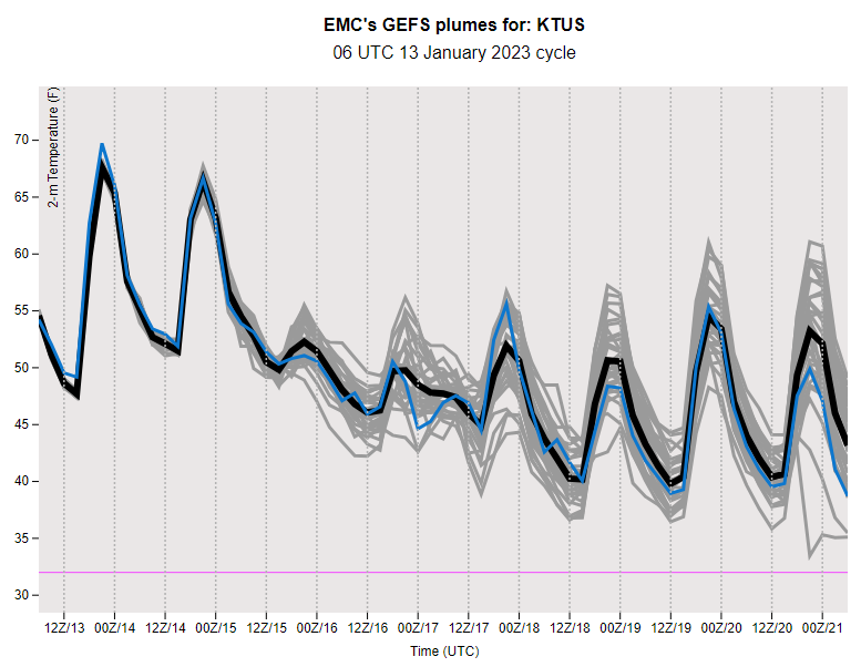
The GFS forecast for 500 mb (above from 06 UTC runs) forecasts a very sharp trough over Arizona at 11:00 pm MST on the 31st. However, forecast of PW from same runs (below) indicates that the trough will have little moisture to work with.


Forecast for precipitation through that time (above) indicates little over most of Arizona. The 00 UTC run of the WRF-GFS at Atmo (below) is a bit more optimistic for area with precipitation (mostly very light) for all of Pima County. So, there'll be some chance for a bit more January at the airport and across the Metro area.

Tuesday, January 24, 2023

Dry Rest Of Month?


Pristine blue skies over the Catalinas this morning at about 7:30 am MST. Lows over night (below) were mostly in the 20s F, but note the colder temperatures on the mountains. Low here at house was 24 F.


At 500 mb (above) there is a long stream of northerly flow from Canada south across Arizona, with cold low now shifted over the Big Bend of Texas.

GEFS plumes from 06 UTC (above for QPF and below for temperature) indicate slight chances for light rain at airport on last day of January, with moderating temperatures following this morning's cold. 

At bottom is GFS forecast for precipitation through 11:00 pm on January 31st. Little in the way of weather to look forward to through the last week of the month.


Wednesday, January 18, 2023

Quick Overview Sunday to Today


View of rain shower over eastern Catalinas yesterday morning at 10:30 am MST.

We had a widespread and heavy rain event across the entire region during past three days. ALERT maps shown here are for the three day period ending at 10:30 am yesterday. Total event amount here at house was 1.55 inches. This was heaviest rain event at the house since August 2021!


Flow in the Rillito peaked at just over 6000 CFS yesterday.

Forecast from NWS this morning indicates fair weather next couple of days, but with cold morning lows, resulting in frost and freeze warnings. Morning view today (below) is from 9:15 am.

Saturday, January 14, 2023

Brief Update


Partly cloudy over the Catalinas and metro area at 10:49 am MST this morning.


Two strong shortwaves will impact Arizona over the next several days. The GFS forecast for 500 mb (above - valid at 18 UTC on Tuesday the 17th shows the leading wave over the Great Lakes, while the second wave extends north-to-south over western Arizona.

Winds will become gusty tomorrow ahead of the first wave - 12 UTC WRF-HRRR forecast above shows steady wind speeds forecast by the model valid at 10:30 am tomorrow morning. Forecast below from same model run is forecast for total precipitation through midnight tomorrow.

Current statement from the NWS webpage is below.

Friday, January 13, 2023

Friday The Thirteenth - A Look To Next Week


View toward the Rincons at 7:15 am MST this morning, with a bit of a short contrail captured also.


Forecasts are trending wet from late Saturday through Wednesday night next week. Above shows morning forecast from Tucson NWS Forecast Office, while below shows 06 UTC plumes from GEFS for QPF at the airport - very large range of amounts in the GEFS continues. Second below shows the temperatures plumes forecast for the airport, with strong cooling beginning on Sunday.


The 500 mb forecast above is from the 06 GFS and is valid at 18 UTC on Tuesday the 17th - a broad trough has settled over the West with a number of embedded shortwaves.

Forecast below is from the 00 UTC WRF-GFS run at Atmo, showing a major precipitation event for Arizona - forecast goes through midnight next Wednesday. Amount at airport (one inch) is similar to the GEFS plumes.

Wednesday, January 11, 2023

Next Chances For Rain


Some purple hues in the 7:00 am MST view toward the Catalinas this morning.

Down at bottom is FlightAware "Misery" map from just a bit ago. The FAA grounded all flights during the early morning hours due to a systems failure. Sure glad I wasn't traveling, since there was obviously a lot of misery spread around the country's airports this morning.


Here in Tucson high cloud cover overnight kept morning lows quite mild, Map of 7:00 am temperatures (above from MesoWest at University of Utah) shows most sites in the 40s, but even some spots above 50 F. 

The 06 UTC GEFS plumes for the airport (QPF above, T below, and wind second below) indicate a distinct cooling and unsettled three days beginning next Sunday. There is considerable variance among the members, so this is currently a situation for monitoring as the weekend approaches.


Friday, January 06, 2023

Outlooks Through Two Weeks


View of cloud bands over the Catalinas at 6:45 am MST this early morning.

Below is current five day outlook from the NWS, indicating mild and dry days for southeast Arizona through next Tuesday.


Longer range forecasts from the 06 UTC run of the GFS model are shown here. Above is total precipitation through 18 UTC on January 13th, and below is same through 18 UTC on January 20th. Activity shifts east and south into Arizona during the third week of the month in the forecasts. Note the huge amounts of precipitation forecast for northern California through the entire period.


At 500 mb a large ridge dominates most of the western US at 18 UTC on 13 January (above). But by 18 UTC on the 20th, a broad trough covers most of the western 2/3rds of the country, bringing precipitation into our area.

Tuesday, January 03, 2023

Light Showers Yesterday


Heavy clouds giving way to some blue sky this morning at 8:00 am MST.

Showers yesterday were fairly widespread but with generally light amounts. Here at house we had0.04" yesterday. Ron Holle reports storms with small graupel at his place in Oro Valley on both the 1st and 2nd.


Model forecasts this morning. Above is from 12 UTC WRF-RR and shows total precipitation through 5:00 am on the 6th. Below is from the 06 UTC GFS and shows total precipitation through 06 UTC on the 13th. Looks like a couple of dry weeks after our wet start to 2023.

Monday, January 02, 2023

General Rain/Snow


View toward the Catalinas at 8:10 am MST this morning shows heavy cloud over the area.

ALERT maps (above and below) show 100 % coverage for 24-hours ending at 8:00 am this morning. Amounts of half an inch and greater were generally restricted to Catalinas/Redington Pass and southwestern portion of network. Here at the house we had 0.27", while DM reported 0.19", Atmo 0.17" and TUS 0.13". Higher elevations had snow, as per image from the General Store in Summerhaven (bottom).

Plot of detected CG flashes (from Atmo and Vaisala - below) for 24-hours ending at 8:00 am this morning shows considerable thunderstorm activity to our north and west - isolated flashes detected in Catalinas and New Mexico Bootheel.


Todays forecasts from NWS (above) and from 12 UTC run of WRF-RR at Atmo, showing almost nothing in Pima County.