Friday, April 30, 2021

More Wind

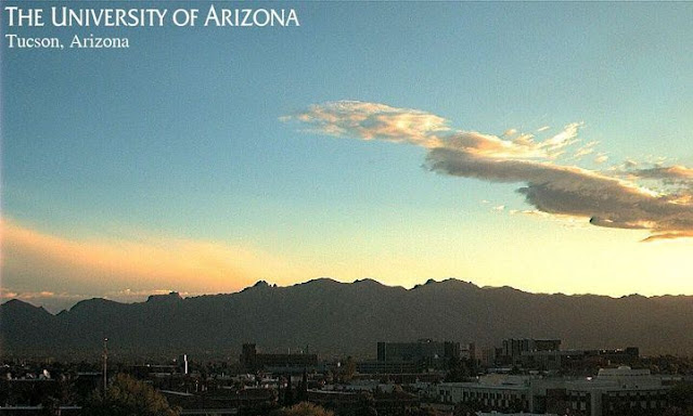
View of Catalinas and cloudless skies at 6:39 am MST this morning. At bottom is view at Castle Valley, Utah, which is near the state border west-southwest of Grand Junction, Colorado.

Yesterday was mild with a low of 50 and a high of 84 F, but winds gusted to 32 mph during the afternoon. Today has started out almost 10 degrees warmer, as hotter temperatures return for the weekend.

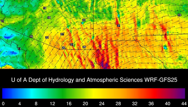
Forecast above is for 10-m wind speeds from the 06 UTC run of the GEFS. Note strong wind peak on Sunday and much lighter winds for today. However, the 06 UTC run of the WRF-GFS at Atmo below (valid at 9:00 am this morning) indicates strong east winds - winds have already picked up here at house.


Forecast winds for 3:00 pm on Sunday afternoon (above, from same WRF run) indicate stronger wind speeds from the southwest. The current forecast from the NWS (below) meshes well with the WRF forecasts.


Thursday, April 29, 2021

Showers On Catalinas


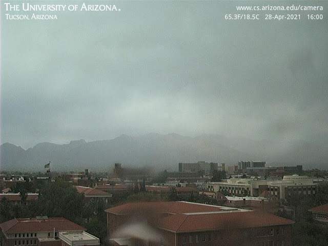
Light showers (above) on the Catalinas at 4:00 pm MST yesterday afternoon.  MesoWest plot of 24-hour precipitation (ending at 6:00 am this morning below) shows light amounts on and near the Catalinas. 

There was a light shower here during the afternoon but amount was less than 0.01", thus a Trace for the day.

Contrast current view of Catalinas (bottom) with yesterday's (above).

Wednesday, April 28, 2021

Mostly Light Precipitation Amounts


Isolated clouds over the Catalinas at sunrise this morning, with some overcast cloudiness to far northwest. Bottom is view at Mt. Lemmon SkyCenter just before sunrise.

Plots of 24-hour precipitation amounts ending at 6:00 am MST this morning: ALERT north above, ALERT south below, and MesoWest for main metro area second below. Amounts are generally less than 0.20"; however, two sites out toward Three Points had over half an inch. My subjective assessment is that once again the WRF forecasts prevailed over the NWS forecasts.

Here at the house there was a thunderstorm about 2:45 pm but just light showers - total in gauge this morning was only 0.02".


The morning 500 mb analysis (above from SPC) shows the cyclone center to be over the White Mountains, but with considerable cold air and troughing still to our west and southwest. It is of interest that TWC's 500 temperature of -24 C appears to be the coldest observed over the continental US - a pretty rare occurrence. The forecast below (from the 12 UTC WRF-RR at Atmo) indicates a bit of very light shower activity this afternoon, mostly near the Catalinas and Rincons.

I had hoped for enough rain to wet the ground, but no such luck; and now we head into May, which is - on average - the driest month here at the house in my 20+ years of record.


Tuesday, April 27, 2021

Showers Possible Today


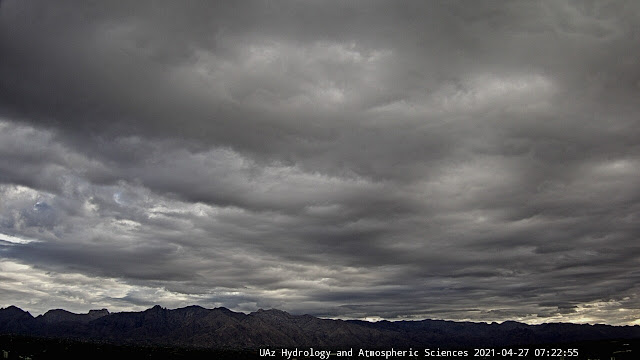
Heavy overcast skies here in Tucson this morning. Sunrise out at San Simon below. At bottom - morning snow in Flagstaff and rain showers out at Parker along the Colorado River.


Visible satellite image from 6:36 am MST (above) shows most of Arizona, except far southwest, with cloud cover.

The current morning forecast for the airport (above from NWS) calls for a 50 percent chance of measurable rain today (down a bit from yesterday's forecast). The 06 UTC GEFS plumes for the airport indicate higher POPs, with an average of about a quarter of an inch. The Atmo WRF-GFS run at 06 UTC (second below) forecasts little for the metro area through 11:00 pm tonight. Take your pick.


The WRF forecast sounding for TWC valid at noon today (above) indicates there is limited CAPE available with a slight chance for some thunder.

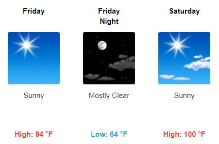
This morning's forecast for Friday and Saturday (below) indicates a rapid warm up, with a high around 100 F on Saturday.


Monday, April 26, 2021

Increasing Chances For Showers


View of Catalinas and clear skies this morning a bit before 6:00 am MST. Down at bottom are early morning views of Bisbee and Flagstaff.

The 500 mb analysis (above from SPC) at 12 UTC this morning shows a complex cyclone over the northwest US, and a trough extending far to its south along the west coast. The 06 UTC GFS 500 mb forecast (below) brings the cyclone south, so that by 5:00 pm tomorrow afternoon the system is centered over Yuma. 

Apparently some problems at Atmo during the night, so no 06 or 12 UTC WRF products for comparison.


Precipitation forecast from the GFS (above) is through noon on Wednesday the 28th. The 06 UTC GEFS plumes for QPF (below) have increased (relative to past two days), and now indicate 100 percent likelihood for rain at the airport tomorrow. Forecast amounts have increased substantially, with the average now over 0.30". The current morning forecast from the NWS is second below, indicating 60 percent POPs for airport tomorrow. The GEFS wind forecast indicates strong winds today, and the NWS forecast calls for gusts as high as 37 mph at the airport. Will be interesting to watch how this all evolves during the next 48 hours or so.


Sunday, April 25, 2021

Quick Look Ahead


View of the Catalinas about 6:30 am MST this morning, showing a bit of haze/dust in the air here. Two views down at bottom: another nice sunrise at Silver City, New Mexico; and view of Guaymas, San Carlos Marina, also about 6:30 am.

The 06 UTC GEFS plumes for rainfall at TUS ((above) are fairly bullish for precipitation Monday night and Tuesday, with average amount a bit over 0.20".

The WRF runs at Atmo are much less indicative of precipitation for southeast Arizona. Above is forecast from 06 UTC WRF-GFS for rain through 11:00 am on Wednesday the 28th; and below is WRF-NAM from 12 UTC forecast for rainfall through noon on the 28th. Not much to get excited about in those forecasts - so we'll watch to see how the various forecasts pan-out.

Forecast second below is for total precipitation though the end of April from the 00 UTC WRF-GFS, with again little forecast for our part of the state. Another situation of dueling forecasts: NWS versus Atmo models.


Friday, April 23, 2021

Trough Nearly Overhead This Morning


There was a bit of fog and stratus over the Mt. Lemmon SkyCenter before sunrise this morning (above from about 5:25 am MST). The skies up there cleared rapidly after sunrise. Down at bottom is a view of Flagstaff and the San Francisco Peaks at about the same time.

This morning's 500 mb analysis (above from SPC) shows that a short-wave trough has just passed by TWC. The strongest part of this trough appears to be over northwestern Mexico - as this feature moves toward the southern Plains severe thunderstorms are expected to develop ahead of it this afternoon.

The 500 mb forecast (below - from 06 UTC WRF-GFS and valid at 11:00 pm on the 27th - next Tuesday night) indicates another, perhaps stronger, trough moving across our area. The GEFS plumes for QPF at the airport (second below) indicate better chances for light rain at the airport with this next system.


Forecast above is from the 00 UTC GFS and is for total precipitation through the end of the month. This model forecast indicates a bit of precipitation to our west. However, the forecast from the 06 UTC WRF-GFS run at Atmo (below) brings some light rainfall across the metro area on Monday night. So perhaps a slight chance for a bit of April rain before the month comes to a mostly dry end.


Falcon 9 Pre-Dawn Launch

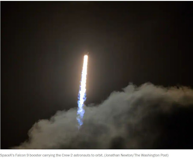
 SpaceX successfully launched a Falcon 9 into orbit during the very early morning hours today. There are four astronauts aboard, who will spend approximately six months on the International Space Station. The crew is international: two astronauts from the US, one from France, and one from Japan. The launch occurred at the Kennedy Space Center - Cape Canaveral, Florida.