Wednesday, September 30, 2020
Fair And Dry
Tuesday, September 29, 2020
Windy Morning
Sunday, September 27, 2020
Drought Continues
Mostly fair skies this morning, but with varying amounts of high cirrus coming by.
Models forecast continuing dry conditions well into early October. Above graphic shows the GEFS plumes for QPF at the airport through next Sunday.
Serious drought conditions continue across much of the western US, including southeastern Arizona. Below is part of drought monitor map from last Tuesday. I snipped the eastern and islands portion of the map to show that the northeast, Alaska, and the Hawaiian Islands are suffering from dry conditions also.
Tuesday, September 22, 2020
September 22nd
Bit of pre-sunrise color this morning, which is the first day of astronomical fall. View from campus at bottom shows some virga east of the Catalinas. Two ALERT sites on the mountain reported rainfall yesterday.
The morning TWC sounding (above) exhibits a shallow layer of CAPE around 500 mb, which will probably support more showers on the Catalinas today. The GFS forecast of total rainfall through 00 UTC on October 1st (below) continues to leave most of Arizona high and dry.
Sunday, September 20, 2020
Rain In September?
Friday, September 18, 2020
Smoke Continues Here
The layer(s) of smoke aloft have gotten a bit thicker today, as a large, 500 mb anticyclone dominates the western U.S. Photos above and below are from just after sunrise this morning. The image at bottom (from Jack Hales webcam wall) is from Mt. Wilson observatory early this morning - view is looking south as the Bobcat fire burns close by.
A look at CG flashes across the US (above from Atmo and Vaisala) for the 12 hours ending at 10:00 pm MST last evening. All-in-all very quiet across the US wrt thunderstorms.
The coming week appears to remain very quiet across the Southwest. Forecast above from the 00 UTC WRF-GFS shows total precipitation forecast (on the 5.4 km grid) for the next seven days ending at 5:00 pm next Friday. The GEFS plumes below show that the sprinkles forecast for southeast Arizona occur at the end of the period. Our dry period here continues into second half of September.
Wednesday, September 16, 2020
Smoke Outlook For Today
Tuesday, September 15, 2020
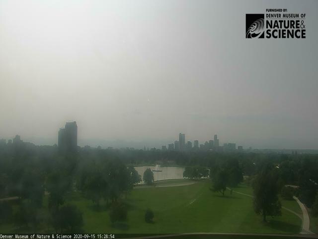
Smoke Decreasing Some Today
Another red sunrise this morning. However, smoke has diminished some overhead (below), and is mainly off to east (and also out west) this morning. Down at bottom the first image shows the smoke at LAX this morning. Second image at bottom shows Old Faithful erupting for a large crowd yesterday afternoon.
Weather news today is focused on Hurricane Sally, which is drifting slowly northwestward off the Mississippi/Alabama coasts. Sally is a Cat 1 hurricane, with 85 mph winds. Visible image above and IR view below, at a bit before 0730 am MST.
The 500 mb analysis (above from SPC at 12 UTC) shows a very weak cyclonic circulation, centered between here and Albuquerque, embedded within the large anticyclone. Heights at Phoenix are now within 10 m of surrounding sites. But, Chihuahua, Mexico, is still 30 to 40 m too low relative to other observations - disregard the poor quality control, which lets the analysis routine decide there is a Southern Hemisphere low south of Chihuahua.
The morning sounding (above) from TWC reamins discouraging with only slight bit of CAPE below a nasty inversion. Precipitable water is just less than inch. Nothing much to look forward to except for continued highs in the 90s, that may flirt with 100 F next few days.
Forecast below (from the 00 UTC WRF-GFS run at Atmo) is for total precipitation through 5:00 pm on the 22nd (next Tuesday).
Monday, September 14, 2020
Sally Moving Slowly Toward Gulf Coast
Smokey skies continue over Tucson this morning - this makes one full week with the smoke from California continuing overhead here. Visible satellite image (below) from 2115 UTC (2:15 pm MST) yesterday afternoon shows the smoke across all but the southeast U.S. Model trajectories indicate that the smoke plumes have reached east across the Atlantic to the UK and Europe.
Forecasts for total precipitation through 5:00 pm next Monday afternoon (the 21st) hold little hope for the Southwest - above is from the 00 UTC WRF=GFS and below is from the 00 UTC GFS run. The GEFS plumes are also flat-lined.
The Atlantic continues very active, with five named tropical storms this morning (above shows IR image from 15 UTC this morning,and below shows morning shows the storms as per NHC). Paulette is currently the only hurricane, but Sally is forecast to to make landfall near Gulfport, Mississippi, tonight as a Category 1 hurricane.
Sunday, September 13, 2020
Smoke And Haze Continues
We've been away for a couple of days, but did not venture far enough to be out from under the smoke from the California fires. View about shows thin smoke overcast continuing here this morning. Bottom is view from downtown looking east toward the Rincons.
Outlook for coming week for most of the West continues to be very dry - above is 06 UTC GFS forecast for total precipitation through 12 UTC on 20 September. So far here at house we have a Trace on the 8th of September.
The Atlantic tropics are very active today, as per morning plot from NHC above. Tropical storm Sally is forecast (below) is forecast to become a hurricane and track toward New Orleans, which is already under a hurricane warning.


