Friday, September 30, 2022

Down Day Yesterday


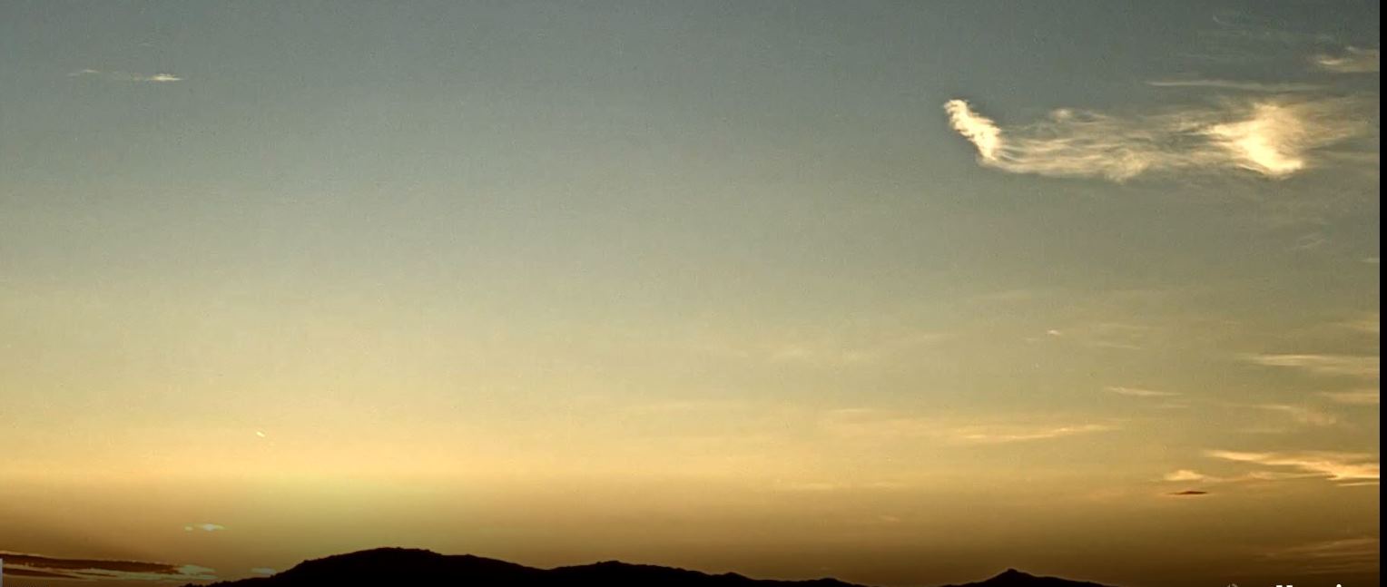
A look at the Catalinas at 600 am MST this morning.

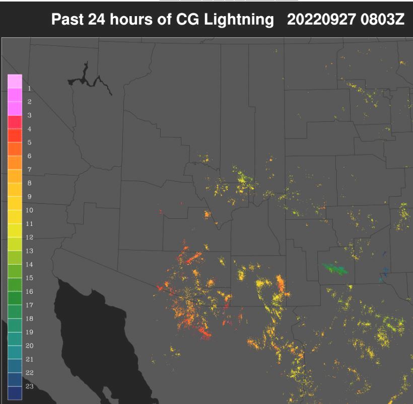
Thunderstorms remained well south and southwest of Tucson yesterday - as per plot of detected CG flashes for 24-hours ending at 0103 am (0803 UTC) below, from Atmo and Vaisala. Basically a dry and down day here.


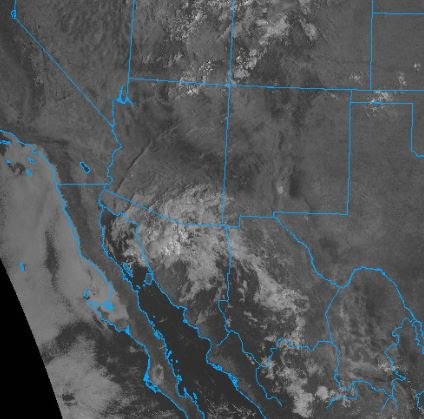
Visible satellite image at 1426 UTC this morning (above) shows some cloudiness over northern Sonora and southeast Arizona. Hurricane Ian is off the South Carolina coast, about to make its third landfall.

Video of Jim Cantore reporting from the west coast of Florida yesterday graphically shows the dangers of being outside in a Cat 4 hurricane. See:

https://www.washingtonpost.com/media/2022/09/29/hurricane-videos-jim-cantore/


The 500 mb level continues to be a mess - above shows the 12 UTC analysis. There is a weak anticyclone centered somewhere north of Tucson and a weak trough, or closed low south of Tucson. The cloudiness shown above is associated with the feature south of here, which is forecast to hang around through the weekend.

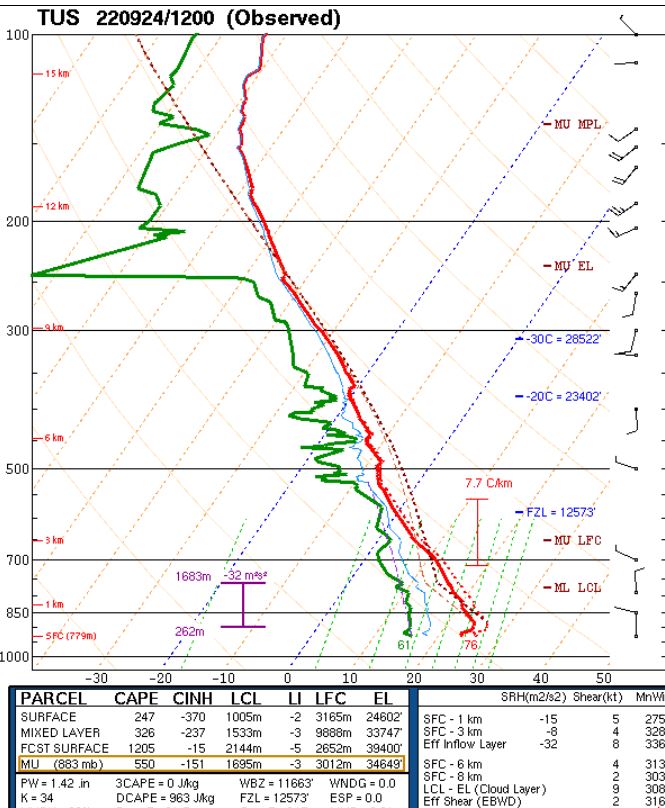
The morning sounding from TWC/TUS is also pretty ugly. There is a bit of CAPE, if boundary layer heats out to around 700 mb. There are almost no steering winds, so some spots could see heavy rain, if storms develop. The 12 UTC WRF-RR forecast does get storms going over much of the metro area - graphic below shows model rainfall through midnight tonight. 

Current morning forecast from NWS indicates POPs for measurable rain at airport of 40 percent today.Time will tell, as September draws to an end.

Thursday, September 29, 2022

Rain Across ALERT Network


Heavy clouds brought a dreary morning here in Tucson. The cloudiness covers a large portion of southeast Arizona and northern Sonora, as per visible satellite image below - from 8:15 am MST.


Plot of detected CG flashes (above from Atmo and Vaisala) shows thunderstorms occurred yesterday afternoon across Pima and Santa Cruz Counties, with nothing to their east. Note that almost nothing mentioned in yesterday's post verified well.


 Showers developed over parts of the metro area, resulting in a number of reports in the ALERT network (above and below). Two sites reported over an inch of rain. Here at the house we had 0.24"; Atmo reported 0.41"; and both the airport and DM measured 0.04".


The morning 500 mb analysis (above - from NCAR RAP) shows that the cloudiness shown above is associated with an inverted trough over Arizona and Sonora. This feature will be slow to move out, bringing continued chances for showers through the weekend, as per am forecast from TUS Forecast Office below.

The current NHC forecast for Hurricane Ian, now off the east coast of Florida, is shown second below.


Wednesday, September 28, 2022

Limited Low-Level Moisture


Red skies this morning over the Rincons at about 6:10 am MST.

Down at bottom is visible satellite image of Hurricane Ian, which is nearing landfall on the southwestern Florida coast. Ian is currently a high-end Cat 4 storm, or perhaps a Cat 5.

Plot of detected CG flashes (above from Atmo and Vaisala) for 24-hours ending at 0133 am this morning. Thunderstorm activity over southeastern Arizona was much reduced relative to Monday, with only activity in central and western portions of Pima County.

The sounding from TWC/TUS this morning (above) is similar to yesterday's. There is little to no CAPE. PW of about an inch, and light winds below 200 mb. A significant increase in low-level moisture would be needed for there to be CAPE for afternoon storms.

There is a layer between 700 and 800 mb with stronger southeasterly winds, so there is a chance of gusts to around 30 mph again today. Highest gust at TUS yesterday was 33 mph.

Forecast above (from the 12 UTC run of the WRF-RR at Atmo) indicates rainfall across Pima County will be similar to yesterday - mostly south to west of our area.

In contrast, the NWS has issued the graphic below, indicating moderate chances for heavy to severe storms in eastern Pima County. The POPs for the airport are currently 30 percent in the morning forecast. I find this outlook a bit puzzling, given the morning sounding.


Tuesday, September 27, 2022

Hot With Gusty Winds


Multiple contrails over the Catalinas just before sunrise (which was at 6:15 am MST) this morning.

Plot of detected CG flashes (from Atmo and Vaisala) above is for 24-hours ending at 1:03 am early this morning. There was considerable increase in thunderstorm activity over southeast Arizona compared to Sunday. This was a surprise to me, given the morning sounding - see yesterday morning's post. There was a bit of a donut hole centered over the airport.

The ALERT network (two graphics below) had no rainfall reports over the metro area, but there were reports over Redington Pass area and south to west of the City. Note several reports over half an inch, with two reports over an inch. Nothing here at house.


The 500 mb analysis (above) remains a mess with the weak winds and height gradients. The sounding appears even more stable today (below from NCAR RAP). There are strong east winds below 800 mb again today.


I missed the gusty winds yesterday - the airport reported a gust to 33 mph. The 12 UTC WRF-RR forecast for winds at 9:30 am (above) indicates another windy morning. The same WRF forecast run predicts almost no rainfall across all of Arizona through midnight tonight, which looks reasonable to me.


Hurricane Ian


Hurricane Ian has moved across western Cuba (above) and is now in the Florida Straits as a high-end Category 3 hurricane. The forecast from NHC (below) indicates that Ian will make landfall in Florida near Tampa as a Category 4 hurricane. 


Monday, September 26, 2022

Chance For Showers?


Pre-sunrise view of Catalinas, with bit of cloudiness, early this morning.

Plot of detected CG flashes for 24-hours ending at 0133 am MST this morning (below, from Atmo and Vaisala). There was only a bit of thunderstorm activity indicated south of the Border.


At 500 mb this morning (above) the large ridge over the western US and Canada continues, but there is no single or clear center of circulation, due to the very weak height gradients and light winds.

The morning sounding from TWC/TUS (below) continues to have mostly light/variable winds; however, layer from 850 to 700 mb has some easterly winds over 20 kt. There is only 1.04" of precipitable water and little or no potential CAPE.


The forecast models bring in slightly higher moisture content from the east during the day. The 12 UTC WRF-RR run at Atmo forecasts some light showers in eastern Pima county through midnight - above forecast is of total rainfall through midnight tonight. Below is morning graphic from the NWS TUS Forecast Office, which is currently forecasting a 20 percent chance for showers at the airport.


Down in the Caribbean, Hurricane Ian is strengthening, and it is forecast to become a Category 3 storm as it moves northward into the eastern GoM, and eventually Florida - as per morning outlook from NHC above. Ian is shown below in a 16 UTC IR satellite image and appears to be a very large storm.


Sunday, September 25, 2022

Quick Update

Scattered high clouds over the Catalinas at 7:20 am MST this morning. Satellite visible look at the West at 14 UTC (below) shows mostly fair skies predominate.


Plot of detected CG flashes (above from Atmo and Vaisala for 24-hours ending at 0103 am early this morning) Shows thunderstorms in eastern Pima County were restricted to the Catalinas and Rincons. Limited activity over Cochise and Santa Cruz Counties and no reports of severe storms.

This morning's sounding from TWC/TUS (below) has PW down to about an inch. Sounding has no CAPE and light/variable winds. Little to expect today, except hot high temperatures around 100F.

Saturday, September 24, 2022

Dry Out


View looking toward the Rincons at 6:15 am MST this morning.

Yesterday was mostly a down day Pima County and also most of the metro area. Plot above shows detected CG flashes (from Atmo and Vaisala) for 24-hours ending 0133 am this morning. Note the clusters of CGs on the north side of the Catalinas and also down near Green Valley. No precipitation reports across most of the ALERT network - two graphics below for 24-hours ending at 7:30 am this morning. 

Yesterday's WRF-RR had by far the best forecast for our area - see bottom two graphics in previous post.


The 500 mb analysis is a real mess over the souther and western US at 12 UTC this morning (above) due to very weak height gradients. There is a weak anticyclonic circulation over the Big Bend country of Texas, with light westerly winds across Arizona. The 12 UTC sounding from TWC/TUS still has 1.42" of PW, but models forecast a decrease over the weekend to values below an inch. Winds below 250 mb are very light. No steering flow if storms were to develop later today.


Forecast above (from the 12 UTC WRF-RR) indicates little rain across all of Arizona, except for southern Cochise County. The morning graphic from the NWS (below) has me scratching my head, given the overall situation this morning. The insert graphic at right top is illegible, even on the NWS web page, but it basically highlights the eastern portion of the TUS forecast area.