Monday, January 31, 2022

Showers Wednesday?


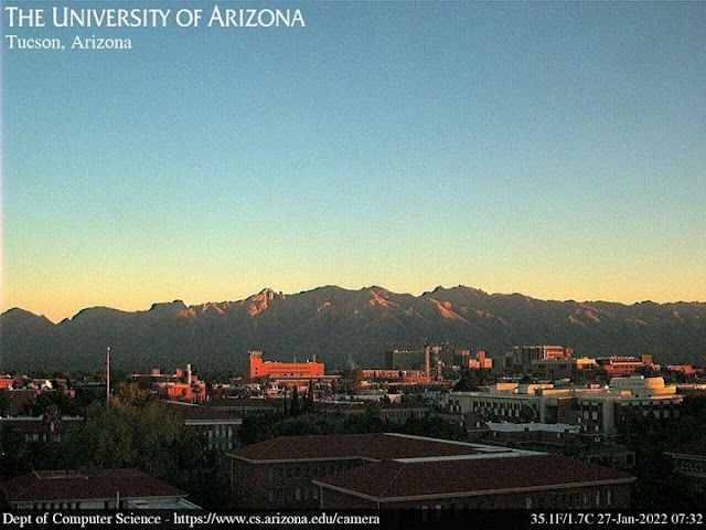
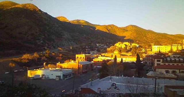
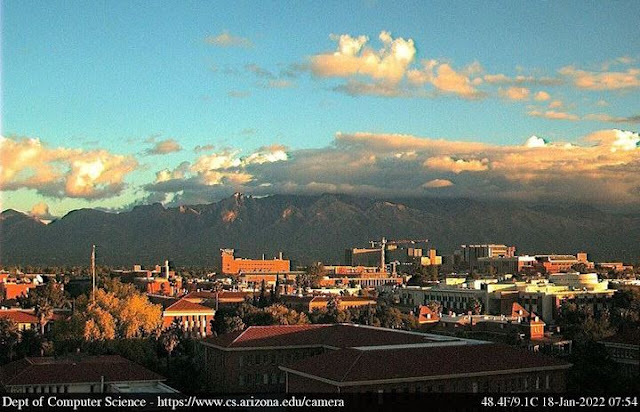
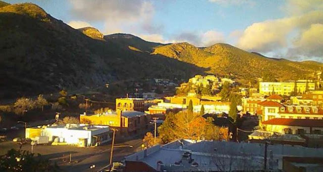
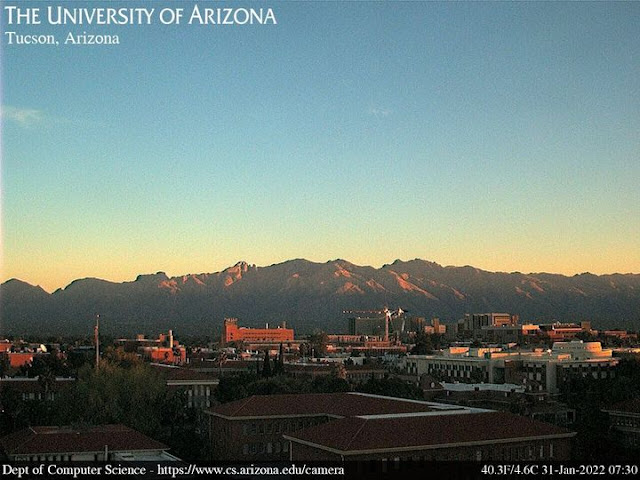
Sunrise views at 7:30 am this morning: above from campus and bottom from Sahuarita.

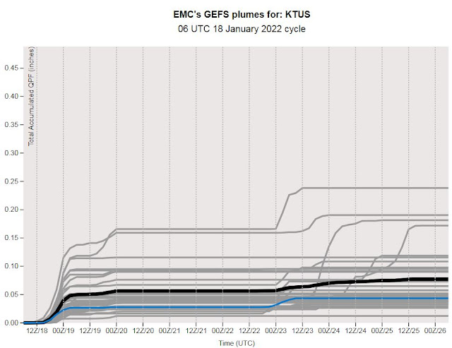
Models are forecasting a chance for showers on Wednesday as a strong 500 mb trough approaches Arizona. The GEFS plumes for QPF (above) show that almost all members forecast measurable rain for the airport - amounts range from 0.30" to perhaps a Trace. Snow levels will come down onto the foothills and perhaps to some valleys in Cochise County. Plumes for temperature (below) indicate quite cold morning lows for Thursday through Saturday.


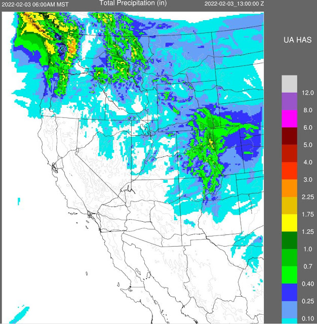
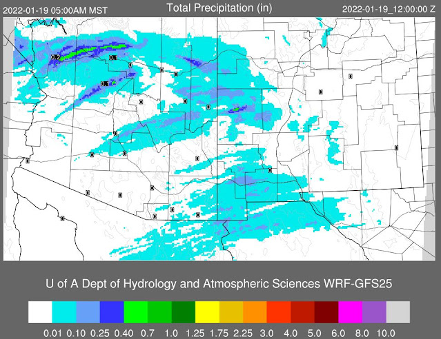
Forecasts from the 06 UTC run of the WRF-GFS at Atmo show radar echoes at 6:00 pm MST on Wednesday (above), and total precipitation amounts through noon on Thursday.

Not a big precipitation event, but at least a bit of weather to watch. 

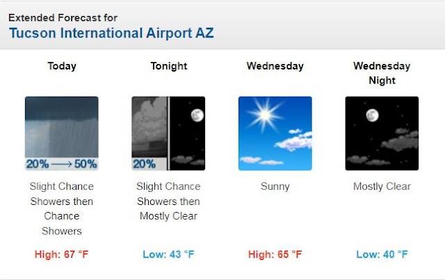
Current morning forecast from the Tucson NWS Forecast Office is second below. Note the 28F low for Thursday morning - this implies a very cold morning up here along the Rillito.


Thursday, January 27, 2022

Wind To End Week


Early morning views - above Catalinas at 7:32 am MST and of Bisbee at 7:35 am, bottom.

Mostly dry and mild weather continues for our region, with little prospects for precipitation into February.


However , there will be some gusty winds tomorrow, as a shortwave digs south across New Mexico, bringing a back-door front with easterly winds. Forecasts here from the 12 UTC run of the WRF-RR at Atmo. Above shows Arizona/New Mexico winds forecast at 9:30 am tomorrow; while below shows plot of winds and temperatures across Tucson area at 8:30 am tomorrow.

Second graphic below shows precipitation forecast by the 06 UTC run of the WRF-GFS out through 
6:00 am on February 3rd (next Thursday).

All the weather excitement next couple of days will be with a developing storm over the eastern third of the country.


Monday, January 24, 2022

Catch Up


I missed posting yesterday, so this is a bit of a catch up. Image above shows early morning shower over north metro at about 2:00 am MST early Sunday morning. Image at bottom is view of Catalinas at dusk yesterday.


The showers  Saturday night?Sunday morning impacted mostly the north portion of the ALERT network (above ending at 10 am MST Sunday morning) - remember the 0.04" ALERT threshold. If I recall correctly, there was a light snow accumulation at the highest elevations of Mt. Lemmon. Precipitation for the main metro area (from Univ. of Utah's MesoWest - below ending at same time) shows mostly Trace to very light amounts. Here at house we had 0.02" in the gauge.


Finally, a look ahead shows very little in the way of precipitation for an extended period. Graphic below shows 06 UTC GFS forecast of precipitation through 06 UTC on February 8th (15 days out). It is a very long-term forecast, so we'll watch to see how things actually evolve.


Saturday, January 22, 2022

Chance For Showers This Weekend


Views at about 7:25 am MST this morning - from campus above and from Sahuarita at bottom.

At 500 mb this morning (analysis above from SPC) there is a closed low over southwestern Arizona, centered near Yuma. This low will move eastward over the weekend, moving nearly over Tucson. However, the system is very starved for moisture - see analysis for total precipitable water at 14 UTC this morning (below). All of the country, with exception of Florida, is very dry with PW values near half an inch or less.


The plumes for precipitation at the airport (above from 06 UTC runs) do indicate light rain for all members late today into tomorrow. The 06 UTC run of the WRF-GFS  forecasts only spotty precipitation over southeast Arizona - graphic below shows model forecast of total precipitation through 5:00 am Monday morning. The GFS plumes and the WRF-GFS are again considerably different for the metro area (see posts last Tuesday and Wednesday). Second below is the current forecast from the NWS Office for the airport with POPs at 30 % for tonight and tomorrow. Time will tell.


Wednesday, January 19, 2022

First Precipitation Of 2022

View of Catalinas with band of sunshine along the foothills yesterday afternoon at 4:50 pm MST. Down at bottom is east view from San Simon at about 7:00 am this morning.


ALERT network 24-hour rainfall at 7:30 am this morning (north half above and south below) - remember that ALERT only reports amounts of 0.04" or greater. Data from MesoWest indicates that almost 100% of reporting gauges in the metro area had a Trace or more.

The airport reported 0.04", DM had 0.05", and here at house I measured 0.18". So with respect to yesterday's forecasts: the GEFS plumes were quite good; the NWS forecast was a bit conservative; and the WRF-GFS had the precipitation shifted east of the metro area.


Tuesday, January 18, 2022

Weak Trough Today


Early morning sunshine illuminating campus above and Bisbee at bottom.

At 500 mb this morning (above), the week short wave mentioned yesterday is now located from northern Utah southwestward across southern California. This feature will move across Arizona during next 24 hours or so, but in a somewhat disorganized way, involving two pieces of the wave.


This morning's sounding from TWC/TUS (above) features some moisture below 600 mb and a touch of CAPE. Winds are basically westsouthwesterly through the troposphere, and generally 50 knots or less. There was a nice smell of moisture in the air this morning here at house.

Here are three versions of current forecasts for differing periods. The GEFS plumes for QPF at the airport indicate a 100 percent chance of very light precipitation (above) late today. The morning forecast from NWS (below) indicates a 50% chance late today (below). Finally, the 06 UTC WRF-GFS forecast (second below) basically keeps Pima County dry through 5:00 am MST tomorrow morning. So, whatever happens today and tonight will essentially be covered by one of the forecasts - we'll watch to see what transpires!


Monday, January 17, 2022

Week Ahead As Per Models


A beautiful sunrise to begin Martin Luther King Day, with nice colors on clouds - above Catalinas and bottom from San Simon.

The forecasts for 500 mb from the 00 UTC run of the GFS indicate a weak short wave across Arizona tomorrow (above), followed by a much stronger system on the weekend (below).


Plumes from the GEFS (above) indicate a slight chance for showers at the airport tomorrow, and chances all over the place for the weekend. The WRF-GFS from 00 UTC (below) is much more bullish, indicating a significant precipitation event for most of state. Will watch how the model trends during the week!


Saturday, January 15, 2022

Changes For Last Part Of Month?


Thin cirrus with some color before sunrise this morning. Down at bottom is view of the Gateway Arch (St. Louis) in morning snow - looks like a couple of barges on the river too. Weather this weekend will be concentrated in central and eastern US.

The 06 UTC run of the WRF-GFS model is forecasting gusty, east winds developing today - forecast above valid at noon today.

Longer range forecasts are holding out hope for for a change to stormy/showery weather for last third of January - note that there has been no precipitation here yet in 2022. Forecast above is from 00 UTC WRF-GFS at Atmo indicating a nice precipitation event for southeastern Arizona by 5:00 pm MST on the 22nd (i.e., a week from today). Below is 00 UTC GFS forecast for precipitation through 11:00 pm on the last day of month. These forecasts are fairly far out, so we will have to watch to see how the situation evolves - remember that the last event forecast for mid-week this week just fizzled away. 


Friday, January 14, 2022

More Sunrise Color

Enough clouds around this morning to provide some pre-sunrise color. Above from campus, and at bottom views from Sahuarita and Wilcox.

Grabbed this header from College of DuPage (Illinois) web page last evening. Really cold in the Chicago area!

Much of the country is facing some kind of weather hazard today - from NWS this morning (above) - as we head into a long, holiday weekend (Martin Luther King Jr. Day on Monday).