Wednesday, March 31, 2021

Hot And Windy


Cloudless skies again this morning over the Catalinas. Below planes (at Lax), bottom train (at Flagstaff), and automobiles (on I-10) north of Tucson.


Forecasts here from 06 UTC WRF-GFS for temperatures at 4:00 pm MST tomorrow on April 1st, and winds at 10:00 am tomorrow morning. Note the hot and windy conditions over most of the lower elevations of Arizona. Appears that the desert southwest of Phoenix may see temperatures over 100 F.

GEFS winds for TUS from the 06 UTC run (above) and precipitation amounts (hardly any) over Arizona through  noon Monday, April 5th (from the 06 UTC WRF run).

Gusty winds tomorrow and again during mid-week next week.


Monday, March 29, 2021

Winds And Fire Hazards


Images here with a few more views of what's now a near-full, but waning moon. Above is unwrapped view from the Mt. Lemmon SkyCenter - moon is peeking out from behind tree just a bit south of west. Below is a lonesome highway view near Lusk, Wyoming (Lusk is in eastern Wyoming - north of Cheyenne and west of Chadron, Nebraska). Down at bottom are views from Denver and the South Pole.


Morning hazards map from the NWS (above) indicates widespread hazards and alerts related to strong winds - don't think I remember seeing such widespread threats related to gusty winds - legend below.

Below shows 06 UTC GEFS plumes for wind speeds at TUS during coming week, with a number of days indicated to have fairly strong, steady wind speeds.


Sunday, March 28, 2021

Full Moon


Full moon last night and early this morning, as per above. Views of the moon setting: below across Mono Lake (east of Yosemite NP) below and at bottom from Prospect Peak, Nevada (east of Austin and south-southwest of Wendover, Utah).


Little prospect for rainfall at airport through Easter weekend, as per GEFS plumes for QPF above. Plumes for wind (below) indicate several windy afternoons through coming week, and 06 UTC WRF-GFS forecast for 10:00 MST this morning (second below) indicates winds kicking up a bit later this morning (RAWS at Mt. Hopkins indicating gusts over 50 mph currently).


Saturday, March 27, 2021

Wind But No Rain


Clouds, including some lenticulars, hanging on and over the Catalinas at 6:24 am MST this morning. There was no rain at lower elevations yesterday, and the WRF model at Atmo was the better forecast yesterday among the GEFS, GFS, and NWS. However, the winds were stronger than forecast, with gusts at the airport from 20 to 33 mph during the afternoon.

Precipitation reports for the 24-hours ending at 6:00 am today - above from ALERT and below from MesoWest. There were a total of 5 sites with measurable rain, all in the Catalinas, Galiuro Mountains, and Mt. Graham. The rest of southern Arizona was precipitation-free.


The GEFS temperature forecast from 06 UTC (above) indicates warm and warmer now through Easter. While the 00 UTC WRF-GFS forecast below indicates that almost all of Arizona will be dry through the end of March.

Friday, March 26, 2021

Nice Day Today


Just a few clouds on the Catalinas this morning. Some fog and stratus drifting across Kitt Peak from the valley to the west - below. Bottom shows the Huachuca Mountains viewed from SR-90 southbound at Whetstone.


Fairly strong 500 mb short wave headed into Arizona today from the Great Basin (above). But, the 06 UTC WRF-GFS forecast for winds at 1:00 pm MST today (below) indicates that gusts won't be nearly as strong as yesterday, when airport had gusts up to 38 mph.


Current morning forecast for the airport (above from NWS) indicates 30 percent chance of showers tonight. However, 06 UTC model forecasts through 5:00 pm tomorrow (from WRF-GFS below and GFS second below) keep showers far to the north of Tucson. So, we'll watch to see which scenario actually plays out tonight.


Thursday, March 25, 2021

More Wind Today


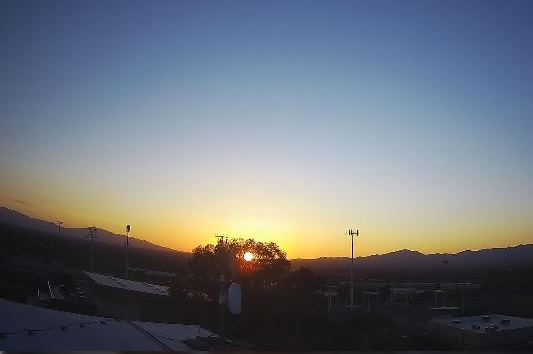
Sunrise this morning as viewed from Sahuarita, which is south of Tucson. Down at bottom is image of large, lenticular cloud over the San Francisco Peaks at 6:20 am MST this morning.

Only some light sprinkles during the morning yesterday, and so total rainfall here was just 0.05".

Wind and dust advisories (above) as issued by TUS NWS this morning - forecast for the airport calls for gusts 40 to 45 mph this afternoon. Below is 06 UTC WRF-GFS forecast for steady wind speeds at 5:00 pm this afternoon, indicating strong winds across much of Arizona. 

The air quality advisory in eastern Pinal County is a bit of a mystery, since there is no mention of this in the early am forecast discussion. I assume that it relates to dust concentrations expected due to the winds weakening as they approach the higher terrain north of the Catalinas.


This morning's forecast for the airport also includes a chance for showers on Friday night, as do the 06 UTC GEFS plumes shown below. A bit more rain would be welcome, but I am certainly tired of the winds recently, since they make morning walks much less pleasant.

Wednesday, March 24, 2021

Light Showers Into Afternoon

Bit of snow on peaks down at Bisbee early this morning.


This morning's 500 mb analysis above is about as forecast yesterday, with a trailing short wave moving southward across Arizona.

The GEFS plumes are again available after being down for several days because of computer upgrades at NCEP. Plumes for temperature (below) show cool days through Saturday and then rapid warming into start of April. Plumes for winds, second below, forecast a very windy day for tomorrow.

Precipitation plumes indicate chances for light showers continuing into this afternoon (above) and GFS precipitation forecast through 5:00 pm MST this afternoon (below) indicates the same. Bit of a sprinkle-shower here within the last few minutes.


Event So Far


Heavy clouds over Catalinas at a bit after 7:00 am MST this morning, but with a bit of blue sky peeking through also. Down at bottom, Sawmill Run restaurant in Summerhaven looked like a Christmas card just before sunrise.

There were showers before dark yesterday and also during the early morning hours - amounts were generally quite light, with a large are of the ALERT network receiving less than 0.04" - see above and below.


Amounts for main metro area above (from MesoWest  through 6:00 am) were light, pretty much as forecast by the models yesterday. Here at house there was 0.05" in gauge a bit ago. Amounts were higher over in Cochise County where many sites measured a quarter to half an inch (below, also from MesoWest).

Will take a look at possibilities for more showers in next post.