Wednesday, May 25, 2022

Last Week Of May


View of the Catalinas at 7:25 am MST this morning - note large wasp checking out the camera. The air here is quite clean compared to Phoenix. Below shows view from Phoenix looking east toward the Superstition Mountains.


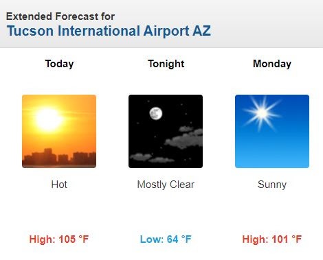
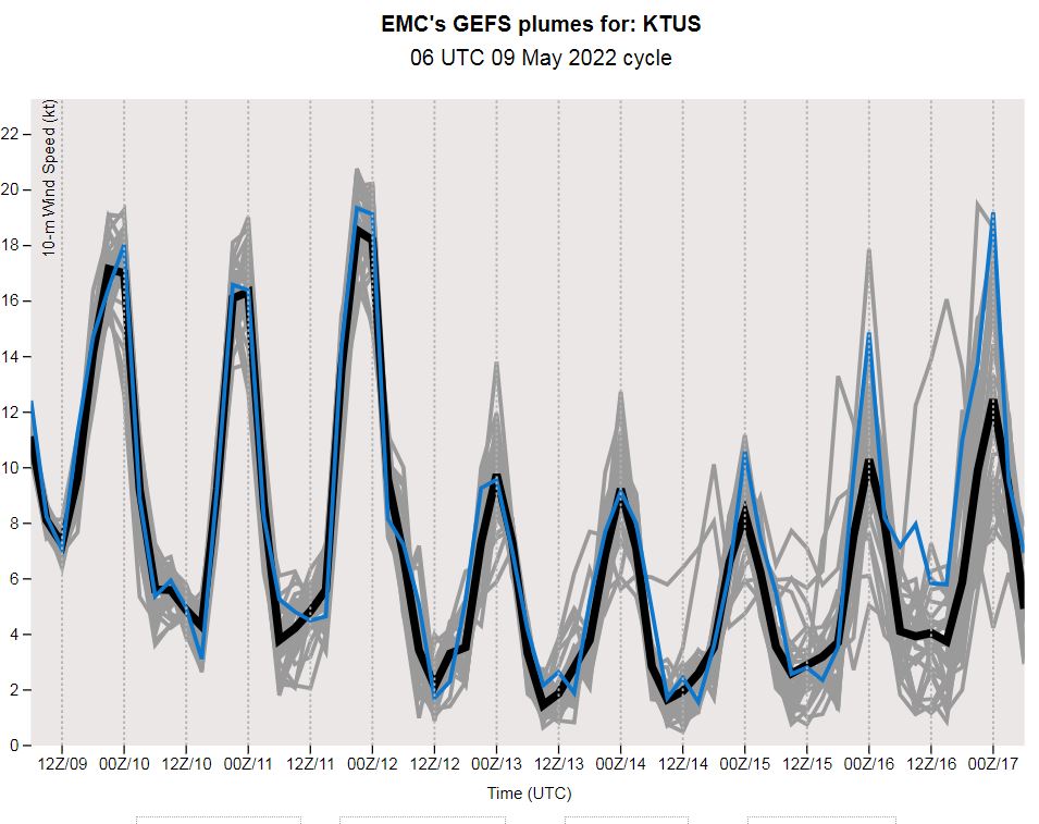
May is going out with little chance of any rainfall here and with temperatures hoovering around 100 F. Graphic above shows 06 UTC GFS forecast of rainfall across the West through 11:00 pm on May 31st. The 06 UTC GEFS plumes for wind at the airport (below) indicate a windy Memorial Day weekend.


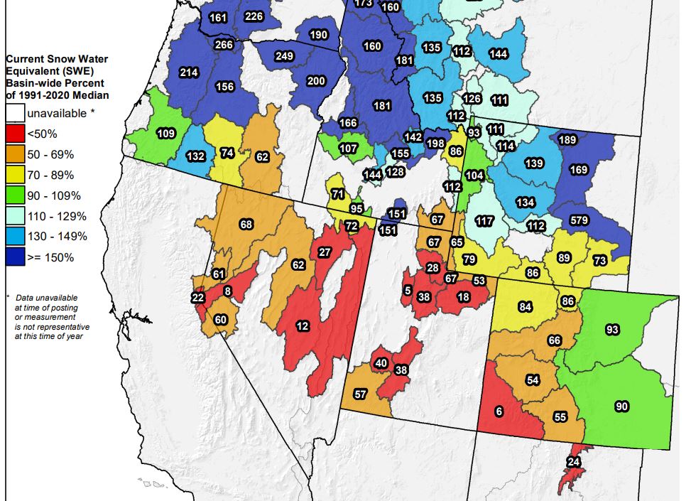
Finally, I took a look at current western US snow pack this morning. Snow water equivalents (SWE) over the Colorado and Green River Basins are below normal, or very much below normal. With Lakes Mead (below) and Powell already at record low levels, the outlook for water supply during the coming few months is quite grim across the Southwest.

Friday, May 20, 2022

Wind Here - Snow Northern Rockies

Another morning with cloud-free skies to end the week. However, places to our north are experiencing a very late snow storm - bottom views show I-80 east of Cheyenne, Wyoming, and also campus of University of Wyoming in Laramie.


There is a large and very cold 500 mb trough sagging into the western US this morning (above) - the temperatures approaching -30 C. The trough has moved little by 12 UTC tomorrow morning (forecast below from 06 UTC GFS forecast this morning).


Locally, we can expect winds and perhaps some dust and more misery for allergy sufferers. The NWS has out a Red Flag warning for most of the southeastern part of Arizona - see above. Forecast from 12 UTC WRF-RR (below) indicates steady winds at airport reaching 29 kt (33 mph), so gusts will likely approach 40 mph, or bit more, in some spots across metro area. 


Graphic below shows various warnings and advisories in effect this morning over northeastern Colorado. Forecast for Boulder calls for 6 to 12 inches of snow through the day tomorrow. Trees are leafed out, so there is potential for major damage.


Sunday, May 15, 2022

Hot Today - Updated

UPDATE: High yesterday at airport did reach a record 105 F.

Few clouds over the Catalinas this morning, along with a lonely contrail.

Current forecast from NWS Forecast Office (above) calls for high today at airport of 105 F. Record high for today is 104 F - so we'll be flirting with a new record high for May 15th.


Very dry conditions prevail - note the low dewpoints at airport yesterday (above) and the 1 % relative humidity.

Little hope in the model forecasts for precipitation this month. Below is the 06 UTC GFS forecast for total rainfall through 06 UTC on the 31st - serious drought continues in our part of the country. Note that it is more than 45 days since last rain here at the house.


Monday, May 09, 2022

Second Week Of May


Nice morning up in Summerhaven at 7:50 am MST this morning. At bottom is view of I-10 from Bowie, Arizona. Note the large patch of prickly pear cactus, with shadow of the instrument tower to left.

Fire weather conditions remain critical and there is a large fire burning southeast of Patagonia - fire was reported at 10,000 acres last evening, with no new updates currently. Header statement below from NWS this morning highlights the situation for next several days.


Forecasts from the 06 UTC runs of the GEFS here show the conditions for the coming week: above - no rain in sight; below - warm to hot temperatures (GEFS temperatures have a cool bias, so highs will probably top 100 F by next weekend); and wind speeds second below - strong and gusty winds continue for next couple of days.


Friday, May 06, 2022

Windy Dry Weekend

View of the Catalinas from campus at 8:45 am MST this morning, showing only a bit of cirrus over head. Our rain-free period is now approaching 40 days, and conditions are very dry.

The NWS Forecast Office has issued a Fire Weather Watch (see current hazards map below) for Sunday, as winds are expected to become strong and gusty over the weekend. Several large wildfires are currently burning in New Mexico - see  https://inciweb.nwcg.gov/  for more detailed information.


Plumes above are for wind speeds from the 06 UTC runs of the GEFS, while below is the 12 UTC WRF-RR forecast for 10-m winds at 4:00 pm on Sunday (note that 24 kt is 28 mph). Second below (from GEFS) shows forecast for relative humidly for the coming week - note the RH values of only 5 to 10 percent during the afternoons.

Winds, dust, and pollen are making things quite miserable for those of us with allergies!


Wednesday, May 04, 2022

Hundred Degrees At Tucson?

 There is an article in this morning's (May 4th) Tucson Daily Star (below) that asks whether the temperature at the NWS observing site on the airport actually hit a high of 100 F on April 26th.


I can't get accurate high temperatures with my thermometer setup, so I don't know what the high was here on April 26th. The trace above is from the NWS ASOS at the airport. The sudden spike to 100 F is shown in the blue trace above, and it does look a bit strange. There were several other spikes in T and Td on the 26th. Reasons for the spikes are not clear. However, the ASOS location (shown below) is near buildings and two major streets, so transient, external effects can't completely be ruled out.

As Donald Rumsfeld once said - what we have here is a "known unknown".

Sunday, May 01, 2022

May Day


Map of TPW (above) for 15 UTC this morning shows that central/northern Plains and the West continue VERY dry, PW values around 5 mm or so. May begins as dry as was most of April.

Brief summary for April: rainfall here 0.00" - the sixth April since 1999 with no rainfall; two mornings had lows in the 30s - 33 F on the 13th and 36 F on the 14th; a number of days had gusty and sometimes duty winds; and the first high temperature of 100 F, or above, occurred April 26 when temperature at airport peaked at 100 F.