Clearing skies this morning at 7:35 am MST, following our widespread, significant rains.

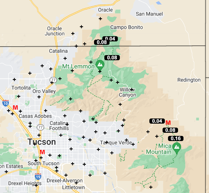
ALERT network totals for the event (above and below). Amounts over 1 inch were common across most of the network.
Here at the house the final total ended up at 1:48" - this was heaviest two-day total since the 1.55" on January 15-17 of this year. ATMO reported 1.40"; DM had 1.31"; and the airport came in with 1.31".

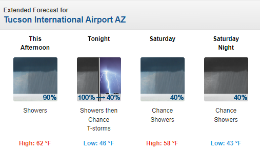
The forecast run from the 06 UTC GFS (below) indicates we'll now have a dry end to 2023.