The frequency of various wind directions during the "monsoon period" (i.e., the period with PW values consistently 30mm or greater) are shown in the table below:
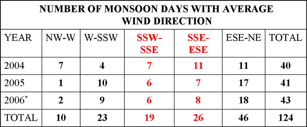
* Note - 2006 data are through August 10th
It is clear that the observed wind directions, within the 600 to 400 mb layer, during the last three summer "monsoon periods" have been highly variable. If wind directions from the SSW to ESE are considered to be typical or favorable "monsoonal flow," then only 36% of the days at Tucson have exhibited "monsoonal" wind directions.
Interestingly, if the wind directions for all days shown in the table are averaged, the resultant mean wind direction during the monsoon periods was from the southeast. This is because the SW and NE winds essentially average to SE, and the result is not an accurate picture of what wind directions actually were during the three summers.
Indeed, these summer wind directions are not at all persistent. Although Tucson experiences a summer period characterized by high PW and significant thunderstorms and rains, the variable wind directions lead one to ask whether Tucson actually experiences a summer monsoon.
CLICK HERE -- for Monsoon Variable Comparison figures discussed above
No comments:
Post a Comment