Pre-sunrise view of the Catalinas at 6:45 am MST this morning.
Yesterday's rainfall at low elevations was widespread, but quite light, as the forecast models were biased on the high side (see last couple of posts). Heaviest amounts (two sites with over half an inch) were from the Catalinas to Redington Pass. There were several inches of snow at higher elevations.
Here at house we had 0.09", Atmo and DM also had 0.09", and the airport reported 0.08". In Cochise county Pioneer Airfield had rain squalls with gusts to 59 mph and Ft. Huachuca had 56 mph. There were no detected CG flashes in southern Arizona.
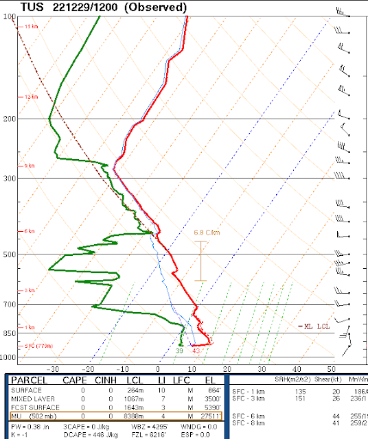
The 250 mb analysis (above) this morning shows a strong short wave from the Four Corners southward across the middle GoC. The very strong jetstream on the west side of the trough will bring a weaker trough across our area today. The morning sounding is quite dry below 450 mb (below). I'll be surprised tif we get showers here; however, current am forecast from NWS calls for 40 and 50 % POPs at the airport today and tonight.
The 06 UTC GEFS plumes (above) also indicate slight chance for showers at airport this afternoon. The plumes are indicating chances for more significant rain at the airport from the 1st through the 3rd. This would be associated with a strong wave approaching the Southwest (GFS forecast below is valid at 5:00 pm on the 1st). We're definitely heading into the New Year with a spell of cool and unsettled weather.


No comments:
Post a Comment