
View of somewhat chaotic skies at 5:45 am MST this morning.
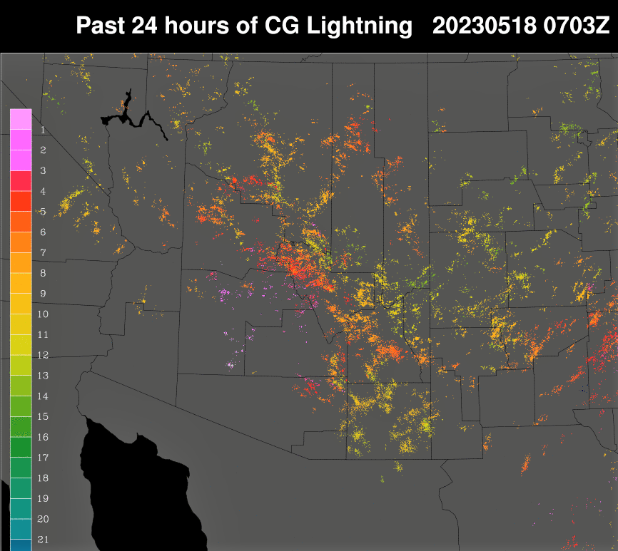
Yesterday was another day with unusual May showers and thunderstorms. Plot above shows detected CG flashes through midnight last night (from Atmo and Vaisala), with activity focused in our corner of Pima County. Rainfall was much more widespread than yesterday's predictions - see previous post. Activity again exceeded my expectations, based on the morning sounding.
Rainfall amounts from the ALERT network (below - for 24 hours ending at 6:30 am) show some spots got a bit over a quarter of an inch. Here at house we had 0.10" around 8:00 to 9:00 pm. I didn't hear any thunder, but the CG plot indicates there may have been some.


This morning's sounding (above) is similar to last two days, with the exception of rain cooled layer near the surface. Deep, mixed layer CAPE is again just a sliver. However, the 09 UTC WRF-RR forecast from Atmo (below) indicates a much more active day. Note the 0.40" predicted for the airport.
Second below shows the 06 UTC WRF-RR forecast for PW, which is indicated to decrease dramatically after today, and bring us more typical dry conditions for May.


No comments:
Post a Comment