
Seems like every morning I have to go to Jack Hales webcam wall to find something interesting. Above is view from Atmospheric Science building at CSU in Ft. Collins, Colorado, showing a pink sunrise and a skiff of snow cover. At bottom is brilliant red/orange sunrise at Mt. Whitney, California.

The GEFS ensemble forecasts indicate little change from our ho-hum pattern. Above is 12-hour forecast for 500 mb mean and spaghetti valid at 12 UTC this morning, while below is same at 168-hours (00 UTC on 4 January). Second below is the operational ECMWF 500 mb forecast valid at 00 UTC on 4 January. These forecasts indicate that the icebox of the Northeast may may tighten its hold on the East and extend southward into Florida.


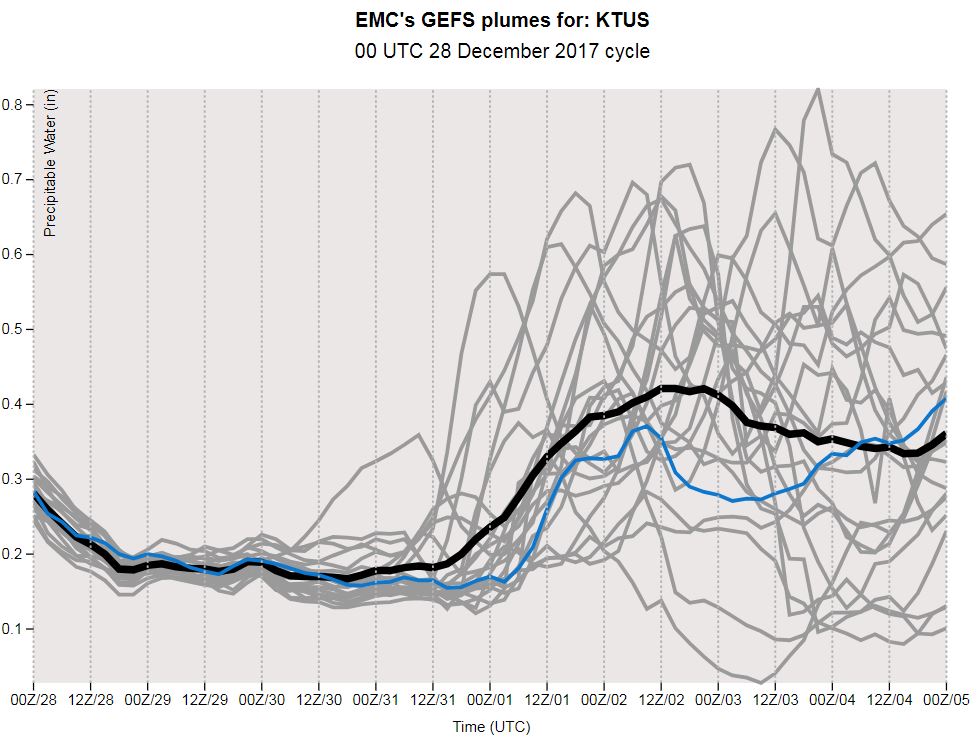
While the GEFS PW plumes from 06 UTC (below) seem to indicate that the most challenging forecast for TUS would be getting the PW within a tenth of an inch during second half of coming week.

No comments:
Post a Comment