Wednesday, September 02, 2020
Dry Start To September
Some low clouds hanging on the Catalinas at a bit after 08:00 am MST this morning.
Was almost totally suppressed across Arizona yesterday afternoon, as September starts out very dry. Plot of detected CG flashes above for 24-hours ending at 01:00 am this morning.
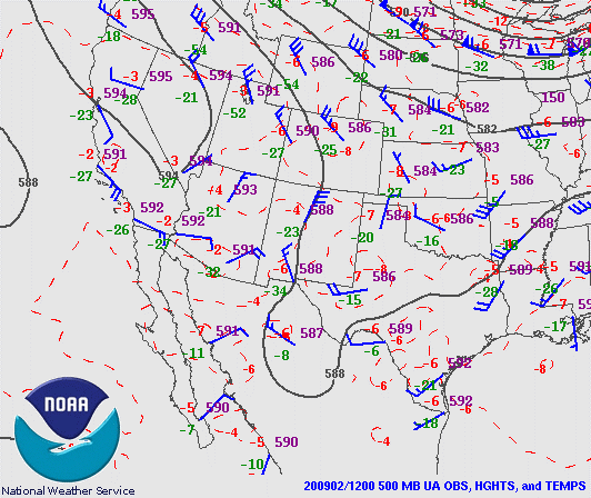
At 500 mb this morning (above from SPC) the analysis shows that the anticyclone has re-established itself over Nevada and California. The warm temperatures are quite amazing - note the -2 and -3 C temperatures in the core of the anticyclone, including -2 C here at TWC.
The morning TWC sounding (above) shows that low-levels have continued moist and that there was potential CAPE again. The PW value remained high at 1.44 inches. However, model forecasts indicate drying during the day and continuing into tomorrow. The forecast for PW (below from the 06 UTC WRF-GFS run at Atmo) is valid at midnight tonight showing values falling below an inch.
Bad and getting worse - what an ugly start for September.
Subscribe to:
Post Comments (Atom)


No comments:
Post a Comment