View of cloud bands over the Catalinas at 6:45 am MST this early morning.
Below is current five day outlook from the NWS, indicating mild and dry days for southeast Arizona through next Tuesday.
Longer range forecasts from the 06 UTC run of the GFS model are shown here. Above is total precipitation through 18 UTC on January 13th, and below is same through 18 UTC on January 20th. Activity shifts east and south into Arizona during the third week of the month in the forecasts. Note the huge amounts of precipitation forecast for northern California through the entire period.
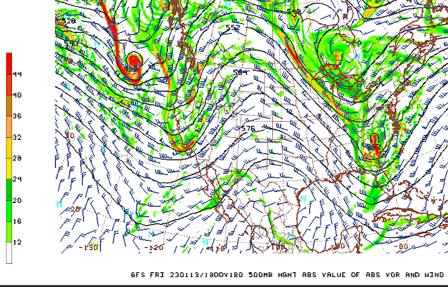
At 500 mb a large ridge dominates most of the western US at 18 UTC on 13 January (above). But by 18 UTC on the 20th, a broad trough covers most of the western 2/3rds of the country, bringing precipitation into our area.


No comments:
Post a Comment