View toward the Rincons at 6:40 am MST, just before sunrise this morning.
Plot of deteced CG flashes for 24-hours ending at 0733 UTC this morning (above from Atmo and Vaisala) shows absolutely no activity across the Southwest and northern Mexico - as quiet as it can be.
At 500 mb this morning (above, analysis from SPC) there is a large, oblong ridge that extends from northern California to the south end of Baja and beyond. There is an elongated trough to the east that extends from central Mexico north to southern Canada.
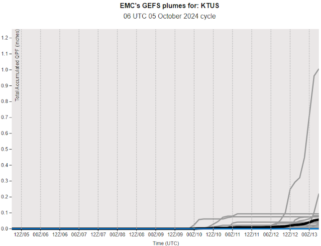
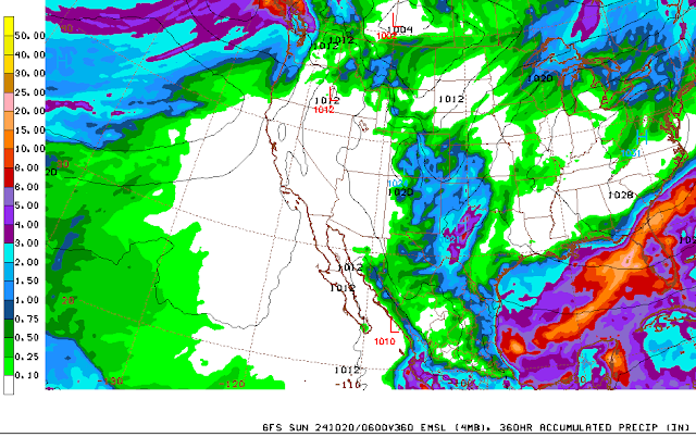
The plumes from the 06 UTC GEFS runs for QPF (above) for the airport indicate a slight chance for some activity at the end of next week. While the 06 UTC GFS run (below)indicates that precipitation avoids Arizona and much of the West through the 20th of Ocotber. So the dryness continues here, along with near-record high temperatures around 100 F. The last time we had a quarter inch or more rain here at the house was back on August 8th when there was 0.36 ".


No comments:
Post a Comment