Saturday, August 21, 2010

Back Home


We have been down in the eastern foothills (about 5 miles northwest of Sonoita) of the Santa Rita Mountains since late yesterday afternoon. Driving south on Highway 83 yesterday there was lightning visible in the MCS down in Mexico. I think southerly outflow from that MCS moved by where we were around 11 pm to midnight. Very cloudy down there much of the morning, with the sun really only coming out after noon. The top photo shows early morning sunshine lighting the Santa Ritas and Mt. Wrightson. The middle photo shows convection bubbling down near Patagonia around 2 pm, and the bottom photo is of a building storm just south of the Santa Ritas at around the same time. As we drove north there were nice towers building on the Whetstone Mountains south of Benson and these grew into the intense storms that are now over in the Green Valley area. Note the wonderfully verdant grass over there - August out there is usually as green as if one were in Wisconsin.


Friday, August 20, 2010

Storm North of Kitt Peak

At 5:43 pm MST on 20 August 2010 - a new cell north of Kitt Peak - perhaps producing a downburst.

Three Different Perspectives


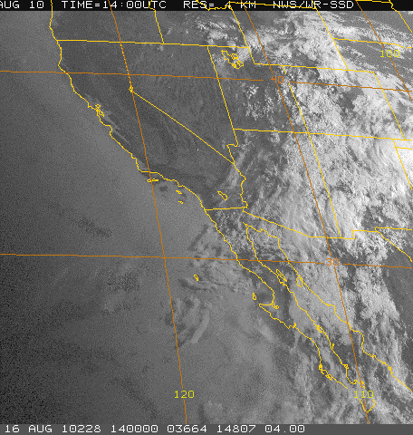
Visible satellite view (top) of storm activity along borderlands around 3 pm (MST) this afternoon. NWS composite radar display (middle) of the same storms. View from Kitt Peak webcam looking south toward Baboquivari Peak. The storm on radar east-southeast of Sells is the storm on right side of webcam view.


Today and Tomorrow - 20 and 21 August 2010


A number of interesting changes are underway, even though we are still under the influence of the 500 mb trough to our northeast. Surface temps and dewpoints are up a few degrees compared to 24-hours ago, and SLP is down 2 to 3 mb in the same period. Thus, a nice slosh of low-level moisture occurred during the night. The deeper, subtropical moisture is poised to push back north across the border - see previous post - and things should be much improved during the night and tomorrow wrt low-level moisture and CAPE. The morning Tucson sounding (top image) might have a bit of CAPE left at dusk, but certainly not much - even though cooler middle level temps have moved in from the west. The vertical wind profile this morning is not good - winds below 500 mb are west to northwesterly (which means a strong diurnal circulation from off the lower deserts this afternoon that may bring drier air with it). Winds above 500 mb are west to sothwesterly and much stronger than the low-level flow.
------------------------------------------------
The RAP 500 mb analysis for 12z this morning (middle image) shows that the lobe of the subtropical anticyclone currently affecting the Southwest is centered off over northern Baja - not a good positioning at all (and unfortunately the 700 mb anticyclone is also out there this morning). However, up at 250 mb there is just a single, well-defined anticyclone that is centered over the Big Bend country of Texas. So, the overall setting is a bit chaotic this morning; however, this morning's NAM forecasts indicate a gradual improvement during the day and night. The 500 mb anticyclone is forecast to shift northeastward across south-central Arizona and be over western New Mexico by this time tomorrow. The 250 mb anticyclone shifts westward into northern Mexico - the net result being a much improved vertical wind profile by tomorrow.
-------------------------------------------------
It appears that most activity today will be along the Borderlands and in Mexico and that cores will tend to move toward the south. However, with a good push of low-level moisture into southern Arizona during the night, activity should be much increased tomorrow. Indeed the NAM forecast of precipitation for the 12-hours ending at midnight tomorrow night (bottom image) has centered the action almost directly over Tucson. So, it will be very interesting to see what the morning U of A WRF runs indicate!


TD Eight-E Forms


It was a very suppressed day yesterday and I found no reports of rainfall in southeast Arizona. An intense MCS developed in northern Sonora during the late afternoon (see top image). The convective cores in this system moved slowly southward, while the anvil streamed northward and reached out over Tucson by dusk.
--------------------------------------------
NHC has declared that TD Eight-E has formed west of Cabo Correntes during the early morning hours (see middle image for IR depiction). The TD is not expected to deepen much as it moves west-northwestward (see bottom image) but it does take a favorable track for helping push subtropical moisture northward up the GoC.

Thursday, August 19, 2010

A Bit of Catch-UP


Things shut down more quickly than I expected yesterday, with very little in the way of storms or rainfall - only some isolated mountain activity. The shortwave over Arizona (see water vapor image from 2200z yesterday afternoon at top) proved to be a more important player than I thought it would - particularly with its rapid advection of drier air into state. The time series of GPS PW (available on Atmo page) were frankly very depressing. Today, values are only in the low 30s mm, at best, at southeast Arizona, low-elevation stations. The middle, nearly current, visible image shows how suppressed the storm activity is today. However, the bottom image (GOES PW image at 1900z today) indicates that higher moisture values remain close to the border, so that there's some hope for a quick recovery. We're almost 2/3rds of the way through August, and there's not been much rain at low elevations this month (0.80" here at house, with more than half of that on a single day). So the last week and a half of month will be critical for determining the month's wet/dry character, just as the last three days of July were.


Alert

All - I have been having some problems this morning and have not been able to
do any blogging or even to look at the morning weather charts. Hopefully, things will
be back to normal by afternoon. Bob

Wednesday, August 18, 2010

Quick Look At Current Conditions


This morning skies over southeastern Arizona and northwestern Mexico are mostly clear - the exception is a south-north band of MCS debris cloudiness from eastern Sonora, northward across eastern Cochise County, on up to the White Mountains. So, sunshine won't be a problem locally, until anvil cloudiness increases this afternoon.
-----------------------------------------------------------
The morning Tucson sounding is shown at top. It appears to be about as unstable as yesterday's sounding, even though PW has decreased some. Compared to GPS PW the sounding is about 3 mm too wet this morning - probably in the layer 700 mb to 850 mb where the Td profile is quite linear. So CAPE may be a bit lower than the data indicate. Steering winds are light south to southwesterly and upper-level winds are 30 to 40 kt from the south. Definitely not a good wind profile for long-lived storms, since the anvils spread directly ahead of cells that develop on the mountains. It is a good profile for back-building storms which can keep cores nearly stationary, with a threat of heavy rains. Cloud bases will probably be up around 650 mb, so that there remains some threat of strong downbursts.
-----------------------------------------------------------
At 500 mb (middle graphic) there is a distinct, albeit weak, shortwave trough located out over the lower Colorado River Basin this morning. It will likely be moving toward the northeast today, leaving southeast Arizona under the influence of some weak subsidence through some of the afternoon. Orographic forcing of the higher mountains will probably be able to overcome this fairly easily. The center of the anticyclone has shifted eastward toward Texas, and the overall subtropical high at 500 mb remains an amorphous, large system with weak height and wind structures - as has been the case much of the summer.
-----------------------------------------------------------
The NAM 500 mb forecast for midnight tonight, from this morning's run, is shown in bottom image. The short wave is forecast to extend from Moab, Utah, south toward Flagstaff, with a weak tail extending southward to the northeast end of the GoC. The overall state of the 500 mb subtropical high is well indicated by this forecast chart. Note that there are no height contours south of 40 degrees or so north, and that there is a large proliferation of tiny vorticity maxima running around everywhere.
----------------------------------------------------------
Looks like another day of mostly mountain/near mountain storms in the southeast. The anvil- shadowing wind profile means that places like the house here are unlikely to get precipitation, unless a cell develops nearly overhead. I suspect that I'll have to be watering some of the plants yet again this afternoon.


Summary of Storms/Rain Yesterday

The 6 pm composite radar (from NCAR RAP - note they only provide base reflectivity products, which is not really very acceptable for complex terrain areas!) for southern Arizona is shown above. This, unfortunately, is about as good as it got in southeastern Arizona - most heavy-hitting storms were to west, Phoenix area, and Rim Country. There were 6 reports of severe thuderstorm winds or damage in Arizona yesterday afternoon - 2 in Phoenix area, and rest out west. Safford did report gusts to 51 mph at 4:23 pm and the severe report noted just south of Ajo indicates gust to 91 mph! There was also a severe report in California, near Barstow in the Mojave Desert.
-------------------------------------------------
The NWS forecast for Zone 33 for last night was again too optimistic, with 50% POPs and heavy rain again highlighted. Most of the rain reports I found occurred during the day yesterday in southeast Arizona. In fact, many Cbs went up noontime-early afternoon on the mountains and filled the skies with lots of orphan anvils. Only 10 of the 93 Pima County ALERT gauges had measurable rainfall last 24-hours; Safford and Ft. Huachuca had thunderstorms but very light rainfall; but 8 of the higher elevation RAWS stations had measurable rain. Most amounts were under half an inch, however, Green Mountain had 1.14", Mt. Lemmon, Mount Graham, and Muleshoe Ranch had amounts over half an inch. Several outflows came by late in day, but obviously did not have enough kick to force new storm development in the metro area.

Tuesday, August 17, 2010

Comment Related to WFZZ

Johne Diebolt commented: Looks like southern Cochise got the brunt of the rainfall Monday. I was impressed at the tenacity of the MVC which hung out almost directly over the house west of the Tucson Mountains yesterday. The cloud-free center was visible just to the northwest and I was able to watch the circulation of the mid level deck around the center. Wish I had time lapse here! By early afternoon it appeared the MVC was aiding in the development/thickening of the mid level deck on its eastern flank over the Tucson Basin...all but squelching any hopes of heating. Was honestly a little supprised that the Tucson/Phoenix offices pulled the trigger on the FFW on the 3PM package, the practice of late has been to 'defer such decisions to the next shift" and that the FFW included the entire AOR for the Tucson office...only to have it withdrawn 5 hours later. I was also taken aback by the 70% PoP forecast rolled out for the Tucson zone. It was pretty apparent by the U of A WRF analysis that we were likely to have another mostly 'off' day. Illustrates the point that in this part of the country, you can have all the dynamics, wind flow, moisture and diffluence aloft you want, but without solar radiation to cook the boundary layer, you aren't going to get much! With a few exceptions of course.

Brief Overview of Pros and Cons Today (8-17-10)


I'll be doing the Atmo weather discussion at 11:30 am this morning, and I'll just give a brief accounting here of the pros and cons I see in the charts and forecasts this morning.
------------------------------------------------------
PROS - the visible satellite image (top) shows that much of the Southwest and Mexico is clear this morning. However, the local are here remains under fairly heavy middle cloud. Yesterday the cloud proved extremely peristent, and loops this morning show that it is barely moving. thus, many areas will get much better heating today - locally we'll have to watch the clouds.
------------------------------------------------------
The PW is quite high (45 to 50 mm) at the low-elevation sites in southern Arizona and the morning sounding (middle image) indicates better CAPE likely this afternoon, so an upturn is likely today relative to the dismal situation yesterday.
-------------------------------------------------------
Although upper-level flow appears strongly confluent this morning, the NAM forecasts show that by evening the flow aloft becomes difluent over southern Arizona.
-----------------------------------------------------
CONS - the wind field through much of the troposphere over the Southwest and Mexico remains very chopped-up and light and variable. Thus, a serious lack of steering level winds and also poor vertical shear, except over northern Arizona and the Great Basin.
-----------------------------------------------------
Surface pressures are 4 to 6 mb higher than they were 48 to 72 hours ago.
------------------------------------------------------
Southeastern Arizona appears stuck under a weak shear zone between two lobes of the 500 mb anticyclone that is moving little (see 500 mb analysis from RAP at bottom).
-----------------------------------------------------
Thus somewhat of a coin toss for the southeast part of state today, with storms being very locally driven and propagating somewhat randomly. Best storm settings today definitely to the north and west of our area.
------------------------------------------------------
An aside, for the second time this summer, the soundings at San Diego have CAPE above the marine layer and there were some storms in the southern California mountains yesterday. I also see that GoC low-level moisture has finally made it to Las Vegas and desert Rock - too bad that we have such a massive hole in the upper-air data out that way.

NWS Tucson Suffers A Bout of WFZZ Syndrome


The 8 pm radar composite above provides an indication of what a down day it was yesterday in southeastern Arizona. Most significant thunderstorm activity was confined to the northern half of the state. Some heavy storms did try to plow southward into the lower Colorado River Basin, but decent steering flow apparently didn't setup out there. Here in southeastern Arizona, the day was a big down turn from Sunday. Only 3 of the 93 ALERT sites had any additional rainfall through the day and last night, once the early morning showers ended. During the afternoon there were some heavy, terrain-locked storms over the mountains to the east, but only Ft. Huachuca picked up a thunderstorm and 0.02". After dark, the area of showers in southeastern Arizona (see radar chart above) began moving slowly to the northeast, and RAWS sites Carr and Rucker had 0.42" and 0.77" respectively, during the nighttime.
--------------------------------------
The NWS here in Tucson had considerably under forecast events on Sunday for Zone 33 (eastern Pima County including all the metro region). Yesterday, however, the 3 pm update indicated 40% POPs for the rest of the afternoon and 70% POPs with heavy rains highlighted for the night. A very large flash flood watch was issued for almost all of southern Arizona. So, this was a classic example of Weather Forecasting Zig Zag Syndrome - which of course is the often observed tendency in our profession to over (under) forecast one day, followed by an under (over) forecast the next day. I've been forecasting for more than four decades, so I've suffered my share of bouts of WFZZ Syndrome over the years.

Monday, August 16, 2010

Very Chopped Up Setting This Morning


The cloud cover (below in previous post) and the chaotic TWC morning sounding (top image) indicate that things will be much more locally driven today. The highly modified sounding is quite moist, but its onion charcter makes subjective forecasting of what it might look like this evening almost impossible. The primary 500 mb vorticity max has passed off to our southwest (middle image is morning NAM analysis), but a contorted trough extends back across eastern Arizona and on to northeastern New Mexico. The NAM forecast for midnight at 500 mb (bottom) indicates main part of inverted trough continuing slowly westward south of San Diego, with the rest of trough weakening and shearing away to the northeast. The NAM forecasts activity today mostly in the higher elevations and in northern Mexico. Situation is further complicated by the weak, backdoor front that has pushed westward across New Mexico, and by the ongoing light area of precipitation along the Arizona/New Mexico border. Quite a mess this morning.
----------------------------------------------------------
I don't expect highly organized storms to repeat today, but wouldn't be surprised by localized storms with heavy rains. The exact timing and location of such storms to be driven by elevation, and amount of sunshine during the day - so, quite a different type of day today!


Quick Summary of Yesterday (Sunday August 15th)


Yesterday was the first good storm day of the summer that we've been here for. Three pulses of storms moved across portions of southeast Arizona and the Tucson metro area. The first of these was around 4 to 5 pm (4 pm MST radar from TUS at top). The storm east of the airport produced gusts to 48 mph when it hit at the airport. The storms up north on the Catalinas intensified, producing heavy rains (more than 2.50 inches at one spot in a couple of hours), and then around 6 pm some damaging winds in the far northwest part of the metro area. Lightning and thunder from these storms occurred here at house but no rain.
---------------------------------------------------------
The next wave of storms affected the Catalinas and north part of town with a second area of heavy echo moving across the Green Valley region around 8 to 9 pm (middle radar is about 8 pm MST). These storms produced a spectacular lightning display here at the house with lots of booming thunder. But we got only some spits of rain, even though we could see that heavy rain was very close to the northeast.
----------------------------------------------------------
Another wave of storms moved in by 10:30 to 11:00 pm and these produced, finally, some moderate thunderstorm rains here at the house. Total in gauge this morning was 0.41". The NWS POPs for yesterday of 30 and 40% proved to be conservative, as most of the metro area (Zone 33) received measurable rainfall (88 of the 93 ALERT gauges), as did most of the reporting stations in southeast Arizona and also the BLM RAWS stations. In the ALERT network 29 sites had a half inch or more rainfall; 6 sites had an inch or more; and Green Mountain in the Catalinas had 2.72 inches.
----------------------------------------------------------
Northern Mexico was quite suppressed yesterday evening, after three days of strong MCS activity, with the storm zone shifted north into Arizona. A strong push of high Td air continues at Yuma, where early morning dewpoints were 75F with south winds of 20 to 25 mph. Apparently, none of the pulses of storms managed to push north into the Phoenix area. Finally, the bottom image shows heavy cloud cover covering the Southwest and Mexico this morning at sunrise, indicating a much more complicated forecast situation today than was the case yesterday.


Sunday, August 15, 2010

Storms Around But Rain Avoids House

First wave of heavy storms has moved through the Tucson metro area, managing to avoid producing much rain except up on the Catalinas, where Green Mountain Alert station has over 2.50" in last three hours. Lightning and thunder and a bit of wind here at house, but not even a spit of rain so far. Image above, looking north from Kitt Peak, caputures a nice, microburst kind of rainshaft on left!

Today's Forecast Pros and Cons


Interesting forecast challenge for today and tomorrow and I'll try to summarize briefly because I have other obligations this morning.
--------------------------------------------------
PROS - We finally will have an excellent wind shear profile in place this afternoon and evening for organized severe thunderstorms to move into low elevations (I think that this will be far and away the best winds aloft setting of the summer so far).
---------------------------------------------------
With last night's outflows, light rains, and moisture recycling, the Tucson sounding will likely have CAPE, and perhaps at moderate levels, by late afternoon. PW values are up in southern Arizona, and Yuma has seen a new upsurge in Td and is currently in low 70sF.
------------------------------------------------------
There are a number of inverted troughs at various levels and these are also interacting with a tropical wave that is south of the GoC. The NAM 500 mb forecast for midnight tonight shows this well and indicates that the best vorticity max should be over northern Sonora. The 200 mb NAM forecast for midnight (bottom) indicates westerly winds aloft and perhaps some difluence over southeast Arizona.
--------------------------------------------------
All the debris cloudiness is to the south to west, and skies will be mostly clear through the heat-up time of day.
--------------------------------------------------
There should be good good convegent wind flows again during the late afternoon with northwesterlies from the low deserts possibly meeting organized outflows.
--------------------------------------------------
CONS - The best subtropical moisture remains south over Mexico.
--------------------------------------------------
The Tucson sounding indicates significant low-level cooling to overcome. Additionally, the sounding this morning is too moist by about 4 mm wrt GPS values, so the CAPE situation may not be as positive as I wrote above. Fortunately, there were not widespread or significant rains during past 24-hours, except far to the east, so that most insolation should go to heating up the boundary layer.
-------------------------------------------------
The models continue to indicate that there will be more storms and rainfall tomorrow, rather than today.
-------------------------------------------------
FORECAST - my forecast is that today there will be an elevated threat of severe thunderstorms with damaging winds, and that organized lines and outflows are likely. Rains will be better than yesterday. Tomorrow will have to await today's outcomes.

Upturn Brought Some Storms to Tucson Area


See previous post about the upturn that was apparent late in afternoon yesterday. The activity managed to redevelop briefly here in the Tucson metro area around 10 to 11 pm, with some high-based storms, lightning, and light rains. Here at house we had 0.05" and most regular reporting stations in southeast Arizona had storms and light rains (exceptions appear to be Safford and the U of A). In the ALERT network 12 stations had rain and 7 of the RAWS stations had rain - most notable were amounts in the far east of 0.91" at Trail Cabin and 0.87" at Ciricahua Headquarters. The Tucson sounding (top) last evening appeared to have little chance to convect, but it was about 4 mm wetter than indicated by the data and there was apparently some high-based CAPE. Strong outflows appear to have converged over the Tucson area around 10 pm with winds gusting 30 to 50+ mph - one outflow came in from the east, and the other came northward from the large, intense MCS that was along the Borderlands. The middle IR image is from 0400Z last evening - the MCS captured in that image has dissipated, leaving a fairly large MCV behind. The bottom image shows that at 1230z this morning there is a newer and still active MCS 0ver western Mexico associated with the westward moving inverted trough. So, finally we have some weather features of more interest!

Saturday, August 14, 2010

Another Dreadful Day in Tucson


It has been another very hot and dry day in Tucson - high 105F, afternoon RH around 20%, and gusty northwest winds of 15 to 20 mph. Guess it's been a great month, considering that it is August, for folks running swamp coolers! Me, I've been out watering thirsty plants yet another evening. The evening 500 mb analysis (top) shows that the 500 mb anticyclone has shifted a bit to north and that winds are now easterly over extreme southern Arizona. Radar loops indeed indicate that echoes are trying to move toward the west. Has been a definite upturn today over the far east part of state and in Cochise County - lightning strikes way up, some rain with a RAWS station near New Mexico having almost an inch. The 7 pm composite radar image (bottom) from Tucson shows some activity continuing in Cochise County and that another large MCS is developing over northern Mexico, for the third night in a row. This MCS should produce more of a cool outflow into the Tucson area by morning and begin to make things more interesting here.

Large MCS in Northwestern Mexico


Dreadful day yesterday - the one report of rain I found this morning was 0.07" at Rucker RAWS site in the Chiricahuas.
------------------------------------------------------
The one thing that has occurred pretty much as called late this week is that the MCS activity in Mexico increased and shifted north. Top IR image shows very large MCS over northwestern Mexico at 0630z last night. The middle IR image shows all the widespread cloud debris that this system has left behind. It seems likely that a residual MCV will spin into northern Baja and southern California carrying some moisture from the MCS with it - thus, effectively bypassing Arizona. The debris cloud here over Tucson (mostly cirrus, but some middle cloud and ACCs) produced a great orange to purple sunrise (best weather of the week, but I wasn't carrying my camera). The bottom image shows the morning sounding at Tucson - quite a pathetic one, with almost no winds in the troposphere and continued very dry air in low levels. The balloon did manage to find an ACC, and the data are all goofed up from 600 to 450 mb with several super-adiababtic layers and an unrealistic 500 mb T of -8C.
-------------------------------------------------------------
The NAM forecasts continue to push the 500 mb anticyclone northward as several pieces of the strung-out, inverted trough move westward across northern Mexico - so there remains some hope for an upturn tomorrow and Monday, assuming the atmosphere can somehow recover CAPE here north of the border.


Friday, August 13, 2010

Summary For Friday the 13th


Well, what a miserable day for thunderstorm watchers! Top image is current TWC sounding (although it is too dry by more than 7 mm, that is all moisture gone missing below 650 mb). It is a great proximity sounding for cumulus pancakeus. The current radar composite (bottom) shows an almost complete lack of radar echoes, of any intensity, over all of Arizona. Most notable today is the continually bad ground clutter around KIWA. Here's hoping the second half of August isn't worse than the first half. A good weekend to all who stop in here.


Today Looks Like - Well Frankly Friday the 13th


Once again, the U of A versions of the WRF model had an accurate forecast yesterday - unfortunately, being right on with the advection of the dry, low-level air from the west (note that both the Marana and Ft. Huachuca wind profilers showed the strong push of northwesterly winds last night below 700 mb). The Phoenix (top) and Tucson (middle) soundings show the dry air present in low-levels this morning. The RAWS stations in the Rincons and Mt. Hopkins show significant drops in the dewpoints during the night. So, it looks like the main storm activity shifted to the east and into the borderlands today, with continued MCS activity in northwestern Mexico. The tropical disturbance off of Mexico came ashore last night, and thus didn't get a chance to be officially recognized.
---------------------------------------------------------------
I continue to agree with Pat H. that things will improve this weekend. Surface pressures continue to fall over the deserts; MCS action continues just to the south; and an extended inverted trough at 500 mb will be crossing northern Mexico, helping push the anticyclone northward. So, I expect increased low-level moisture, especially by Sunday [see NAM forecast of 500 mbs for midnight Sunday (bottom)], and increased thunderstorm activity. Vertical wind profiles look quite favorable for strong storms beginning late saturday into Monday. So, a hopeful outlook.

Brief Summary For Yesterday


As noted in the post below, there was only a bit of an upturn yesterday on this side of the border. Considerably more CG lightning strikes noted (however, I can't do anything quantitative with the CGs - I used to have access to a beautiful SRP product that displayed CGs for the 24-hours ending at 12Z each day for entire state - but alas no more). Only seven gauges picked up measurable rain yesterday and amounts were all less than a quarter of an inch.
--------------------------------------------------------------------------
The series of IR satellite images shown above, 06Z on 12th through 06Z on 13th, illustrates that MCS activity in Mexico did increase yesterday and shift northward. So, that's about it for another fairly dismal summary.

Thursday, August 12, 2010

Various Comments

Appears that there has been a bit of an up-turn in activity today with more reports of rain and also more CG detections - especially in Cochise and Santa Cruz Counties.
-------------------------------------------------------------
I note that SLP is falling nicely across the state with drops of 2 to 3 mb during past 24-hours.
-------------------------------------------------------------
The northward racing MCS of this morning crashed around 9 am. However, MCS activity is occurring further north in Mexico this afternoon. Nogales had a strong outflow passage from the south a bit ago.
-------------------------------------------------------------
The evening Tucson sounding has no CAPE but the flawed RRS data are more than 6 mm too dry wrt GPS data - so there may be a bit of CAPE around at lower elevations - appears that there's certainly enough in middle-levels for early am ACC.
--------------------------------------------------------------
Jim Means of Alpine, California, writes: Here in Southern California we're hoping for promising signs of not just the monsoon returning, but for the return of summer also. Thanks to the unshakable trough that's been sitting of the coast, we have had only one week of summer-like temperatures and monsoon action over here. Every day brings new record low high and low temperatures. July in San Diego was the coldest since 1933, and things are continuing cool in August. It looks like the models are promising that the westward expansion of the upper high will start beating back the trough, I only hope we get a little moisture along with that. We're starting to get some tropical action again in the Eastern Pacific so that should help.
---------------------------------------------------------------
Even though NHC hasn't blessed it yet, there appears to have been a TD spinning off the southwest coast of Mexico this afternoon.
---------------------------------------------------------------
Finally Pat Holbrook comments:
Ye of little faith...monsoon will be back this weekend as trof pulls out.
---------------------------------------------------------------
I tried to write this in my discussion this morning, but apparently it didn't come across.