
The time series of GPS vs raob PW for Tucson/U of A is shown below with the two observations being in good agreement this morning. However, note the extreme, too dry nature of the past two 0000 UTC soundings! There were some afternoon and evening storms both in the Tucson area and also in the Phoenix area. Storms developed briefly southeast of Tucson and there were some sites that measured light rainfall amounts. These included 5 ALERT sites to south and around Vail; Sasabe, M. Hopkins; and Nogales. As the outflows from Mexico moved north across this part of Arizona south winds of 30 to 40 mph were common - Mt. Hopkins RAWS station recorded 50 mph and the Atmo anemometer had 47 mph. Here at the house we had a switch to gusty south winds after dark - but the outflow brought only a slight smell of rain with it.

The surface plot from NCAR (below) at 1200 UTC this morning shows the leading edge of the surge just south of Las Vegas. Surface dewpoints of 60F, or higher, extend from the southeast corner of Arizona west and northwestward to north of Blythe and across the low southern California deserts.

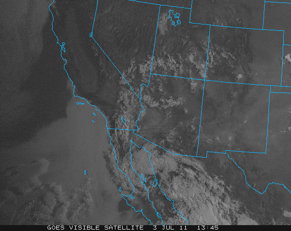
The 1345 UTC visible satellite image of the Southwest and northwest Mexico shows that clouds have reached north into southern Nevada and Utah. There appear to one or two mesoscale vortices left behind by the Mexican MCSs - it appears that one of these may head toward the California/Mexico border regions today. So, a very interesting day on tap for many areas.
No comments:
Post a Comment