
View of Catalinas above is yesterday afternoon just before the Pacific cold front moved across metro area. Winds ahead of the front were very strong - estimated gusts of 40 to 50 mph here at the house. Rainfall was widespread with essentially 100% coverage over the ALERT network. There was one station see below that came in with 0.00 but that appeared to be perhaps a malfunction when compared to nearby gauges. The northern three sectors of the network are shown below - amounts were heaviest over the northern Catalinas and Redington Pass area with much lighter amounts across the City. We had 0.14" here at house.


Only thunderstorm activity in southern Arizona occurred far to the west (below shows detected CGs through 1 am MST today - March 3rd. As the showers passed through our area radar tops of the convection were in the range of only 14 to 20 thousand feet MSL.

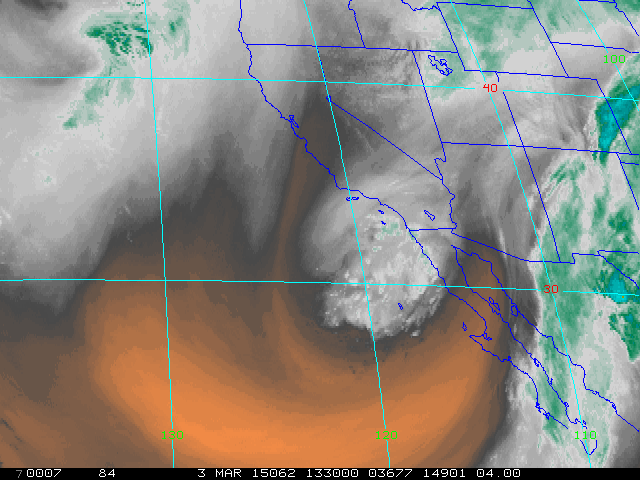
The trailing S/W has now closed off to the southwest of San Diego, after kicking yesterday's closed low rapidly northeastward - water vapor image above is from 1330 UTC this morning. This feature will open up and cross eastern Arizona and northern Mexico during the next 36-hours - NAM 500 mb forecast below is valid at 5:00 am MST tomorrow morning. The WRF-NAM forecasts some showers along the Borderlands as this happens with some activity as far north as eastern Pima County.

No comments:
Post a Comment