Edited to add observed temperatures at 05:00 and 07:00 am this morning. Just below are current observations from MesoWest for metro area at 07:00 am MST. Down below the 05:00 am forecast are observations from 05:00 am. The model forecasts were reasonably good, but seem to have overdone the warm area on the west side of redington pass. temperature spread at both times a bit less than 15 F. Note that TUS was 34 F at 05:00 am and 30 F at 07:00 am. Here at house we are 23 F, with moderate frost and some ice on my three Max/Min thermometers, which is not good.
Both the 00 and 06 UTC forecasts from the current WRF-GFS forecasts today indicate easterly winds and a substantial warming early tomorrow morning with temperatures holding around 50 F at sunrise.


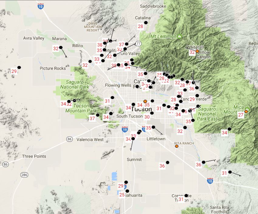
These two forecasts from the 12 UTC WRF-GFS this morning illustrate how difficult it will be to pin down the low temperatures to expect tonight and tomorrow night. Both are valid at 05:00 am MST - top is for Sunday morning (tomorrow) and below is for Monday morning. Current low temperature forecasts for the airport from NWS are for 29 F tomorrow morning and 34 F for Monday morning.
But temperatures across the metro tomorrow at 05:00 am have a range of almost 15 degrees in the model forecast due to how light local winds are forecast to be. For Monday morning the model forecasts warming winds to keep temperatures almost 15 to 20 degrees warmer than Sunday - so another bit of a roller coaster ride.

No comments:
Post a Comment