
Early morning view of Catalinas at a bit after 6:00 am MST this morning.
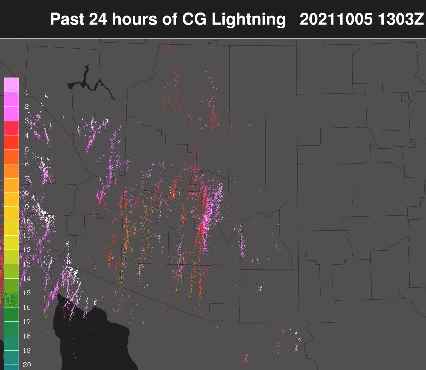
Plot of detected CG flashes (above from Atmo and Vaisala) for 24 hours ending at 6:00 am (1300 UTC) this morning. Most thunderstorm activity stayed to the northwest of the metro area. Plot of ALERT reports for 24 hours ending at 9:00 am this morning (below) shows 15 sites had 0.04", or bit more, around the edges of the network - nothing here at house.


Visible image above shows shows considerable clouds and storms over Arizona, and Utah, as well as southern Nevada and California. Extreme southern Nevada did have storm activity during the late valid period of the outlook shown in previous post (see CG plot above).

Morning 500 mb plot (above from Univ. of Wyoming) shows the low heading into southern California and trough to its southeast, which will cross Arizona today.

Forecast sounding (from the 12 UTC WRF-RR) shows that at 4:00 pm there is still considerable CAPE as well as deeply mixed BL - so I would still expect some thunderstorm activity around our area. But precipitation forecast from same run (below - valid through midnight tonight) keeps most of the rainfall over the northern two thirds of Arizona.
Morning outlook from Tucson NWS forecast office is at bottom.


No comments:
Post a Comment