View looking from campus toward Catalinas at 3:30 pm MST this afternoon, showing the widespread, light rain. The event started across much of the metro around 6:00 this morning and has produced significant amounts of rain.
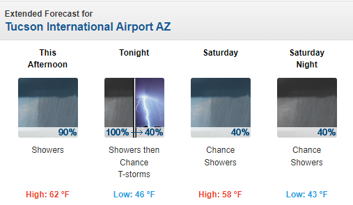
Current forecast for the airport (from the NWS Forecast Office - below) indicates gradually diminishing POPs through Saturday night.
Current base scan at 3:40 pm for the Tucson radar shows both the widespread nature of this event, and also the significant terrain blockage that impacts the radar's coverage and low-elevation scans. The IR image (below - also from 3:40 pm) shows the extent of the system that is moving through the Southwest,
Reports from the ALERT Network (below at 3:45pm) show widespread coverage of amounts greater than half an inch. Here at house there was 0.79" in the gauge at 3:00 pm, with light rain continuing. A most welcome event, after three weeks of dry conditions.


No comments:
Post a Comment