View of the Catalias at 7:25 am MST this morning.
At 500 mb (above) this morning a large anticyclone is centered over northern Sonora, Mexico. The GFS forecast however (below), valid at 06 UTC on 24 June indicates a strong trough over the western U.S.
As the trough moves across our area, the GEFS plumes for QPF (above) indicate chances for showers at the airport from the 23rd on through the 27th.
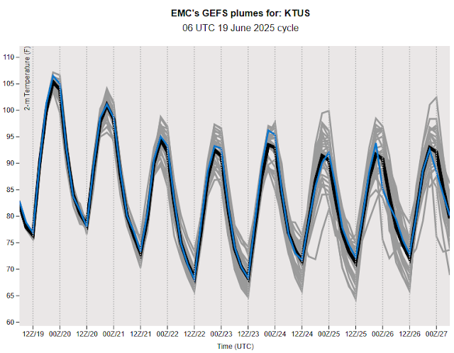
The plumes for temperature (above) indicate a cooling trend, after hot days today and tomorrow. The plumes for wind speed (below) indicate windy conditions tomorrow and Saturday, but with lighter winds the rest of the coming week. So, it looks like there is some chance for the summer storm season to start before the end of June - something we'll keep an eye on.


No comments:
Post a Comment