Saturday, November 18, 2023

More Showers

Showers moving in from the west at 8:15 am MST this morning (view above and radar base scan below).


Precipitation for 24-hours ending at 7:30 am (above from ALERT network) was concentrated in a band from south of Three Points northeastward to the Catalinas. Here at house there was 0.06" in the gauge.


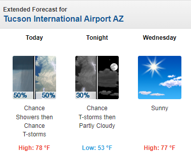
The upper-air sounding from TWC/TUS (above) this morning is very similar to yesterday morning's - PW over an inch, bit of CAPE, and strong winds aloft. Current NWS morning forecast below.

Friday, November 17, 2023

Light Showers Last Night


View of the Catalinas at 7:48 am MST this morning, with a bit of fractus at east end.

Plot of detected CG flashes for 24-hours ending at 0813 UTC (above from Atmo and Vaisala) shows that there were some thunderstorms in northern portion of eastern Pima County - didn't hear any thunder here.

Showers were fairly widespread across the ALERT network - plots above and below show 24-hour rain amounts ending at 7:30 am this morning. Amounts were generally light: here at house we had 0.08"; the airport reported 0.04"; DM had 0.02"; and Atmo recorded 0.05". Most of rain occurred after dark last night from around 8 to 11 pm.


Morning sounding from TWC/TUS (above) has over an inch of PW, even with very dry mid-levels. Winds aloft are westerly and remain quite strong above 500 mb. Sounding has perhaps a sliver of CAPE.


Forecast above is for total precipitation through midnight tomorrow night and is from the 12 UTC WRF-RR run at Atmo. The current NWS forecast this morning (below) calls for best chance of additional showers occurring tomorrow.

Thursday, November 16, 2023

Quick Update Thursday November 16th


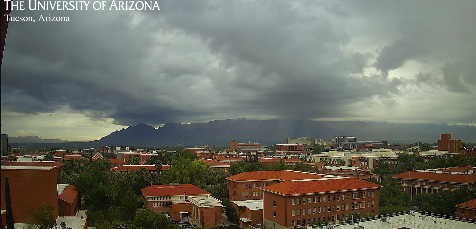
View of the Catalinas from campus at 7:50 am MST this morning shows a gloomy start to the day.

IR image from 7:10 am (above) shows plume of clouds with colder cloud-top temperatures just nudging into southern Arizona. The morning sounding (below from TWC/TUS) indicates deep moisture, with almost an inch of PW, but essentially no CAPE. Most noticable aspect of the upper-air data are the strong winds, greater than 100 kts, above 400 mb.


Forecast of total precipitation (above - from the 12 UTC WRF-RR run) indicates widespread, but mostly light precipitation across most of southern Arizona through 6 am tomorrow.

Graphic above (from the NWS Forecast Office) shows POPS for measurable precipitation through 11 pm tonight - value for the airport is 38 percent. Current forecast for the airport (below) indicates highest POPS during the day on Saturday. Still waiting for first November rain here at the house.

Wednesday, November 15, 2023

Slight Chance For Showers Through Saturday


Heavy clouds with some virga over the Catalinas at 7:30 am MST this morning. View toward the Rincons (bottom) shows colorful red/orange skies at 6:20 am.

Current morning forecast from the NWS Forecast Office (above) indicates 20 to 30 percent POPs for the airport tonight through Saturday.

Panels below show the 00 UTC GEFS plumes for QPF at the airport (just below) and the 06 UTC WRF-RR forecast for rainfall through 11 am on Saturday morning (second below). Will hope for a bit of rain in our gauge next several days.


Monday, November 13, 2023

Showers By End Of Week?


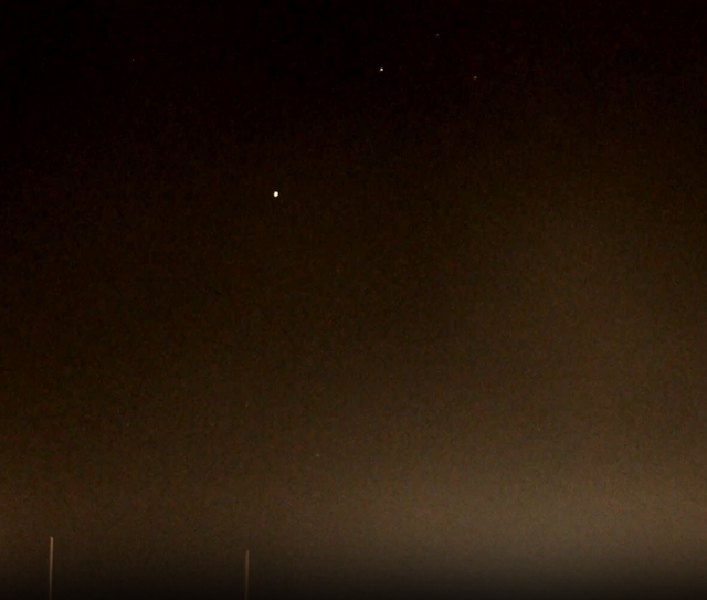
Venus rising in eastern skies this morning about 5:40 am MST.

Plumes for QPF at the airport (above from the 06 UTC GEFS runs) indicate chances for showers from the 16th through the 19th later this week (Thursday through Sunday). Range of amounts is quite large, from zero to over an inch. Note that the operational GFS (blue) is nearly flat-lined at zero.

Plumes for PW at the airport peak on Thursday at almost an inch and then decrease sharply throuh Monday the 20th. The 06 UTC GFS 500 mb forecast (below for 18 UTC on Sunday) indicates a sharp trough crossing Arizona. But, in the GFS forecasts this a distinctly moisture-starved short-wave. 


Forecast above (from the 00 UTC GFS run is for total precipitation through 5:00 PM on Sunday afternoon, with most of the state totally dry. However, the NWS National Blend of Models (see blend.mdl.nws.noaa.gov) shown below forecasts considerable precipitation across Arizona (light green indicates 0.10 to 0.25" and each color change increases the amount by 0.25"). So, quite a difference between these two NWS guidance products. 

The current morning forecast from the NWS Tucson office indicates 20 percent, or greater, POPs for each forecast period from Wednesday night through Saturday night, with maximum POPs indicated at 60 percent during the day next Saturday. Clearly a wait and watch kind of situation for the coming week.
Wednesday, November 01, 2023

October Summary


Pre-sunrise view on October 9th.

There is little to summarize for October. Here at the house the entire month's rainfall occurred within less than two hours during the afternoon of the 24th. Amount was 0.69 inches. Since 1999 there have been 6 Octobers with no rainfall and 3 with greater than 2 inches. Maximum amount was 5.06 inches during 2000.

There were several days with gusty winds, but speeds were not strong enough for me to note in my daily log entries.

Monday, October 30, 2023

Dry And Windy


Morning view looking toward Redington Pass at 5:45 am MST today.

Plumes for PW from the 06 UTC runs (above) indicate very low values for the coming week.
Plumes for wind (above) forecasts stronger winds today and tomorrow. The 06 UTC WRF-GFS (below) indicates strong winds at airport during the late morning today. Morning NWS forecast for airport (second below) calls for gusts in mid-to-upper 30s mph today through Wednesday.


Saturday, October 28, 2023

Mild And Dry


Pre-dawn view looking toward Redington Pass at about 5:40 am MST this morning

Plumes from the 06 UTC runs of the GEFS are shown here for coming week at the airport - not much to write about. The QPF plumes (above) are flatlined at zero. Plumes for T (below) indicate a bit of a cool-down at mid-week, as we move into November. The plumes for PW (second below) indicate dry and then very dry conditions.

The 06 UTC run of the GFS (below) for total precipitation (below) indicates dry conditions for all of the Southwest through 06 UTC on November 12th. Basically we are looking at beautiful Fall weather for next couple of weeks.

Wednesday, October 25, 2023

Rain In The Gauge


Clean, crisp skies this morning at 7:20 am MST, with only a few scattered clouds over the Catalinas.

Plot of detected CG flashes (from Atmo and Vaisala) for 24 hours ending at 1:03 am this early morning indicates widespread thunderstorm activity across eastern Pima County. 

Data from the ALERT network (above and below for 24 hours ending at 7:00 am this morning) show widespread rain reports, except fr the northwest corner of the network. Many amounts were over half an inch, with three sites exceeding an inch. Here at the house we had 0.69", most of which fell shortly after 1:00 pm. DM reported 0.58", the NWS reported 0.19" at the airport, and Atmo had only 0.05". It was most rain here at the house since mid-July (0.82" on July 17th).


In the eastern Pacific Hurricane Otis (shown in IR image above just after landfall near Acapulco) intensified rapidly as it approached Mexico. The storm went ashore around 0625 UTC as a Category 5 hurricane with sustained wind speeds around 165 mph. Graphic below relates some details regarding Otis' strength. There was probably very serious damage across the Acapulco area.

Tuesday, October 24, 2023

Thunder

Cb over west end of Catalinas at 8:00 pm MST last evening. We had some thunder here a bit after 8 pm, but no rain. 


Some reports of rain in north metro and Catalinas (ALERT map above for 24-hours ending at 7:00 am this morning). Heaviest amount was an isolated report of 0.39" over Keystone Peak southwest of the metro area. Composite radar plot from 8:10 pm yesterday (below) shows strong storm in northern part of city. Second below shows detected CG flashes (from Atmo and Vaisala) for 24-hours ending at 1403 UTC (7:03 am MST) this morning. Basically there was only one storm in eastern Pima County.


This morning's sounding from TWC/TUS (above) shows strong winds aloft and a small amount of BL CAPE.  The 12 UTC WRF-RR forecast (below) indicates considerable precipitation across our region. The morning forecast from NWS (second below) calls for 50 percent chances for showers and thunderstorms  today. Still hoping for some rain in the gauge here!