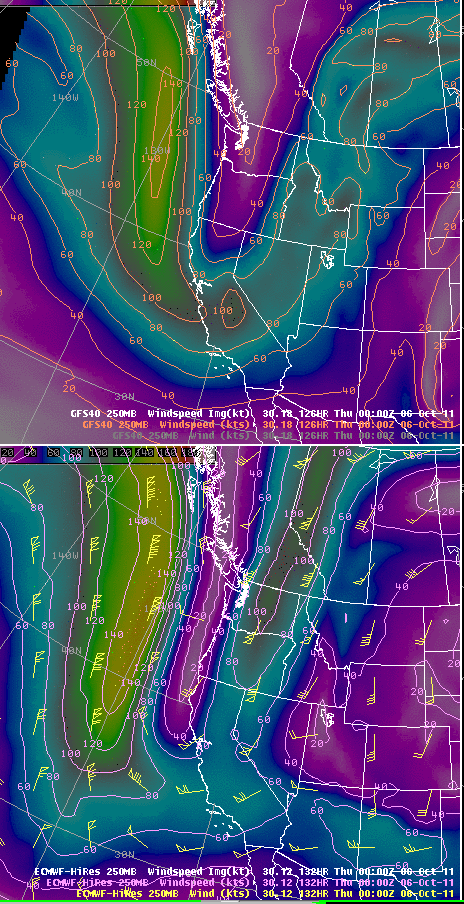
Alex Tardy, NWS San Diego, posted the above image to the Albany MAP list a bit ago. I have grabbed it, since it is relevant to the post below. The top panel is GFS predicted 250 mb wind speeds for 00Z October 6th (next Wednesday at 5 pm MST). The bottom panel is from the ECMWF valid at the same time, also for 250 mb winds. The difference between the two forecasts is quite striking. The ECMWF jetstream down the back of the trough is much stronger than that forecast by the GFS. Further, the GFS has strong winds already coming around the bottom of the trough, in contrast to the ECMWF. Thus, it is not surprising that the ECMWF is currently forecasting a slower, and deeper system than is the GFS. Time will tell which model has better forecast the evolution of this system - perhaps the first significant winter-type event of the Fall season.
No comments:
Post a Comment