The latest forecast from the NWS for the airport (TUS) is really nasty (above) with the heat forecast to continue at deadly levels for the coming week - lowest high temperature forecast by NWS during the week is 108 F.
Of course, not much happens during summer until this pattern interacts with subtropical moisture and CAPE to produce thunderstorms and cooling rainfall (what most folks consider the monsoon begins when decent rains affect substantial areas of the state). The 1:00 pm MST CIRA blended PW analysis above shows very very dry air over the Four Corners with moister air (PWs near or above 1 inch) over southern California and southwest Arizona. Generally PWs have to go above 30 mm (higher above often better) before much can happen at lower elevations.
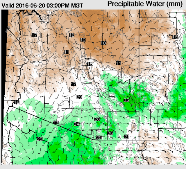
The 12 UTC WRF-GFS forecast for PW at 3:00 pm on Monday afternoon is shown below. Moisture from the east sneaks into parts of Pima County, while moisture from the GoC gets into western half of the county. The WRF forecasts indicate thunderstorms moving from higher elevations into parts of the metro area later on Monday. These storms could produce very strong winds and dust and some spits and sprinkles of rainfall - chance for rain better at higher elevations. Regardless of details, Monday could be a really nasty day. The PW in the model forecasts goes just above 30 mm from 6:00 to 11:00 pm om Monday, due to moist outflows from the storms. There is another period with PW above 30 mm in the forecasts during the early morning hours of the 23rd, as moist sneaks in again from the GoC. But no serious influx of decent low-level moisture is in sight yet.


No comments:
Post a Comment