
Another nice sunrise today, with a bit of jet contrail heading toward LA probably. The west coast trough dominates for the next week - below is GEFS 500 mb mean heights for 5:00 pm MST on Tuesday.


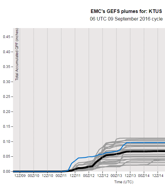
The main forecast questions relate to moisture and CAPE for southeastern Arizona - how long can low-level moisture linger and how will CAPE evolve, before dry Pacific air dominates during the week? The 12 UTC CIRA blended PW analysis (above) shows PW holding around an inch or a bit more (greens) across southern Arizona. The 06 UTC GEFS plumes for QPF at TUS (below) develop a spike of CAPE on Sunday that leads to a chance of thunderstorms in the metro area that evening. The 06 UTC WRF-GFS forecast of composite radar echoes at bottom is valid at 4:00 pm on Sunday. Some hope then for seeing thunderstorms around eastern Pima County before the new week begins.

No comments:
Post a Comment