Have been dealing with some challenges here and haven't gotten back to NWS changes posts yet - but I will today or tomorrow.
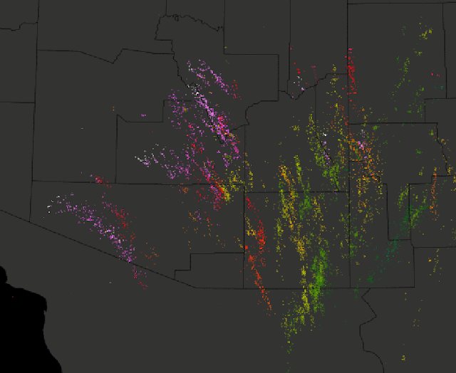
Considerable thunderstorm activity locally after midnight - above graphic shows detected CG flashes for past 24-hours (from Atmo and Vaisala), but most in Pima County have been since around midnight. Some storms going considerably west of where expected over western and central Pima County.
Below is WDT radar/gauge rainfall estimate for 24-hours ending 6:00 am MST (from Maricopa County FCD). Most rainfall was over to our northeast to east. Airport had 0.08; we had 0.07" here at house; and DM had a Trace.
This morning's skewT plot for the TWC sounding data indicates strong easterlies in low-levels that become southeasterly above 700 mb. A sliver of CAPE is indicated by the SPC analysis with much of it in the -10 to -20 C temperature range; fitting the nighttime show of CG flashes.
The forecast sounding below is from 06 UTC WRF-GFS and is for Sonoita at 5:00 am this morning - forecast seems to have easterlies confined to a more shallow layer than the TWC data indicate. Indeed, winds at the Mt. Hopkins RAWS site have been gusting from 40 to just over 50 mph since about 1:00 am this morning. Appears winds will become more southeasterly, so the strong gap winds may abate later this morning. The NWS gird forecast for the site indicates only gusts to as high as 26 mph later this morning - so observed winds coming in about double the grid forecast speeds.
Finally, at bottom is 06 UTC WRF-GFS forecast of precipitation through 5:00 pm tomorrow afternoon. The early morning thunderstorms were a bit underplayed in Pima County, but the main event continues to be forecast for eastern Arizona and parts of New Mexico.
Thursday, November 03, 2016
Subscribe to:
Post Comments (Atom)


No comments:
Post a Comment