
Sunrise this morning behind Thimble Rock. Very warm morning (80 F here at 6:00 am MST) with increased PW and more humidity. Yesterday was hottest day of summer so far - 109 F at airport.

Thunderstorms yesterday afternoon stayed mostly locked onto mountains and avoided lower elevations. Flash density plot above (from weather.graphics and Vaisala) is for 24-hours ending at 6:15 am this morning. Only six stations in ALERT network had rainfall (0.04" or greater) with highest amount 0.24" in the Rincons.

PW has increased steadily at campus GPS site (above plot for seven days ending this morning) and has now reached an inch and a quarter. Perhaps a bit more thunderstorm activity this afternoon. Pattern has stagnated and we can now hope for a significant surge of low-level moisture into southern Arizona for better rain chances.
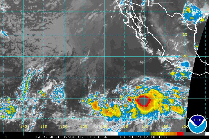
The IR satellite image below from 13 UTC appears (to me) to indicate that TS Barbara has formed near 110 W and 10 N - although the NHC has yet to declare this has happened.
No comments:
Post a Comment