Sunrise on Mt. Moran in the Tetons this morning.
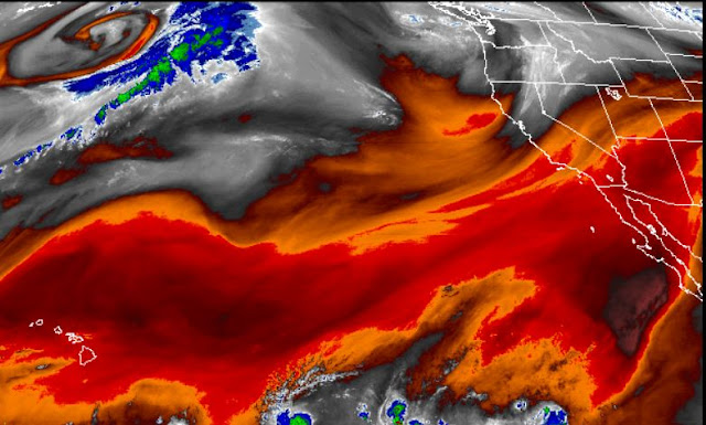
It's very dry here in the Southwest, although the 12 UTC MIMIC analysis of TPW (above) shows that better moisture lurks to the south of the border. Upper-level water vapor is extremely low at 13 UTC (below), with darker shades of red showing increasingly dry air aloft.
The morning TWC sounding had bad data and is not available - although 500 mb plot above included the bad data, as per plus 11 C temperature. Longer range GEFS forecasts for 500 mb keep us in westerly flow from the Pacific for at least the next seven days (below are the GEFS average forecasts at 84-hours and 168-hours).


No comments:
Post a Comment