
Morning views: above on Mt. Lemmon near Ski Valley, and bottom shows the San Francisco Peaks from Flagstaff.

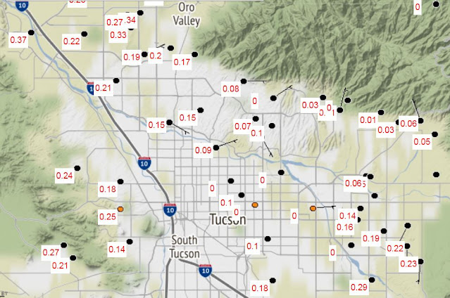
Time series from Atmo above (T and Td) shows the very strong frontal passage that occurred around 3:00 pm MST, with a temperature drop of more than 20 F in just a few minutes. Plot below (from MesoWest) shows 24-hour precipitation amounts for metro area. Heavier amounts avoided the main part of the city.
Most observation sites across southeast Arizona reported strong winds with gusts generally running 45 to 60 mph - strongest I saw was 66 mph at the exposed Guthrie RAWS station.
Here at the house I estimated gusts around 40 to 50 mph, along with 0.11" of cold rain.
Looks like rest of month will feature a gradual warm-up with little chance for any more precipitation here.

No comments:
Post a Comment