
Some nice pre-sunrise over the Catalinas at about 6:15 am MST this morning. I have been away for a couple of days, but am back in time to see some weekend showers - I hope.

Very, very quiet across the continental US and northern Mexico yesterday and last night. Plot of detected CG flashes for 24-hours ending at 3:01 am this morning (above, from Atmo and Vaisala) shows only thunderstorm activity was a small cluster west-southwest of Houston.

The morning sounding from TWC/TUS (above) is dry and very stable. However, a weak, closed low at 500 mb is forecast to move from off southern California eastward across southern Arizona during the weekend. The 500 mb forecast below is from the 06 UTC GFS and is valid at 12 UTC on Sunday morning.


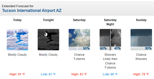
Plumes from the 06 UTC GEFS (above for QPF) all indicate precipitation at the airport from the 15th into the morning of the 16th. The current NWS Forecast Office outlook through Sunday (below) reflects the GEFS forecast above.
However, the 12 UTC WRF-RR forecast of precipitation through 5:00 pm Sunday afternoon (second below) is considerably less optimistic. So a weather watchers' chance to evaluate how the differences play out.

No comments:
Post a Comment