The strong blocking at high latitudes of the Northern Hemisphere continues into January. The GFS ensemble, mean forecasts for 500 mb, with height anamolies overlain, are shown above for 72 and 168 hours from 00 UTC last evening. The high heights at 72 hours reach from Greenland across north polar regions into Siberia. By 168 hours the model forecasts the North American high to shift a bit westward, while blocking weakens over Siberia and strengthens over the Northwest Pacific and Bering Sea. During December 2010 somewhat similar blocking was associated with unusually warm temperatures, at high latitudes, from eastern Canada to the Bering Sea and unusual cold from Siberia to Europe.
------------------------------------------------------------
Moisture Over The Eastern Pacific
------------------------------------------------------------

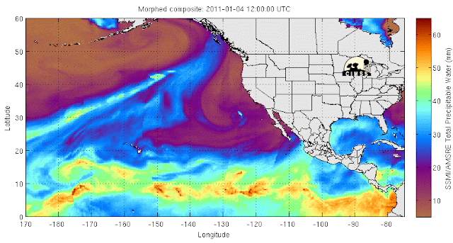
Water vapor and PW images for the eastern Pacific this morning indicate that the strong moisture plume from west of 170 E is being pulled northeastward all the way into western Canada. The cutoff low west of California is beginning to tap some of the higher moisture from its west and northwest. An interesting situation to follow, since the models do not eject this system to the east until Thursday and Friday.


No comments:
Post a Comment