Friday, August 24, 2018
Heavy Clouds And Cooler Temps Bring Mostly Down Day Yesterday
Heavy cloud cover and morning storm activity kept high temperatures down 5 - 10 F yesterday, storms stayed on mountains and intensified to south also. View above at 3:00 pm MST yesterday and ALERT below rainfall through 7:00 am this morning. Second below shows CGs (from Atmo and Vaisala) for 24-hours ending at 1:30 am this morning. Phoenix area turned active yesterday, with more severe storms and wind reports - but note the Tucson donut hole.
Heavy storms developed during morning south of here - Elephant Head 0.51"; Tubac 0.87"; and Nogales 0.95". The Nogales ASOS is at the "International" airport several miles east-northeast of the city, where much heavier rains and serious flash flooding occurred at mid-morning.
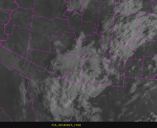
The TWC morning sounding above (from SPC) remains little changed very tropical and moist with considerable CAPE. East winds remain light but layer is deeper, so a bit more steering flow possible today. The visible satellite image below, from 7:00 am, shows that most of southeastern Arizona remains under the clouds - will there be breaks in this that allow better heating?
Above is morning 500 mb analysis and down at bottom is that for 250 mb (both from SPC). Little has changed at 500 since yesterday morning - weak inverted trough remains from southern GoC north into central New Mexico. Another key question for today is whether this feature will move toward the west.
The 250 mb/upper-tropospheric cyclone/inverted trough has moved westward and appears to be centered south of El Paso and west of the Big Bend of the Rio Grande - as per 1330 UTC water vapor image below (and loops of same) and also 250 data at bottom.
The various WRF models forecast the upper feature to begin nudging the mid-level IT westward, and locate it over eastern Pima Count by late afternoon. All three versions I looked at forecast an active storm day for us, with 12 UTC WRFRR forecast really pounding the metro area, but model forecasts clouds to break by noon and temperatures around metro to go into 90s (vs middle 80s yesterday). Watch for clearing skies.
Subscribe to:
Post Comments (Atom)


No comments:
Post a Comment