Sunday, May 10, 2020
Thunderstorms Yesterday - Mostly To Our Southwest
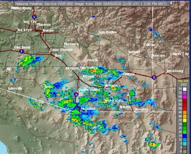
Thunderstorms over eastern Catalinas at about 3:20 pm MST. Radar echoes (below, from about 3:10 pm) were mostly occurring over higher terrain from our east though south to southwest.
Most lightning flash activity was also from southeast to west of Tucson. Across the metro area an outflow from the southwest produced gusts around 30 mph, along with noticeable cooling, as it moved by around 5:00 pm. There were isolated reports of measurable rainfall at some sites in southeast Arizona (below from MesoWest).
Second below is 12 UTC skew-T plot for TWC morning sounding - steering flow remains weak, but CAPE and PW are a bit higher today. There are already showers over the Catalinas before 10:30 am. Should be an interesting day.
Subscribe to:
Post Comments (Atom)


No comments:
Post a Comment