View from campus of the Catalinas this morning shows a bit of cloud far to the north, with hazy air over the north part of the city. Image at bottom is sunrise as viewed from Sahuarita, south of Tucson.
Our last significant rain occurred a month ago today, when 0.67 inches fell here at the house
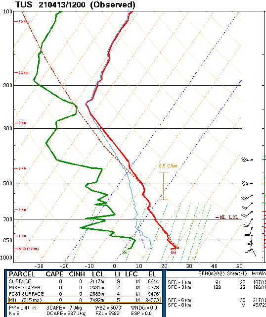
At 500 mb this morning (12 UTC analysis above from SPC) most of the country is dominated by a large trough that includes closed circulations over the Northwest and over northern Minnesota. The morning sounding here at TWC (below, also from SPC) is very dry (PW of 0.41 inches), with the winds missing above 400 mb, due to problems of some sort.
Shown here are the 06 UTC GEFS plumes for T (above) and winds below. To provide some perspective to these model values, note that: the NWS forecast high temperatures for today, tomorrow, and Thursday are: 88, 87, and 84 F, indicating the low bias in the GEFS highs; NWS wind speeds are similar to the GEFS values, but with gusts forecast as high as 30, 30, and 34 MPH for the same three days.


No comments:
Post a Comment