
Contrails over the Catalinas this morning - note dirty air, with dust from the east already over the metro area. Colorful sunrises at Silver City, New Mexico, and Teton Pass, Wyoming, are shown down at bottom.
Quick summary for March here at house: 4 days with measurable rainfall, all 0.05" and less, except for 0.66" night of 12th into early morning of 13th - total rain here was 0.75". Two mornings had lows below freezing ( 24 F on 1st and 30 F on 17th), and there were 10 mornings with lows in the 30s.
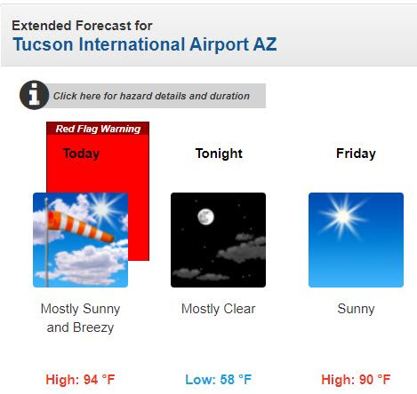


Forecast steady wind speed above from 06 UTC WRF-GFS indicates strong winds for southeast portions of Arizona, with 30 mph at the airport at 8:00 am MST this morning.
The plumes for temperature (below from same run) forecast a warm weekend, into early next week. Temperatures may flirt with 100 F here Sunday and Monday, with no April showers in sight.


No comments:
Post a Comment