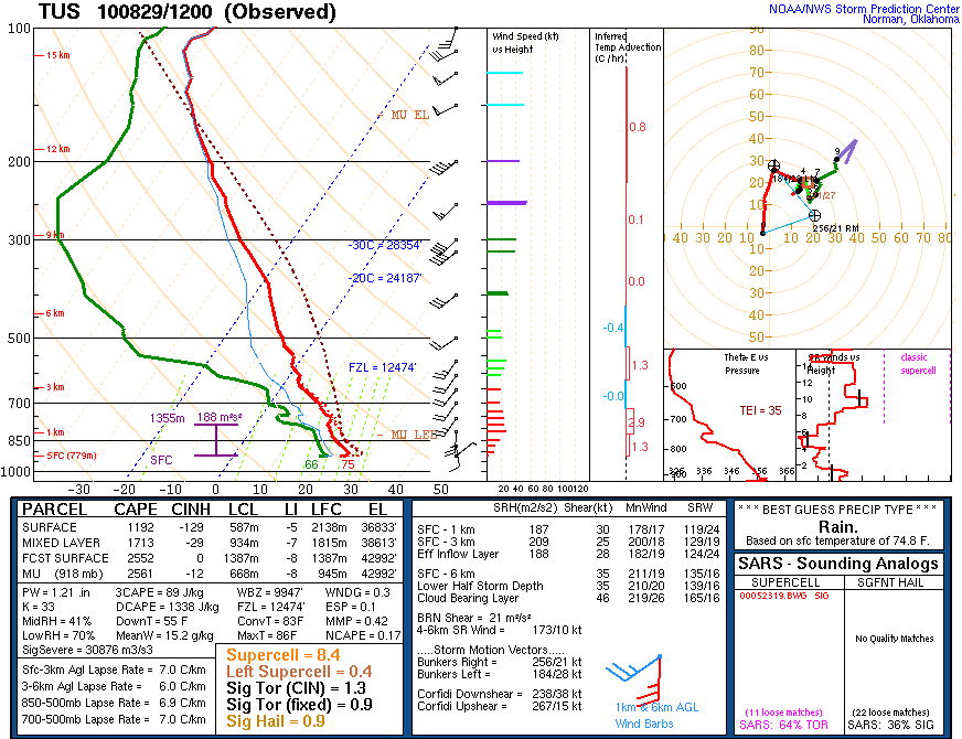


Today is a classic end-of-summer transition day, with lingering low-level moisture, and the strong 500 mb trough approaching. The Tucson morning sounding shows reduced PW today but with substantial CAPE, if lower-based convection can get going. Deep mixing today will dry and stabilize things. The shear profile in the vertical is very Plains-like and and as about as good as it ever gets out here - supercells definitely possible. The SPC has outlooked a possible severe thunderstorms area in central and southeast Arizona (middle graphic). The main forecast issue is whether storms will develop west of the two major metro areas (Phoenix sounding similar to Tucson's) or to the east. The NAM forecasts a squall-like feature in southeast Arizona this afternoon and evening (bottom image for precip through midnight). I tend to think that stroms will be developing just to east of the metro areas, but I was too negative yesterday and will have to watch what happens today. Again, it will be very interesting to see what the U of A versions of WRF model predict!
No comments:
Post a Comment