Friday, August 31, 2012
Bit Of an Uptick
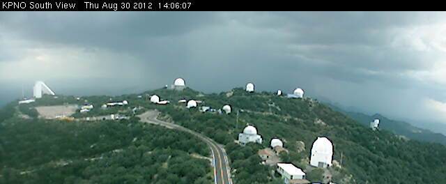
There was a bit of an uptick in storm activity yesterday, and the ALERT network had 4 sites with rainfall. Image above is looking south from Kitt Peak around 2 pm MST - two south-to-north updrafts ahead of rain showers to the far south. Interior southern California had more widespread activity yesterday, with several severe storms reported. Flagstaff apparently had a severe, convective gust of 62 mph a bit before 3 pm. However, metro Tucson mostly saw thick anvil streaming in from the southwest (below is visible satellite image from 5:30 pm MST). An outflow moved across the metro area around 4:30 pm, from the storms to the southwest. But, mostly another dry day - no rain since the event of the 22nd here at the house. The 100+ temperatures have really dried things out.
This morning PW continues to increase slowly, with amounts of 1.50" and higher from Tucson west to southern California. However, CAPE is low low (morning sounding plot for Tucson is below, from SPC), except for higher elevations. Low-level winds will continue to advect higher moisture toward the east and storm anvils will again stream off toward the northeast. No early WRF again today. This morning's NAM forecasts storms this afternoon and evening, again over higher elevations and to the southwest of Tucson.
Subscribe to:
Post Comments (Atom)


No comments:
Post a Comment