
The forecasts and models took a bit of a beating yesterday. Apparently, boundary layer subsidence and warm middle-level temperatures kept southern Arizona almost completely suppressed during the day. Visible image at 5 pm MST (above) shows only a couple of isolated storms in Cochise County. Northern Arizona, New Mexico, and even southern California and northern Baja were all more active.Models had focused storm activity to the southwest of Tucson during the afternoon and mostly struck out.
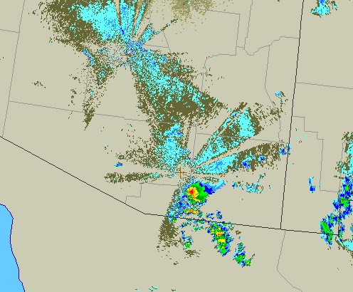
However, after dark some storms did intensify over Cochise County. I went outside to do a lightning check about 9:20 pm MST and could see nearly continuous lightning to the distant southeast. Regional radar (from NCAR RAL) at 10 pm (above) indicated a strong storm near Ft. Huachuca, which reported severe wind gusts to 62 mph and 0.41" of rain from this storm. A plot of detected lightning CGs for the 20 minutes ending at 0619z (below) indicates new storms over the Santa Rita Mountains and near Patagonia and Nogales. Tubac received 0.47" from the Santa Ritas storm. Only 6 stations in the ALERT network (about 5 % areal coverage) reported rainfall during the night - amounts were very light except for the Tubac site. The airport reported a thunderstorm a bit after midnight.
It was hot, however, with a second day with a high of 105F - six straight days with highs over 100F.

No comments:
Post a Comment