Thursday, October 03, 2013
Significant Storms - Elsewhere Of Course
Tropical Storm Karen has developed during past 24-hours and is now off the northeastern tip of Yucatan - above shows position this morning (Thursday, October 3rd). Below is the current forecast for Karen from NHC. The NHC forecasts Karen to briefly become a weak hurricane, before it goes ashore along the central GoM coast. Hurricane and Tropical Storm Watches have been issued. Weather attention the next several days will be mostly focused on Karen, especially given the forecast track.
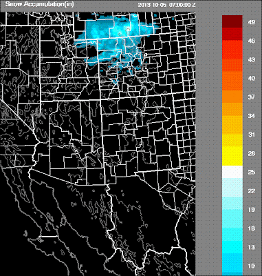
Meanwhile, a cold, closed low at 500 mb is bringing snow to the northern Rocky Mountains this morning. The early WRF-GFS (at 5.4 km grid) forecasts the main snowfall from this storm to impact I-80 across southern Wyoming. The WRF-GFS forecast of accumulated snow through midnight Friday night is shown above.
Long dry spell continues here with breezy and slightly cooler conditions next couple of days.
Subscribe to:
Post Comments (Atom)


No comments:
Post a Comment