Sunday, September 02, 2018
Quick Look - Sunday September 2nd
Thunderstorm at sunrise above off on east side of Rincons. Composite radar at 5:00 am MST (below) was indicating very active and strong storms from the one above, stretching close to I-10 into New Mexico.
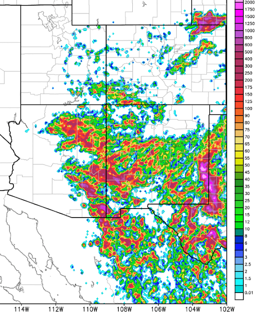
Here are two CG Flash Density plots (from weather.graphics and Vaisala). Above is for 6-hours ending at 5:00 am and below is 24-hour period period through same time. The nocturnal storms were again very active and heavy (as were yesterday's further north - several reports of severe hail along the Rim country yesterday). The 24-hour plot shows how very active storms were across much of eastern Arizona and New Mexico.
Storms in metro were noted in post below, and rain amounts changed little except for some light amounts northwest and north of Catalinas, and rains up on mountain reaching around 3/4 inch at Mt. Lemmon. Heaviest amounts I found were on Mt. Graham, where Columbine RAWS reports over 2 1/2 inches during past 24-hours.
The TWC morning sounding (plot and analysis below from SPC) remains moist and VERY unstable, with a Plains type severe thunderstorm wind profile. Various WRF forecasts indicate a very active thunderstorm day - with strong to possibly severe storms extending well into late night - for much of southeast Arizona, where south winds continue to import mT air from Sonora. Should be another quite interesting weather day.
Subscribe to:
Post Comments (Atom)


No comments:
Post a Comment