
There was a precipitous drop in Td yesterday afternoon (from about 1:00 pm MST until a bit before 6:00 pm), as shown above in the T and Td trace above from ATMO. During the period of Td around zero to 5 F, the winds became west-southwesterly, but T did not change noticeably, nor did wind speeds which dropped slightly. A very strange episode that appeared to be localized from Tucson southward and westward (Nogales data showed this behavior). Data are very sparse to the west and southwest, and virtually non-existent for today and yesterday, as the RAWS observations are off-line.
Below is the 00 UTC plot of the TWC upper-air sounding (release time about 4:00 pm), taken during the dry event. The BL has three three slightly separate layers - but essentially it is well-mixed and very dry up to 600 mb. Apparently it managed to warm enough to develop this structure (which may also have been due to advection here from our southwest). Regardless, an unusual event occurring under heavily cloud-covered conditions.

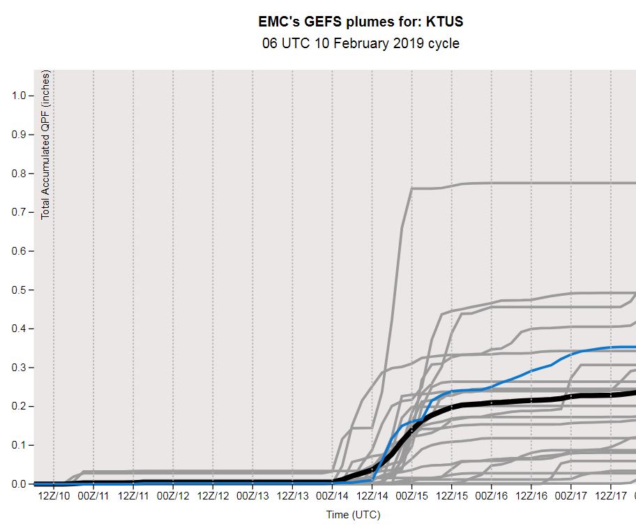
Finally, the GEFS plumes for QPF at TUS are shown below (from the 06 UTC run). Many of the members are forecasting rain here on Valentine's Day (spread in forecast amounts is from nearly 0.80" to three members which forecast zero amounts). Although the trough associated with this is centered well to our north in the forecasts, the flow aloft becomes west-southwest with a long fetch from the Pacific, which brings in very moist, sub-tropical air. The degree and timing of the moisture plume will play the key role in determining timing and amounts of precipitation over Arizona.
No comments:
Post a Comment