
Category 4 Hurricane Odile is the 7th major hurricane of the season in the eastern Pacific this season. Above is visible satellite image of Odile located south-southeast of the southern end of Baja. Located to the southwest of Odile is TD Sixteen-E. The forecast track for Odile, from NHC, this morning (Sunday, September 14th) is shown below. Odile poses a serious threat to southern Baja, since it is forcast to track very close to Cabo San Lucas as a major hurricane.


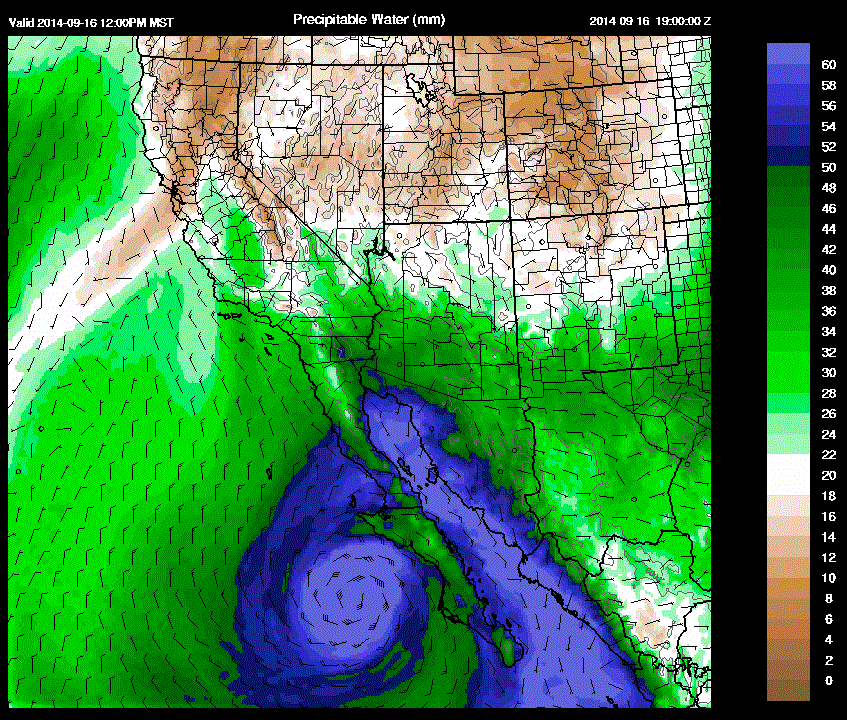
The 12 UTC blended PW analysis from CIRA at Colorado State is shown above. Values of of PW from 35 to 50 mm are already in place over all of the GoC. I expect that higher values of low-level moisture will return to southwest Arizona late tonight or tomorrow morning. The forecast of PW from the WRF-NAM early run this morning is shown below on the 5.4 km grid. Valid time is noon Tuesday and forecast indicates deep moisture with Odile to be entering the lower Colorado River Basin at that time - model timing is likely a bit slow. There is also a stream of high PW air into southeast Arizona with east-southeasterly flow up the Rio Grande - this is similar to the situation with Norbert. It is far too early to anticipate the details of how the week may unfold, except that there will much to watch weather-wise during coming days.
No comments:
Post a Comment